Refine your search for walks in Saint-Nazaire-les-Eymes
Saint-Nazaire-les-Eymes walks
 Manival - Côte Bonne
 Visorando Member
 4.52 mi
 +1,434 ft
 -1,421 ft
 3h 20
3h 20
 Easy
Easy
 Departure from Saint-Ismier (Isère)
Footprints in the snow for this walk, which can be enjoyed in the summer sun or in the shade of oak and fir trees...
Bec Charvet via the Pas de la Branche
 Tourism professional
 9.74 mi
+4,688 ft
-4,688 ft
8h 35
9.74 mi
+4,688 ft
-4,688 ft
8h 35
 Extremely difficult
Departure from Saint-Ismier (Isère)
Extremely difficult
Departure from Saint-Ismier (Isère)
A long hike through the woodland that takes in the dangerous Pas de la Branche, which is fortunately well-equipped.
(!) Please read the ‘Practical Information ’ section carefully before setting out on this hike , which is reserved for experienced walkers who do not suffer from vertigo and are suitably equipped.
Around the Tour d'Arces
 2.47 mi
+1,076 ft
-1,050 ft
2h 05
2.47 mi
+1,076 ft
-1,050 ft
2h 05
 Average
Departure from Saint-Ismier (Isère)
Average
Departure from Saint-Ismier (Isère)
A gentle walk along paths that seem to have been forgotten by everyone, with some lovely surprises. Several circular loops are possible in the area without the risk of getting lost. If you have children, take care: there are sometimes tricky or even dangerous sections, but if you take reasonable care, there is no reason to miss out on this lovely circular loop.
Col de Baure and Château Nardent starting from the Fontaine Bonnet car park
 6.61 mi
+2,369 ft
-2,336 ft
5h 05
Average
Departure from Bernin (Isère)
6.61 mi
+2,369 ft
-2,336 ft
5h 05
Average
Departure from Bernin (Isère)
Ascent to Château Nardent, a lovely viewpoint over the Grésivaudan valley situated on a promontory of the Petites Roches plateau near Saint-Pancrasse. Shaded walk: almost the entire route is in the shade.
Les Grandes Eymes
 1.58 mi
+377 ft
-377 ft
1h 00
Easy
Departure from Bernin (Isère)
1.58 mi
+377 ft
-377 ft
1h 00
Easy
Departure from Bernin (Isère)
Visit the Haut-Bernin on a gentle walk at the foot of the Chartreuse cliff. You can contemplate a cumulative altitude of 9845m which is more than the Everest, with le Mont-Blanc (4806m), le Grand Pic de Belledonne (2977m) and la Dent de Crolles (2062m). You will meet lots of dog walkers and you will walk through forests, vineyards, and pass beehives.
 Circular route via La Carrelière and Lake Freydières from Le Versoud
17.01 mi
+3,428 ft
-3,412 ft
3 hrs
 Difficult
Departure from Le Versoud (Isère)
Difficult
Departure from Le Versoud (Isère)
A lovely circular walk that takes you to Lac de Freydières via La Carrelières. Stunning views of the Belledonne range punctuate this route.
A circular route via the ridge to the Col de la Cochette
 Association / Club / Walk leader3.15 mi
+1,207 ft
-1,178 ft
2h 30
Average
Departure from La Combe-de-Lancey (Isère)
Association / Club / Walk leader3.15 mi
+1,207 ft
-1,178 ft
2h 30
Average
Departure from La Combe-de-Lancey (Isère)
A lovely walk with numerous views of the Chartreuse, Belledonne and Savoie.
Roche Rousse
 5.89 mi
+2,077 ft
-2,077 ft
4h 30
Average
Departure from Le Sappey-en-Chartreuse (Isère)
5.89 mi
+2,077 ft
-2,077 ft
4h 30
Average
Departure from Le Sappey-en-Chartreuse (Isère)
A lovely walk offering views of the entire Sappey-en-Chartreuse valley and the surrounding mountains.
Tour de l’Écoutoux
 6.63 mi
+2,008 ft
-2,031 ft
4h 50
Average
Departure from Le Sappey-en-Chartreuse (Isère)
6.63 mi
+2,008 ft
-2,031 ft
4h 50
Average
Departure from Le Sappey-en-Chartreuse (Isère)
An ideal forest walk in hot weather for those looking to cool off a little.
The plus: you can go for a swim halfway along the route.
Downside: you have to cross the road on the way back (if anyone knows an ‘easy’ route through the rocky outcrop at Le Bret to avoid the road, I’d love to hear about it).
Emeindras loop
 6.79 mi
+2,129 ft
-2,116 ft
5h 00
Average
Departure from Le Sappey-en-Chartreuse (Isère)
6.79 mi
+2,129 ft
-2,116 ft
5h 00
Average
Departure from Le Sappey-en-Chartreuse (Isère)
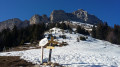
A hike with a variety of points of interest, including the beginnings of skiing, rural life with woodworking and alpine pastures, and the impressive cliffs of Chamechaude.
Le Habert de Chamechaude
 4.21 mi
+1,936 ft
-1,936 ft
3h 35
Average
Departure from Le Sappey-en-Chartreuse (Isère)
4.21 mi
+1,936 ft
-1,936 ft
3h 35
Average
Departure from Le Sappey-en-Chartreuse (Isère)
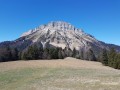
This easy hike takes you to an alpine pasture above the small resort of Sappey-en Chartreuse. You will arrive at a magnificent site at the foot of the Chamechaude cliffs, with an exceptional panorama stretching from the Sept Laux massif to the Vercors.
Circular route around Le Sappey-en-Chartreuse
 8.67 mi
+2,169 ft
-2,169 ft
5h 55
Average
Departure from Le Sappey-en-Chartreuse (Isère)
8.67 mi
+2,169 ft
-2,169 ft
5h 55
Average
Departure from Le Sappey-en-Chartreuse (Isère)
Circular route starting from Chemin des Combes, crossing above Sappey-en-Chartreuse to reach the Écoutoux viewpoint and return to the starting point.
From Sappey-en-Chartreuse to Émeindras de dessus via the high ridges
 5.69 mi
+1,877 ft
-1,873 ft
4h 15
Average
Departure from Le Sappey-en-Chartreuse (Isère)
5.69 mi
+1,877 ft
-1,873 ft
4h 15
Average
Departure from Le Sappey-en-Chartreuse (Isère)
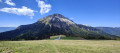
This hike takes you to the top of the Sappey ridges, where you can enjoy beautiful panoramic views (the Belledonne mountain range, Dent de Crolles, Saint-Hugues, Chamechaude and the series of ridges).
On 28/12/18, I modified the route between the new points (1) and (2) to take into account the 2018 logging operation that destroyed the previous hiking trail (shown as a dotted line on the map).
Bec Charvet
5.38 mi
+2,156 ft
-2,152 ft
4h 20
Difficult
Departure from Saint-Pierre-de-Chartreuse (Isère)
Bec Charvet is a peak located slightly off the Grande Randonnée hiking trails, offering unobstructed views of the great peaks of Chartreuse and beyond.
The following description outlines a route passing through the Emeindras de Dessus mountain pasture, where you can already enjoy a beautiful view of the panorama.
L'Écoutoux
 5.83 mi
+1,699 ft
-1,699 ft
4h 10
Average
Departure from Le Sappey-en-Chartreuse (Isère)
5.83 mi
+1,699 ft
-1,699 ft
4h 10
Average
Departure from Le Sappey-en-Chartreuse (Isère)
This small peak in the forest above Sappey-en-Chartreuse makes for a very pleasant outing in the forest. There are few views, except from the summit, which offers a beautiful panorama of the Belledonne massif, Chamechaude and the Dent de Crolles.
 Circular route via the Habert de Chamechaude and the Émeindras, from Sappey-en-Chartreuse
 6.55 mi
+2,254 ft
-2,251 ft
7 hrs
Average
Departure from Le Sappey-en-Chartreuse (Isère)
6.55 mi
+2,254 ft
-2,251 ft
7 hrs
Average
Departure from Le Sappey-en-Chartreuse (Isère)
A lovely circular route alternating between woodland and mountain pastures, running along the eastern slope of Chamechaude, with a few steep ascents and descents, but no real difficulties provided there are tracks to follow on the descent from the Habert de Chamechaude to the Col de l’Émeindras. The Émeindras area is very busy in fine weather, whilst the Habert de Chamechaude is much less so.
The northern ridges of Mont Saint-Eynard
 7.92 mi
+2,812 ft
-2,789 ft
6h 05
Difficult
Departure from Le Sappey-en-Chartreuse (Isère)
7.92 mi
+2,812 ft
-2,789 ft
6h 05
Difficult
Departure from Le Sappey-en-Chartreuse (Isère)
From Le Sappey-en-Chartreuse, climb up to the ridges of Mont Saint-Eynard, which offer beautiful panoramic views of the Belledonne mountains, the Dent de Crolles and Chamechaude.
Circular route via the Habert de Chamechaude and the hollowed-out tree trunk serving as a drinking trough
 7.08 mi
+2,352 ft
-2,323 ft
5h 20
Average
Departure from Le Sappey-en-Chartreuse (Isère)
7.08 mi
+2,352 ft
-2,323 ft
5h 20
Average
Departure from Le Sappey-en-Chartreuse (Isère)
This hike, mostly through woodland, will take you close to the eastern cliffs of Chamechaude and offer a stunning view from the habert, stretching towards the Belledonne and Taillefer massifs, all the way to the Vercors.
Fontaine Ardente - the flaming fountain
 1.11 mi
+594 ft
-571 ft
1h 00
Average
Departure from Meylan (Isère)
1.11 mi
+594 ft
-571 ft
1h 00
Average
Departure from Meylan (Isère)
A short hike to enjoy this geological feature: a flaming fountain.
Mont Pravouta and Col des Ayes
 2.91 mi
+1,109 ft
-1,109 ft
2h 20
Average
Departure from Saint-Pancrasse (Isère)
2.91 mi
+1,109 ft
-1,109 ft
2h 20
Average
Departure from Saint-Pancrasse (Isère)
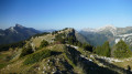
Short family-friendly walk with a magnificent view, manageable on foot or on snowshoes.
Bec Charvet via the north-east face
 3.03 mi
+1,476 ft
-1,483 ft
2h 40
Average
Departure from Saint-Pierre-de-Chartreuse (Isère)
3.03 mi
+1,476 ft
-1,483 ft
2h 40
Average
Departure from Saint-Pierre-de-Chartreuse (Isère)
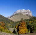
A short, quiet hike offering interesting views of the Dent de Crolles and Chamechaude, far from the crowds. Significant elevation gain to the summit of Bec Charvet.
The route is partly unmarked: follow the route on the map and the instructions carefully.
Bec Charvet Circular Loop
 3.41 mi
+1,470 ft
-1,476 ft
2h 50
Difficult
Departure from Saint-Pancrasse (Isère)
3.41 mi
+1,470 ft
-1,476 ft
2h 50
Difficult
Departure from Saint-Pancrasse (Isère)
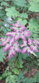
A lovely circular route in the Chartreuse with the Bec Charvet as the highest point, a descent towards the Col de la Faïta via the ridges and the return via a section ofthe GR®9.
From Col du Coq to Sainte-Marie-du-Mont
 14.29 mi
+4,423 ft
-5,938 ft
10h 25
14.29 mi
+4,423 ft
-5,938 ft
10h 25
 Very difficult
Departure from Saint-Pancrasse (Isère)
Very difficult
Departure from Saint-Pancrasse (Isère)
The route runs mainly through the Chartreuse Natural Park, passing through the massif's iconic passes and mountains. The route combines fairly steep climbs, passages through plateaus, mountain pastures and a village.
The Crête du Saint-Eynard
 3.33 mi
+1,145 ft
-1,158 ft
2h 30
Average
Departure from Le Sappey-en-Chartreuse (Isère)
3.33 mi
+1,145 ft
-1,158 ft
2h 30
Average
Departure from Le Sappey-en-Chartreuse (Isère)
This circuit runs along the Saint-Eynard ridge and offers a bird's eye view of the Grésivaudan valley and Grenoble.
Montfallet Tower and Col du Lautaret
 6.11 mi
+1,319 ft
-1,342 ft
4h 00
Average
Departure from Laval (Isère)
6.11 mi
+1,319 ft
-1,342 ft
4h 00
Average
Departure from Laval (Isère)
An ideal walk for mid-season and for exploring Belledonne from a moderate altitude.
Mont Saint-Eynard via Rocher du Bret
 2.84 mi
+1,270 ft
-1,276 ft
2h 25
Difficult
Departure from Le Sappey-en-Chartreuse (Isère)
2.84 mi
+1,270 ft
-1,276 ft
2h 25
Difficult
Departure from Le Sappey-en-Chartreuse (Isère)
A fairly short but steep circular route up the little-known Rocher du Bret ridge. At the summit, you will be rewarded with a 360° panorama of the southern Chartreuse, Belledonne, the Grenoble conurbation and the Vercors. The return journey is more conventional, passing by the Batteries du Saint-Eynard, which offer some more beautiful views.
The Saint Eynard ridge and the Pré du Plat
 2.99 mi
+509 ft
-522 ft
1h 50
Easy
Departure from Le Sappey-en-Chartreuse (Isère)
2.99 mi
+509 ft
-522 ft
1h 50
Easy
Departure from Le Sappey-en-Chartreuse (Isère)
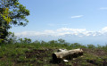
A short and easy walk on the ridge of Mont-Saint-Eynard, above Grenoble, offering beautiful panoramic views of the city, the Belledonne mountain range and, at the end, the Sappey valley. This walk is a local classic and can be very busy.
The Combeloup National Forest above Murianette
 6.36 mi
+1,890 ft
-1,877 ft
4h 35
Average
Departure from Murianette (Isère)
6.36 mi
+1,890 ft
-1,877 ft
4h 35
Average
Departure from Murianette (Isère)
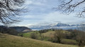
This circular will take you to the heights of Murianette, with beautiful views of Grenoble and the Grésivaudan valley.
The climb is quite steep, but the reward of superb views is well worth it!
You will pass through Les Molinières and La Pérérée without crossing them, then cross Les Combes and the Combeloup National Forest before reaching Pressembois.
All these places are charming and the trails are bucolic!
Le Pal de Fer
1.43 mi
+2,001 ft
-0 ft
2h 25
Average
Departure from Crolles (Isère)
An original outing that allows you to discover the superb work carried out here for the construction of the Touvet funicular railway. The ascent is on foot and the descent, to relieve the knees, is by funicular.
(Please note): This route is currently closed. See explanations here
(Comment from a hiker) dated 18 June 2023: small difficult section: crossing the scree slope where you need to use two ropes to reach the path in the forest.
From Montfort Castle to the Crolles Waterfall
 3.88 mi
+974 ft
-965 ft
2h 40
Average
Departure from Crolles (Isère)
3.88 mi
+974 ft
-965 ft
2h 40
Average
Departure from Crolles (Isère)
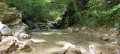
A 25-minute drive from Grenoble, this is a family-friendly walk starting from the Saint-Hilaire-du-Touvet funicular station, beneath the paragliders, to the path leading to the Crolles waterfall. There is little elevation gain and it can be done in all weathers.
Dent de Crolles via the Terreaux and Rocheplane steps
 8.23 mi
+3,937 ft
-3,940 ft
6 hrs
Very difficult
Departure from Saint-Hilaire (Isère) (Isère)
8.23 mi
+3,937 ft
-3,940 ft
6 hrs
Very difficult
Departure from Saint-Hilaire (Isère) (Isère)
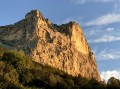
A splendid but little-used circular, starting from Saint-Hilaire du Touvet and passing through the Pas des Terreaux, the Dent de Crolles, the Cheminée du Paradis and the Pas de Rocheplane.
Much of the hike is on poorly marked paths on steep slopes. The Cheminée du Paradis is a small climbing step, which explains the level of difficulty.
It is possible to extend this hike in a pleasant way, either during the hike itself or nearby.
Circular Revel via Mongiron
 4.36 mi
+1,220 ft
-1,201 ft
3h 05
Average
Departure from Revel (Isère) (Isère)
4.36 mi
+1,220 ft
-1,201 ft
3h 05
Average
Departure from Revel (Isère) (Isère)
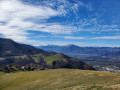
A short hike with beautiful views of the Chartreuse, Vercors and Belledonne mountains, starting from the church in Revel and alternating between forest trails and hamlets.
Best done in the afternoon or evening to avoid being dazzled by the morning sun on Belledonne.
Jean small pass Refuge
 7.62 mi
+3,136 ft
-3,107 ft
6h 15
Average
Departure from Saint-Mury-Monteymond (Isère)
7.62 mi
+3,136 ft
-3,107 ft
6h 15
Average
Departure from Saint-Mury-Monteymond (Isère)
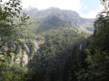
This is a beautiful hike in the Belledonne Massif, where you can admire beautiful waterfalls, explore a wild valley and get close to the last glacier in the massif. The view from the refuge overlooks the Grésivaudan valley, from the Chartreuse massif to the Vercors massif.
Lac Blanc from the Col de Pré Long
 9.97 mi
+4,446 ft
-4,426 ft
6 hrs
Very difficult
Departure from Saint-Mury-Monteymond (Isère)
9.97 mi
+4,446 ft
-4,426 ft
6 hrs
Very difficult
Departure from Saint-Mury-Monteymond (Isère)
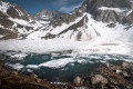
Lac Blanc is undoubtedly one of the most beautiful lakes in the Belledonne massif with its turquoise colour. This hike offers the best of Belledonne: forests, torrents, scree slopes, mountain pastures and mineral landscapes. The beauty of the landscapes along the route makes up for the somewhat strenuous climb.
Climb up to Les Petites Roches and take flight
 3.58 mi
+617 ft
-587 ft
2h 10
Easy
Departure from Saint-Hilaire (Isère) (Isère)
3.58 mi
+617 ft
-587 ft
2h 10
Easy
Departure from Saint-Hilaire (Isère) (Isère)
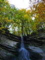
Whether you're a paraglider or hang glider, Saint-Hilaire-du-Touvet is paradise. From the valley, the funicular takes paragliders and walkers alike to the Petites Roches plateau, where everyone can take off into the air or walk on the edge of the void.
For hikers, this route at the foot of the Dent de Crolles offers a viewpoint over the valley before entering the forest in search of the remains of the Moulin de Porte-Traîne mill.
 Col du Murier – Uriage – Pinet – Murianette
30.98 mi
+3,625 ft
-3,625 ft
4 hrs
Difficult
Departure from Meylan (Isère)
This is a cycling route of moderate difficulty. It’s ideal for those who don’t want to tackle major mountain passes such as the Glandon or the Croix de Fer but still wish to complete a challenging ride with a bit of difficulty. Much of the route consists of small roads passing through tiny villages. Great for clearing your head.
Les Dioux Waterfall and the Porte Traine Mill
 3.17 mi
+528 ft
-528 ft
1h 55
Easy
Departure from Saint-Hilaire (Isère) (Isère)
3.17 mi
+528 ft
-528 ft
1h 55
Easy
Departure from Saint-Hilaire (Isère) (Isère)
On the Saint-Hilaire du Touvet plateau, this is a circular loop of 2 to 3 hours that is suitable for young children.
Very shady and close to the Saint-Hilaire paragliding training slopes (FFVL South take-off point), it also gives children a fun opportunity to watch the sails inflate.
From Corenc to the Col de Vence
 3.98 mi
+1,286 ft
-1,286 ft
2h 55
Easy
Departure from Corenc (Isère)
3.98 mi
+1,286 ft
-1,286 ft
2h 55
Easy
Departure from Corenc (Isère)
An easy walk just a stone’s throw from Grenoble. Or how to go from an urban suburb to a quiet, peaceful rural area that you would never have imagined could be so close to a city.
Cabane de Pravouta - La Plagne
15.41 mi
+4,469 ft
-6,211 ft
12 hrs
Very difficult
Departure from Saint-Pierre-de-Chartreuse (Isère)
Third and final day of this trip to the Chartreuse to collect the car.
From Corenc to the Clos des Capucins
3.58 mi
+817 ft
-817 ft
2h 20
Average
Departure from Meylan (Isère)
A pleasant walk that takes you to the Clos des Capucins, either through the woods or along the quiet streets of the upper parts of Corenc and Meylan.
The summit of Pravouta, crossing from Saint-Hugues
 5.87 mi
+2,654 ft
-2,654 ft
6 hrs
Average
Departure from Saint-Pierre-de-Chartreuse (Isère)
5.87 mi
+2,654 ft
-2,654 ft
6 hrs
Average
Departure from Saint-Pierre-de-Chartreuse (Isère)
Pravouta is a secondary peak in the Chartreuse range that is very popular due to its accessibility and its location, which makes it a beautiful viewpoint. Most visitors climb it from the Grésivaudan-Petites Roches side via the Col du Coq. This route takes you up the Saint Hugues-en-Chartreuse side and back down to the starting point.
From Granges Freydiere to the Cabane du Grand Colon
 5.51 mi
+2,024 ft
-2,024 ft
4 hrs
Average
Departure from Revel (Isère) (Isère)
5.51 mi
+2,024 ft
-2,024 ft
4 hrs
Average
Departure from Revel (Isère) (Isère)
A lovely snowshoe walk in Belledonne with no major difficulties, a steady climb up to the hut through pretty forests.
Unusual Chamechaude via L'Arche, Le Jardin, La Brêche Arnaud and Le Canyon
 5.99 mi
+3,868 ft
-3,865 ft
5 hrs
Extremely difficult
Departure from Sarcenas (Isère)
5.99 mi
+3,868 ft
-3,865 ft
5 hrs
Extremely difficult
Departure from Sarcenas (Isère)
A challenging hike that allows you to discover the most beautiful (and least known) landscapes around the summit of Chamechaude.
The route includes a few fun climbs and descents, a very short off-trail section, a breach through a cliff, a spectacular couloir and an aerial sangle overlooking numerous chamois, a guaranteed spectacle for anyone aiming to reach the summit before midday.
The route is far from the summer and Sunday crowds.
Molettes to Pleurey circular loop
3.36 mi
+705 ft
-705 ft
2h 10
Easy
Departure from Revel (Isère) (Isère)
An easy walk, mostly on a path. The hike can be done on foot or by bike. You can start much lower down in Revel, either from the village or from an intermediate point.
Fort du Saint-Eynard from the Col de Vence
 4.25 mi
+2,014 ft
-1,985 ft
3h 40
Average
Departure from Corenc (Isère)
4.25 mi
+2,014 ft
-1,985 ft
3h 40
Average
Departure from Corenc (Isère)
A classic hike from the Col de Vence to the Fort du Saint-Eynard.
The entire route follows theGR®9trail, with no difficulty in finding your way. Wide panoramic view from the summit.
Mont Rachais and the Quichat batteries from the Col de Vence
 6.49 mi
+1,601 ft
-1,585 ft
4h 25
Average
Departure from Corenc (Isère)
6.49 mi
+1,601 ft
-1,585 ft
4h 25
Average
Departure from Corenc (Isère)
Starting from the Col de Vence, climb to Mont Rachais via the ridge after a detour via the Quichat batteries and return to the pass.
Mont Rachais from the Vence Pass
 4.80 mi
+1,132 ft
-1,112 ft
3h 10
Easy
Departure from Corenc (Isère)
4.80 mi
+1,132 ft
-1,112 ft
3h 10
Easy
Departure from Corenc (Isère)
Easy access to Mont Rachais. View over Chartreuse, Belledonne, Grenoble and the Vercors.
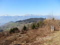
Pré Marcel as seen from the Col des Mouilles
 4.22 mi
+1,109 ft
-1,106 ft
2h 55
Average
Departure from Sainte-Agnès (Isère) (Isère)
4.22 mi
+1,109 ft
-1,106 ft
2h 55
Average
Departure from Sainte-Agnès (Isère) (Isère)
A circular walk in the mid-mountains, offering beautiful views of Belledonne and Chartreuse. The walk presents no difficulties apart from the slightly steep climb.
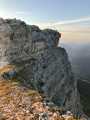
Chamechaude circular via the Arche, the Rampe de l'Écureuil and the Canyon
 4.36 mi
+2,533 ft
-2,523 ft
4h 15
Difficult
Departure from Sarcenas (Isère)
4.36 mi
+2,533 ft
-2,523 ft
4h 15
Difficult
Departure from Sarcenas (Isère)
This circular aims to offer alternatives to the very busy normal route, allowing you to discover lesser-known aspects of Chamechaude, the highest point in the Chartreuse. Without being as technical as the Arnaud breach or as exposed as the Sangle du Jardin, this route is off the beaten track: it therefore sometimes requires a sense of direction and certain (short) steep passages require effort and attention.
Please read the Practical Information section carefully.
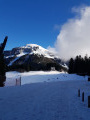
Col de Porte
 7.07 mi
+1,358 ft
-1,358 ft
4 hrs
Average
Departure from Sarcenas (Isère)
7.07 mi
+1,358 ft
-1,358 ft
4 hrs
Average
Departure from Sarcenas (Isère)
In the heart of the Chartreuse mountains, the Col de Porte is a former family ski resort whose ski lifts are now closed. The paths are more or less well marked allowing you to enjoy the trails on cross-country skis or snowshoes. The proposed circuit climbs through forest, coming out on a crest and offers superb views over the entire Chartreuse mountain range.
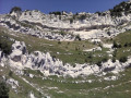
A circular route via the Pas de Montbrun and Pas de Rocheplane, starting from Les Massards
 5.57 mi
+3,383 ft
-3,383 ft
5h 30
Difficult
Departure from Saint-Hilaire (Isère) (Isère)
5.57 mi
+3,383 ft
-3,383 ft
5h 30
Difficult
Departure from Saint-Hilaire (Isère) (Isère)
A hike to explore the secluded Pas de Montbrun, which leads to the ridge of the Rochers de Bellefont via a route of moderate exposure and without any major difficulty, apart from finding your way in the upper section. From Les Massards, the path heads towards the Source du Sanglier and then the Col de Marcieu, leaving it opposite the Pas de Montbrun. A narrow track climbs up a scree slope and, via a few short scrambling sections, reaches the ridge leading to the Pas de Rocheplane. A well-marked path crosses a few rocky outcrops and, after a section through the forest, returns to the car park.
Tour of the two highest peaks in the Chartreuse
 17.39 mi
+6,673 ft
-8,005 ft
7 hrs
Very difficult
Departure from Sarcenas (Isère)
17.39 mi
+6,673 ft
-8,005 ft
7 hrs
Very difficult
Departure from Sarcenas (Isère)
Chamechaude (2,082 m) and the Dent de Crolles (2,062 m) are the two highest peaks in the Chartreuse; allow for a walk of around 30 km – fancy a go?
Chamechaude from the Col de Porte
 4.78 mi
+2,474 ft
-2,474 ft
4h 20
Difficult
Departure from Sarcenas (Isère)
4.78 mi
+2,474 ft
-2,474 ft
4h 20
Difficult
Departure from Sarcenas (Isère)
The highest point of the Chartreuse massif. As a bonus, there is a cable to access the summit platform.
Magnificent panorama of the Chartreuse, with views of Mont Blanc, Mont Aiguille and the Vercors.
Mont Jalla via the Col de Vence, La Bastille and La Vierge Noire
12.31 mi
+2,953 ft
-2,982 ft
1.5 hrs
Average
Departure from Corenc (Isère)
A pleasant mountain bike ride (with or without e-bike), via the Col de Vence, Mont Jalla, Les Clémencieres, La Bastille, and back via La Vierge Noire
Circular Grande Lance de Domène route via the Col des Lances and Lac du Loup
 10.14 mi
+5,709 ft
-5,709 ft
10 hrs
Extremely difficult
Departure from La Combe-de-Lancey (Isère)
10.14 mi
+5,709 ft
-5,709 ft
10 hrs
Extremely difficult
Departure from La Combe-de-Lancey (Isère)
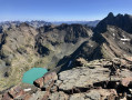
A circuit and ascent to Belledonne’s finest viewpoint, amidst the ibex. Climbing the Grande Lance de Domène is straightforward, but the return via the Col des Lances requires an ice axe and crampons in all seasons, and the very steep scree on the north face invariably turns the hiker into a left-turning dahu.
Between the Col des Lances and Lac du Loup, the Glacier de la Sitre and its lake form one of the wildest landscapes in the range, where you may encounter eagles and chamois.
La Grande Lauzière from Pré Raymond
 12.01 mi
+5,144 ft
-5,154 ft
10h 00
Difficult
Departure from La Combe-de-Lancey (Isère)
12.01 mi
+5,144 ft
-5,154 ft
10h 00
Difficult
Departure from La Combe-de-Lancey (Isère)
This route begins with the classic ascent to the Refuge de la Pra. From the refuge, the route takes you off the beaten track, through magnificent high-mountain scenery. Head towards Lac David via the western slope of the Grande Lauzière, which offers a beautiful view of the Claret, Longet and Bernard lakes. Shortly afterwards, you look out over Lac David. The path crosses a small pass, descends into a small valley, and climbs up a rocky ridge with views of the rugged eastern slope of the Grande Vaudaine. You climb the southern ridge of the Grande Lauzière to its pass, then on to its summit.
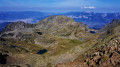
Traversée du Pic du Grand Doménon
 12.36 mi
+5,305 ft
-5,315 ft
10h 20
Very difficult
Departure from La Combe-de-Lancey (Isère)
12.36 mi
+5,305 ft
-5,315 ft
10h 20
Very difficult
Departure from La Combe-de-Lancey (Isère)
This route begins with the classic ascent to the Refuge de La Pra. From the refuge, the route takes you off the beaten track into a magnificent high-mountain setting. Head towards Lac David via the western slope of the Grande Lauzière, which offers a beautiful view of the Claret, Longet and Bernard lakes. Shortly afterwards, you look out over Lac David. The path crosses a small pass, descends into a small valley and climbs up a rocky ridge with views of the rugged eastern slope of the Grande Vaudaine. You follow the southern ridge of the Grande Lauzière up to its pass. From there, you can see the route leading to the Pic du Grand Doménon.At the summit, there is a superb view of the Alps. The descent to the Col du Bâton follows its northern ridge. Then, via a scree cone, the route joins the Croix de Belledonne path. You walk alongside the Grand and Petit Doménon lakes to reach the Col de La Pra, from where the ascent path leads back to the car park.
This route is reserved for mountaineers in good physical condition.
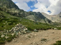
Crossing the Grande Lance de Domène
 10.38 mi
+4,751 ft
-4,760 ft
8h 55
Difficult
Departure from La Combe-de-Lancey (Isère)
10.38 mi
+4,751 ft
-4,760 ft
8h 55
Difficult
Departure from La Combe-de-Lancey (Isère)
The ascent to the Col de la Pra follows the very busy path to the Refuge de la Pra. From the pass just before the refuge, the path leads towards the Doménon lakes. It joins the spillway of the first lake, the start of this traverse.Although strenuous, the ascent up the western slope, which is well marked with paint and cairns, presents no technical difficulties or exposed sections. The descent down the eastern slope is not as easy to follow, but the route remains clear. The return journey follows the shores of Lac du Grand Doménon and then Lac du Petit Doménon to rejoin the outbound path.
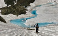
Lacs du Bâton and Lac du Bœuf from Freydières
 13.76 mi
+6,529 ft
-6,503 ft
10 hrs
Very difficult
Departure from La Combe-de-Lancey (Isère)
13.76 mi
+6,529 ft
-6,503 ft
10 hrs
Very difficult
Departure from La Combe-de-Lancey (Isère)
This is a very wild hike, half of which takes place in valleys completely off the beaten track, exploring the playground of the chamois, mouflons and ibex that abound in Belledonne.
The lakes of Bâton and Bœuf, nestled in the rounded rocks opposite the peaks of Oisans, are the highlights of the hike.
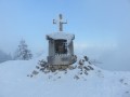
The ridges of Mont Fromage from Col de Porte
 6.39 mi
+1,348 ft
-1,345 ft
4 hrs
Average
Departure from Sarcenas (Isère)
6.39 mi
+1,348 ft
-1,345 ft
4 hrs
Average
Departure from Sarcenas (Isère)
A very pleasant hike, described here snowshoe users, but also good for walks on sunny days.
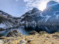
Lac du Crozet
 5.78 mi
+2,244 ft
-2,244 ft
4h 35
Average
Departure from Revel (Isère) (Isère)
5.78 mi
+2,244 ft
-2,244 ft
4h 35
Average
Departure from Revel (Isère) (Isère)
A pretty lake in a rocky landscape, overlooking the Grésivaudan valley. From the lake, you can enjoy a magnificent panorama of the Chartreuse mountains.
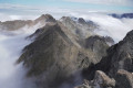
La Pliou – Lac du Crozet – Col de la Pra – Croix de Belledonne
 12.58 mi
+5,292 ft
-5,292 ft
10h 25
Very difficult
Departure from La Combe-de-Lancey (Isère)
12.58 mi
+5,292 ft
-5,292 ft
10h 25
Very difficult
Departure from La Combe-de-Lancey (Isère)
A lovely hike in the Belledonne massif leading to the Croix de Belledonne, following a route with a significant elevation gain. The route takes in the beautiful Lac du Crozet and the equally stunning Lacs du Doménon. It is possible to split the hike into two stages, spending the night at the very pleasant Refuge de la Pra.
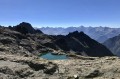
Pic du Grand Domènon and Grande Lauzière via Lacs du Bois and Lac du Bœuf
 12.56 mi
+6,247 ft
-6,243 ft
8 hrs
Very difficult
Departure from Revel (Isère) (Isère)
12.56 mi
+6,247 ft
-6,243 ft
8 hrs
Very difficult
Departure from Revel (Isère) (Isère)
A stunning hike that allows you to discover two gems of the Belledonne massif that are almost never visited: the Lac du Bois and Lac du Bœuf are little jewels off the beaten track of the massif. The Pic du Grand Domènon, the highest point of the walk, is a magnificent viewpoint that is much less visited than the Croix de Belledonne, offering views of the Bauges, Mont Blanc, the Grandes Rousses, the Oisans, the Dévoluy, the Taillefer, the Vercors and the Chartreuse and, of course, Belledonne and its lakes.
Please note: this hike is on the borderline between very difficult and extremely difficult.
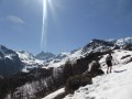
La Pointe de la Sitre
 5.97 mi
+3,176 ft
-3,163 ft
5h 30
Difficult
Departure from Saint-Mury-Monteymond (Isère)
5.97 mi
+3,176 ft
-3,163 ft
5h 30
Difficult
Departure from Saint-Mury-Monteymond (Isère)
This is a beautiful hike that climbs to Pointe de la Sitre and makes a detour to the lake of the same name.
There you will find a magnificent view of the Grésivaudan valley and the Grand Pic de Belledonne.
This hike is not particularly difficult, except perhaps for the slopes, which can be steep in places.
Lac du Crozet - Lac du Loup - Lac de la Grande Sitre
 8.83 mi
+4,190 ft
-4,173 ft
7h 40
Difficult
Departure from Saint-Mury-Monteymond (Isère)
8.83 mi
+4,190 ft
-4,173 ft
7h 40
Difficult
Departure from Saint-Mury-Monteymond (Isère)
A magnificent hike combining forest and low mountains, flora and fauna.
Circular route via the Col de la Sitre
 6.09 mi
+2,825 ft
-2,805 ft
5h 15
Difficult
Departure from Saint-Mury-Monteymond (Isère)
6.09 mi
+2,825 ft
-2,805 ft
5h 15
Difficult
Departure from Saint-Mury-Monteymond (Isère)
Come and discover this corner of the Belledonne massif in a high-mountain atmosphere, passing from forest to rocky terrain before returning via the mountain pasture and a charming refuge.
Rocher de l’Homme
 9.49 mi
+5,430 ft
-5,410 ft
8 hrs
Very difficult
Departure from Saint-Mury-Monteymond (Isère)
9.49 mi
+5,430 ft
-5,410 ft
8 hrs
Very difficult
Departure from Saint-Mury-Monteymond (Isère)
There are several ‘Rochers de l’Homme’ in Belledonne; the highest, at 2,755 m, is also one of the least visited. Like all the prominent peaks in the range, it offers an exceptional panorama stretching from Mont Blanc to the Écrins and from the Chartreuse to the Cerces, with the added bonus of a spectacular view of the west face of the Grand Pic.
This off-trail hike between Lac Blanc and the Combe de la Pierre requires sure-footedness to climb the southern ridge of the Rocher de l’Homme. Watch out for ibex.
La Croix de Belledonne via the lakes
 13.96 mi
+6,759 ft
-6,719 ft
12h 20
Very difficult
Departure from Saint-Mury-Monteymond (Isère)
13.96 mi
+6,759 ft
-6,719 ft
12h 20
Very difficult
Departure from Saint-Mury-Monteymond (Isère)
A magnificent hike to the Croix de Belledonne, passing the Boulon waterfalls, Lac Blanc, the Grande Pente snowfield, Lac du Grand Doméon, Lac du Petit Doméon and Lac du Crozet. Incredible scenery, with the chance to spot ibex, chamois and marmots. But please be aware: as the route involves crossing two snowfields, the use of crampons is strongly recommended given the steepness of the slopes.
La Pinéa - Chalet du Charmant Som circuit
 7.80 mi
+1,916 ft
-1,936 ft
5h 15
Average
Departure from Sarcenas (Isère)
7.80 mi
+1,916 ft
-1,936 ft
5h 15
Average
Departure from Sarcenas (Isère)
Circuit in Chartreuse starting from the very popular Col de Porte.
The goal is the pointed summit of La Pinéa and a relaxing break at the Charmant Som chalets under the watchful eye of Chamechaude.
La Pinéa, Montvernet and Montfromage via the Col de Porte
 6.20 mi
+1,870 ft
-1,893 ft
4h 30
Average
Departure from Sarcenas (Isère)
6.20 mi
+1,870 ft
-1,893 ft
4h 30
Average
Departure from Sarcenas (Isère)
A family hike away from the busy Charman Som route, avoiding the mountain pasture where dogs are not allowed from 10 June to 15 October. Mainly in the woods, the route is very pleasant in summer.
Charming Som circular via Mont Fromage
 8.61 mi
+2,067 ft
-2,087 ft
6 hrs
Average
Departure from Sarcenas (Isère)
8.61 mi
+2,067 ft
-2,087 ft
6 hrs
Average
Departure from Sarcenas (Isère)
A beautiful circular loop with no technical difficulties, allowing you to traverse a varied ridge and climb Charmant Som in the process, with views of the main peaks of Chartreuse and Belledonne.
From Col de Porte to Charmant Som
7.43 mi
+1,788 ft
-1,811 ft
4 hrs
Average
Departure from Sarcenas (Isère)
This is a magnificent, very accessible winter snowshoe hike, which takes you to the summit of Charmant Som from the Col de Porte resort via the snow-covered D57E road, which is sometimes difficult to see when the snow is deep.
This route offers magnificent panoramic views of all the surrounding mountains with a very reasonable elevation gain. Pass by the Oratoire d'Orgeval and the Chalets du Charmant Som.
Tour of the Crozet, Loup and Grande Sitre lakes
 7.93 mi
+3,435 ft
-3,442 ft
6h 40
Difficult
Departure from Saint-Mury-Monteymond (Isère)
7.93 mi
+3,435 ft
-3,442 ft
6h 40
Difficult
Departure from Saint-Mury-Monteymond (Isère)
Circular of the three lakes of Crozet, Loup and Grande Sitre from Saint-Mury-Monteymond on the north-western balcony of the Grande Lance de Domène in the Belledonne Massif.
The banks of the Isère
15.11 mi
+98 ft
-102 ft
1.5 hrs
Easy
Departure from Meylan (Isère)
A short, almost flat cycle ride, ideal for families or for getting back into shape after the winter break.
La Pinéa from the Col de Porte
 4.08 mi
+1,391 ft
-1,391 ft
3h 05
Average
Departure from Sarcenas (Isère)
4.08 mi
+1,391 ft
-1,391 ft
3h 05
Average
Departure from Sarcenas (Isère)
One of the classic hikes in Grenoble. A few short, steep climbs, a lovely, almost flat section through the woods and a fun ascent to the summit for a 360° view of Grenoble, the Chartreuse, Belledonne, the Vercors, Mont Blanc, etc.
Le Grand Replomb
7.74 mi
+4,229 ft
-4,226 ft
7h 15
Difficult
Departure from Sainte-Agnès (Isère) (Isère)
This is a rather wild hike in Belledonne that requires a good sense of direction.
With the exception of the lower part, the markings, when they exist, are quite varied, with a few yellow marks, orange lines, blue dots and, above all, numerous cairns of all sizes.
There aretwo cable passages at (10).
The Col de la Mine de Fer and Lac de Crop loop from Pré Marcel
9.81 mi
+4,039 ft
-4,045 ft
8h 00
Difficult
Departure from Sainte-Agnès (Isère) (Isère)
A lovely hike in the Belledonne massif, allowing you to appreciate all the mountain levels, from forest to alpine meadows and up to the mineral levels of high altitude. From Pré Marcel, climb to the Refuge Jean Small Pass, then cross the Col de la Mine de Fer. Descend the opposite slope to Lac de Crop, then after a descent into its glacial cirque, reach the car park via a discreet path.There are several ravines and steep passages, some of which are secured by cables, before reaching the Refuge Jean Small Pass (altitude 1,950 m).
Col de la Mine de Fer, Lac de Crop, Pont de la Betta from Pré Marcel
11.49 mi
+4,314 ft
-4,321 ft
9h 00
Difficult
Departure from Sainte-Agnès (Isère) (Isère)
A long circular loop that climbs from Pré Marcel through woodland to the Jean Collet Refuge, before ascending towards the Col de la Mine de Fer amidst a rocky high-mountain landscape. The path switches to the opposite slope, offering magnificent views to the right over the Brèche de Roche Fendue and the Ferrouillet peaks, to the left over the Grand Replomb, and, far below, nestled in the centre of the cirque, the splendid Lac de Crop with its beautiful ultramarine blue waters. After skirting its right bank and passing its narrows, the trail reaches the Pont de la Betta before embarking on a long traverse through the forest, passing in front of the Waterfall des Avoux before returning to the car park. This walk, in the Belledonne massif, is a variation on the circular route ‘Le Col de la Mine de Fer and Lac de Crop’, starting from Pré Marcel.
Loop from Pré Marcel to Col de la Mine de Fer, Lac de Crop and Orionde.
 10.20 mi
+4,560 ft
-4,564 ft
8h 40
Difficult
Departure from Sainte-Agnès (Isère) (Isère)
10.20 mi
+4,560 ft
-4,564 ft
8h 40
Difficult
Departure from Sainte-Agnès (Isère) (Isère)
This hike in the Belledonne massif is a version of route no. 44130540, entitled "Le Col de la Mine de Fer et le Lac de Crop en boucle, à partir de Pré Marcel" (The Iron Mine Pass and Lake Crop loop, starting from Pré Marcel), which avoids the passage through the Bois de la Croix Blanche, where the abandoned trail, resembling an adventure course, may put some people off. This loop, starting from Pré Marcel, although shorter, covers the mountain levels, passing from forest to alpine meadows and high-altitude mineral levels, not to mention the magnificent Lac de Crop. From Pré Marcel, climb to the Refuge Jean small pass, then cross the Col de la Mine de Fer. Descend the opposite slope to Lac de Crop, then, after descending its glacial barrier, go around Montagne de Barlet to find the uphill trail and return to the Pré Marcel car park.
Lac de Crop via Le Rafour – a circular route from Pré Marcel
 6.89 mi
+3,035 ft
-3,015 ft
5h 50
Difficult
Departure from Sainte-Agnès (Isère) (Isère)
6.89 mi
+3,035 ft
-3,015 ft
5h 50
Difficult
Departure from Sainte-Agnès (Isère) (Isère)
A lovely circular route that takes you above Lac de Crop, offering a bird’s-eye view. The route is partly off the beaten track, but the path is sometimes steep, difficult to follow, and even slightly exposed on a short section just after Le Rafour. You’ll need sure-footedness and good footwear!
I’d also recommend taking a map and a GPS.
Mount Rachais from Frette
 4.66 mi
+1,207 ft
-1,207 ft
3h 10
Average
Departure from Quaix-en-Chartreuse (Isère)
4.66 mi
+1,207 ft
-1,207 ft
3h 10
Average
Departure from Quaix-en-Chartreuse (Isère)
Mount Rachais, from the hamlet of Frette, situated on its far northern side.
Lac Blanc and the Freydanne Glacier via the waterfalls
 7.92 mi
+5,059 ft
-5,059 ft
8h 05
Difficult
Departure from Saint-Mury-Monteymond (Isère)
7.92 mi
+5,059 ft
-5,059 ft
8h 05
Difficult
Departure from Saint-Mury-Monteymond (Isère)
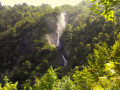
Lac Blanc is undoubtedly the jewel among Belledonne’s many lakes. Its popularity lives up to its reputation. The vast majority of hikers set off from Pré Comté (on the IGN map, La Souille at 1,365m) rather than from Chenevrey (alt. 910m), no doubt due to the extra elevation gain. Yet this route, though more strenuous, is enchanting. The ascent takes place in the shade of the Saint-Mury forest, following the turbulent Ruisseau de Vorz, then opens out into a clearing revealing the superb Cirque du Boulon and its high cliffs, cascaded over by a spray of waterfalls. At the top of the cirque, the path joins the Pré Comté trail to reach Lac Blanc. Against a backdrop of high mountains, the hike continues towards the Pic Central de Belledonne, reaching the foot of the Freydanne Glacier and the vertiginous north face of the Grand Pic de Belledonne
Lac Blanc de Belledonne from Chenevrey via Le Pleynet
5.67 mi
+4,245 ft
-4,245 ft
6h 20
Difficult
Departure from Saint-Mury-Monteymond (Isère)
A very beautiful hike, difficult due to the elevation gain on the way there and back, which leaves no time to rest and leads to a fabulous lake.
Col de la Pra and Grand Colon from the Quatres Chemins car park
 9.34 mi
+4,242 ft
-4,236 ft
8h 00
Difficult
Departure from Revel (Isère) (Isère)
9.34 mi
+4,242 ft
-4,236 ft
8h 00
Difficult
Departure from Revel (Isère) (Isère)
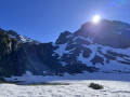
Hiking with lakes and streams in the Belledonne mountains, parking thirty minutes from Grenoble.Important note: please take into account the opinions of hikers on this outing. These opinions can be found at the bottom of the page in the Comments and Discussions section.
Loop via Lac du Crozet, Grande Sitre and the Refuge du Pré du Molard
9.79 mi
+4,386 ft
-4,390 ft
8h 20
Difficult
Departure from Revel (Isère) (Isère)
This hike takes you on a loop around Lake Crozet, covering several types of terrain (scree, a mountain pass, forest, lakes). It does not present any significant technical difficulties (climbing, exposed passages), but there are some sections in full sun and a few steep slopes.
Depuis les Quatre Chemins, Le Grand Colon, son couloir Est et le Lac Crozet
8.68 mi
+3,724 ft
-3,724 ft
7h 15
Difficult
Departure from Revel (Isère) (Isère)
Assez fréquentée, la randonnée au Grand Colon se prolonge habituellement par la descente sur le charmant Lac Merlat, pour rejoindre le refuge et le Col de la Pra, puis par le Vallon Mercier, le Lac Crozet. Le parcours, ici proposé, est une alternative moins belle, mais plus secrète, présentant un raccourci à cette descente classique.
Du Grand Colon un sentier longe une éminence rocheuse, légèrement plus haute (cote 2402), située au Nord-Est, puis passe un col pour descendre un pierrier encaissé, entre La Roche Fendue et le Galeteau, avant de retrouver le Vallon Mercier et le Lac Crozet.
The Égaux trail
 4.30 mi
+748 ft
-722 ft
2h 40
Average
Departure from Saint-Pierre-de-Chartreuse (Isère)
4.30 mi
+748 ft
-722 ft
2h 40
Average
Departure from Saint-Pierre-de-Chartreuse (Isère)
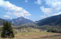
A lovely, varied walk with a beautiful view over the Saint-Pierre valley. The ‘moderate’ difficulty rating is solely due to a steep climb halfway through the walk (110 m elevation gain over 600 m). Otherwise, it is relatively short, easy and follows good paths.
__
The hamlets of Saint-Hugues de Chartreuse
 3.92 mi
+430 ft
-423 ft
2h 10
Easy
Departure from Saint-Pierre-de-Chartreuse (Isère)
3.92 mi
+430 ft
-423 ft
2h 10
Easy
Departure from Saint-Pierre-de-Chartreuse (Isère)
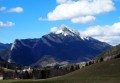
Take a short walk in the Saint-Pierre de Chartreuse valley. You can admire the peaks of Chamechaude to the south, Charmant Som to the west and Grand Som to the north-west, while passing through charming Carthusian hamlets.
Montrond via the forest track
 4.30 mi
+889 ft
-883 ft
2h 45
Easy
Departure from Saint-Martin-d'Uriage (Isère)
4.30 mi
+889 ft
-883 ft
2h 45
Easy
Departure from Saint-Martin-d'Uriage (Isère)
A short variation on the Montrond route published by the Uriage Tourist Office, which allows you to avoid most of the muddy paths in autumn, winter and spring.
Beautiful views of the Chartreuse and the Vercors around Le Pinet.
The Flin Plateau and the Chartreuse peaks
 2.55 mi
+292 ft
-289 ft
1h 25
Easy
Departure from Saint-Pierre-de-Chartreuse (Isère)
2.55 mi
+292 ft
-289 ft
1h 25
Easy
Departure from Saint-Pierre-de-Chartreuse (Isère)
This is an easy walk, ideal for families. The setting: views of three peaks in the Chartreuse range – the Charmant Som, Chamechaude and the Grand Som. The walk can be done on foot in summer or on snowshoes in winter.
The Lance Sud de Malissard circular
 7.84 mi
+3,658 ft
-3,638 ft
6h 50
Difficult
Departure from Saint-Pierre-de-Chartreuse (Isère)
7.84 mi
+3,658 ft
-3,638 ft
6h 50
Difficult
Departure from Saint-Pierre-de-Chartreuse (Isère)
This is a beautiful hike that offers a 360-degree panoramic view of the Chartreuse and Belledonne mountains in the distance from the summit.
This hike also allows you to enjoy the magnificent limestone landscapes of the surrounding area!
Please note: the final stretch through the rocks between the Col de Bellefond and the summit of the Lance Sud is quite steep and requires you to use your hands. In addition, the west face of the summit ridge is steep and therefore not necessarily suitable for people who are afraid of heights.
Dent de Crolles and Lance Sud de Malissard loop via Perquelin
 11.77 mi
+5,079 ft
-5,052 ft
8 hrs
Very difficult
Departure from Saint-Pierre-de-Chartreuse (Isère)
11.77 mi
+5,079 ft
-5,052 ft
8 hrs
Very difficult
Departure from Saint-Pierre-de-Chartreuse (Isère)
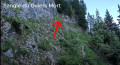
Here is an unusual and challenging hike. It takes in all the must-see sights of the Dent de Crolles and its surroundings: Source du Guiers Mort, Arche à l’Aiguille, Sangle Barrère, Chemin des Crêtes, Arche de Rocheplane and Lance Sud de Malissard.
⚠️ 05/06/2026: route modified to avoid the Trou du Glaz path, which has been closed since November 2025 following a rockslide.
Col de Bellefont via Le Chaos and back via the Col de Saulce
6.85 mi
+3,720 ft
-3,678 ft
6h 25
Difficult
Departure from Saint-Pierre-de-Chartreuse (Isère)
A beautiful, wild hike in the heart of the Chartreuse and on the edge of its nature reserve. The route starts in the woodland, to the sound of the waterfall and the source of the Guiers, climbs up the cliff face, crosses the wild and rugged Chaos de Bellefont, passes through mountain pastures, and reaches the ridge with its stunning views.
The Bellefont Hut from the hamlet of Perquelin
 5.73 mi
+2,178 ft
-2,156 ft
4h 30
Average
Departure from Saint-Pierre-de-Chartreuse (Isère)
5.73 mi
+2,178 ft
-2,156 ft
4h 30
Average
Departure from Saint-Pierre-de-Chartreuse (Isère)
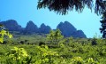
A walk well sheltered from the sun in the heart of the Cartusian forest. Best done on hot days.
Once you reach the hut, you will be rewarded with a splendid 359° panorama.
Please note! Several hikers have reported a landslide between points (3) and (4). This landslide could be a problem for people prone to vertigo and could prove dangerous.
Dent de Crolles via Le Prayet
 7.47 mi
+5,604 ft
-5,620 ft
8h 20
Very difficult
Departure from Saint-Pierre-de-Chartreuse (Isère)
7.47 mi
+5,604 ft
-5,620 ft
8h 20
Very difficult
Departure from Saint-Pierre-de-Chartreuse (Isère)
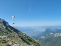
A very nice alternative for climbing to the Dent de Crolles from Perquelin, as a substitute for the Trou du Glaz, which is closed: rockfall in winter 2026. No technical difficulty apart from the descent of the Pas de l’Œille, where it is sometimes necessary to use your hands, and no vertiginous sections. The circular route can be done in either direction.
Around Guiers Mort (1): the spring
 2.64 mi
+1,191 ft
-1,188 ft
2h 15
Average
Departure from Saint-Pierre-de-Chartreuse (Isère)
2.64 mi
+1,191 ft
-1,188 ft
2h 15
Average
Departure from Saint-Pierre-de-Chartreuse (Isère)
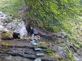
A short hike around the Guiers Mort, a pretty little stream. The walk is mainly through the woods and along the valley floor to discover its source. This walk can be followed by a second one, still around the same stream: the Gorges du Guiers Mort, where you can even take a dip.
These two short hikes can be done one after the other (3½ hours + 30 minutes by car) or separately.
The Bellefont Pass via the Colonel's Trail
 6.98 mi
+3,402 ft
-3,399 ft
6h 10
Difficult
Departure from Saint-Pierre-de-Chartreuse (Isère)
6.98 mi
+3,402 ft
-3,399 ft
6h 10
Difficult
Departure from Saint-Pierre-de-Chartreuse (Isère)
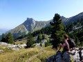
A beautiful, fairly challenging walk offering splendid views of all the peaks of the Chartreuse.
Caution! Read the comments carefully. A tricky scree slope has been reported.
Bellefont rock field from Perquelin
5.88 mi
+2,858 ft
-2,828 ft
5h 10
Difficult
Departure from Saint-Pierre-de-Chartreuse (Isère)
An unusual hike through the rocky outcrops of the Chaos de Bellefont. Expect a few short sections of easy climbing. You must follow the markings in the Chaos de Bellefont very carefully to avoid getting lost.
Le Charmant Som from Les Cottaves
 5.83 mi
+2,608 ft
-2,605 ft
4h 55
Difficult
Departure from Saint-Pierre-de-Chartreuse (Isère)
5.83 mi
+2,608 ft
-2,605 ft
4h 55
Difficult
Departure from Saint-Pierre-de-Chartreuse (Isère)
You set off from the Saint-Pierre-de-Chartreuse valley and climb to 1,867 metres on the Charmant Som, the central peak of the Chartreuse. You’ll be treated to a panoramic view of all the peaks in the massif and the surrounding area.
Short walk around Bel aux Airs
 3.43 mi
+600 ft
-587 ft
2h 05
Easy
Departure from Les Adrets (Isère)
3.43 mi
+600 ft
-587 ft
2h 05
Easy
Departure from Les Adrets (Isère)
Starting from the Col d'Hurtières, you’ll enjoy varied scenery. Let yourself be surprised by the views. This walk is enjoyable in both summer and winter.
The Charmant Som in a circular pattern from Les Revols
 6.24 mi
+2,772 ft
-2,762 ft
5h 15
Average
Departure from Saint-Pierre-de-Chartreuse (Isère)
6.24 mi
+2,772 ft
-2,762 ft
5h 15
Average
Departure from Saint-Pierre-de-Chartreuse (Isère)
A beautiful circular route away from the beaten track to one of the most beautiful peaks in the Chartreuse.
This hike takes you along the spectacular but very passable Chemin des Dalles, which runs along the rock face below the summit.
The Quinsonas and Mont Rachais crosses from La Tronche
 4.60 mi
+2,497 ft
-2,497 ft
4h 15
Average
Departure from La Tronche (Isère)
4.60 mi
+2,497 ft
-2,497 ft
4h 15
Average
Departure from La Tronche (Isère)
Whilst the Croix de Quinsonas, situated on Mont Jalla, pays tribute to local Resistance fighters, the one on the ridge of Mont Rachais is far more enigmatic as to its origin. But both offer superb vantage points over the sprawling Grenoble conurbation, surrounded by Belledonne, the Taillefer, the Matheysine and the Vercors.
Le Grand Colon
5.39 mi
+3,166 ft
-3,166 ft
5h 15
Average
Departure from Revel (Isère) (Isère)
A fairly short hike starting from the Baraque des Carriers car park, but very interesting and moderately difficult, with a beautiful view from the summit. A lovely moment shared at the summit with a ibex.
Crossing the Montagne des Quatre Seigneurs
 5.44 mi
+1,696 ft
-2,093 ft
4h 00
Average
Departure from Saint-Martin-d'Uriage (Isère)
5.44 mi
+1,696 ft
-2,093 ft
4h 00
Average
Departure from Saint-Martin-d'Uriage (Isère)
There are countless route options in this forested area on the outskirts of the Grenoble conurbation, delighting both walkers and mountain bikers alike. The advantage of this route, linking the village of Saint-Martin-d’Uriage to Eybens, is that it offers varied views, first of the Belledonne massif and then of the “capital of the Alps”, dominated by the Vercors and the Chartreuse.
The Venon circuit starting from Sonnant d’Uriage
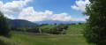 8.97 mi
+1,453 ft
-1,434 ft
5h 25
Average
Departure from Saint-Martin-d'Uriage (Isère)
8.97 mi
+1,453 ft
-1,434 ft
5h 25
Average
Departure from Saint-Martin-d'Uriage (Isère)
A countryside walk combining forest paths with visits to villages such as Venon and Saint-Nizier, as well as a few hamlets tucked away in the woods...
La Pinéa from the Orgeval oratory
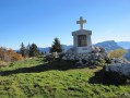 4.35 mi
+1,096 ft
-1,115 ft
2h 55
Easy
Departure from Saint-Pierre-de-Chartreuse (Isère)
4.35 mi
+1,096 ft
-1,115 ft
2h 55
Easy
Departure from Saint-Pierre-de-Chartreuse (Isère)
La Pinéa via the ridge that connects it to Charmant Som.
On a clear day, there is a beautiful view of the Grande Sure, Charmant Som, Chamechaude and Mont-Aiguille.
Circular route from the Cabane de Bellefont via Saint-Pierre-de-Chartreuse
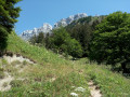 8.38 mi
+2,976 ft
-2,976 ft
6h 25
Average
Departure from Saint-Pierre-de-Chartreuse (Isère)
8.38 mi
+2,976 ft
-2,976 ft
6h 25
Average
Departure from Saint-Pierre-de-Chartreuse (Isère)
A shaded circular route with beautiful scenery and very well signposted. The climb is a bit steep at the start. No technical sections apart from a short stretch near the Rocher du Mollard (above the cliff) where you’ll need to reassure those prone to vertigo and hold onto children. There’s a safety cable to hold onto, though it’s not strictly necessary.
Best done in dry weather.
See practical information regarding certain restrictions.
Pierre Mesure from Saint-Pierre-de-Chartreuse
 Tourist office5.16 mi
+1,204 ft
-1,198 ft
3h 25
Average
Departure from Saint-Pierre-de-Chartreuse (Isère)
Tourist office5.16 mi
+1,204 ft
-1,198 ft
3h 25
Average
Departure from Saint-Pierre-de-Chartreuse (Isère)
A walk along a wooded slope leading to old meadows; discover Carthusian architecture.
Charmant Som circular loop
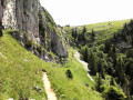 2.49 mi
+978 ft
-1,004 ft
2h 00
Average
Departure from Saint-Pierre-de-Chartreuse (Isère)
2.49 mi
+978 ft
-1,004 ft
2h 00
Average
Departure from Saint-Pierre-de-Chartreuse (Isère)
A lovely little hike that extends the climb to the magnificent, very popular viewpoint at the summit with a more secluded detour around Charmant Som. This leads to the promontory with a beautiful view of the Grande Chartreuse Monastery, returning to the car park via the western balcony.
Le Charmant Som
 1.67 mi
+640 ft
-643 ft
1h 20
Easy
Departure from Saint-Pierre-de-Chartreuse (Isère)
1.67 mi
+640 ft
-643 ft
1h 20
Easy
Departure from Saint-Pierre-de-Chartreuse (Isère)
In summer, there is a very easy walk with magnificent views of the Grande Chartreuse, Mont Blanc and many other peaks.
Dogs are not allowed at Charmant Som, even on a leash, from 10 June to 15 October.
From Saint Pierre-de-Chartreuse to the Arcabas Museum
5.66 mi
+600 ft
-597 ft
3h 10
Easy
Departure from Saint-Pierre-de-Chartreuse (Isère)
As you follow the streams, change valleys and visit the church of Saint-Hugues de Chartreuse, decorated by the painter Arcabas.
The Lances de Malissard from Les Essarts
 6.60 mi
+2,592 ft
-2,618 ft
5h 20
Difficult
Departure from Saint-Pierre-de-Chartreuse (Isère)
6.60 mi
+2,592 ft
-2,618 ft
5h 20
Difficult
Departure from Saint-Pierre-de-Chartreuse (Isère)
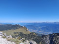
This route has the least elevation gain for climbing one of the four peaks over 2,000 m in the Chartreuse. Magnificent view of the back of the Dent de Crolles, the north of the Chartreuse and, on the other side, the majestic Mont Blanc.
Charming Som via the Bérard ridge
 9.19 mi
+4,633 ft
-4,610 ft
6 hrs
Very difficult
Departure from Saint-Pierre-de-Chartreuse (Isère)
9.19 mi
+4,633 ft
-4,610 ft
6 hrs
Very difficult
Departure from Saint-Pierre-de-Chartreuse (Isère)
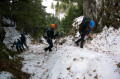
A wonderful circular hike with no major difficulties, except for the length and elevation gain! After the point (3), the trail becomes more technical (especially in rainy or snowy weather).
Tour of the Saint-Pierre-de-Chartreuse valley
 8.15 mi
+965 ft
-955 ft
4h 35
Average
Departure from Saint-Pierre-de-Chartreuse (Isère)
8.15 mi
+965 ft
-955 ft
4h 35
Average
Departure from Saint-Pierre-de-Chartreuse (Isère)
Leave the village and walk around the valley, discovering the main peaks as you go: Charmant Som, Chamechaude, Dent de Crolles, Scia and Grand Som. You will also pass through several Carthusian hamlets.
Loop of the Cascade de l'Oursière and the Belledonne Sud lakes
 11.77 mi
+4,327 ft
-4,331 ft
9h 10
Difficult
Departure from Saint-Martin-d'Uriage (Isère)
11.77 mi
+4,327 ft
-4,331 ft
9h 10
Difficult
Departure from Saint-Martin-d'Uriage (Isère)
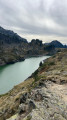
This magnificent loop trail starts at the Gâte car park and climbs through the woods to the viewpoint of the impressive and beautiful Cascade de l'Oursière waterfall, then follows the Ruisseau du Doménon stream through a welcoming grassy valley, ideal for a short rest before tackling the climb up a scree slope. At the top, you will find the stream again, which flows peacefully through an alpine meadow in a picture-postcard setting. Once you have crossed a valley, you will discover the charming Lac Merlat in a high mountain atmosphere. Take a short detour to the Refuge de la Pra before continuing on to admire the series of superb lakes: Claret, Longet, Bernard and Léama. After crossing a few rocky outcrops, you come to a cute little lake and then the three Robert Lakes at the foot of the Croix de Chamrousse. The descent from the Brèche Robert Nord leads to the Lac des Pourettes in a marshy basin and finally a passage through the forest brings you back to the car park.
The David Lake circular route via the Oursière Waterfall
 9.92 mi
+4,193 ft
-4,199 ft
8h 15
Difficult
Departure from Saint-Martin-d'Uriage (Isère)
9.92 mi
+4,193 ft
-4,199 ft
8h 15
Difficult
Departure from Saint-Martin-d'Uriage (Isère)
This very pretty circular loop up to Lac David via the Cascade de l'Oursière allows you to first enjoy the various Pra lakes (Bernard, Longet, Claret) and then make a beautiful traverse under the Jasse Bralard peaks. Throughout the traverse, you can enjoy a magnificent view overlooking the city of Grenoble below.
Lacs Robert via L'Oursière
 7.52 mi
+3,274 ft
-3,255 ft
6h 20
Difficult
Departure from Saint-Martin-d'Uriage (Isère)
7.52 mi
+3,274 ft
-3,255 ft
6h 20
Difficult
Departure from Saint-Martin-d'Uriage (Isère)
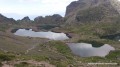
This is a magnificent circuit in the Belledonne massif that will take you to the shores of the Robert lakes, a site well known to skiers who visit the Chamrousse resort.
The difficulty is not technical, but should be taken into account due to the steep slopes in places and the particular nature of this mountain range, which is often shrouded in fog.
Lake Claret via the Oursière Waterfall
 8.91 mi
+3,264 ft
-3,261 ft
6h 55
Difficult
Departure from Saint-Martin-d'Uriage (Isère)
8.91 mi
+3,264 ft
-3,261 ft
6h 55
Difficult
Departure from Saint-Martin-d'Uriage (Isère)
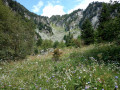
A really lovely hike that climbs up to Lac Claret, taking in the impressive Waterfall de l’Ousrière as well as Lacs Bernard and Longet.It offers a lovely overview of the Pra Lakes, accompanied by superb views of a large part of the peaks of the Belledonne massif.It is, however, quite a long hike.
Lakes of La Pra
 10.79 mi
+4,160 ft
-4,157 ft
8h 35
Difficult
Departure from Saint-Martin-d'Uriage (Isère)
10.79 mi
+4,160 ft
-4,157 ft
8h 35
Difficult
Departure from Saint-Martin-d'Uriage (Isère)
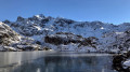
This hike takes you to a series of lakes set like precious stones along the path from the Oursière waterfalls to the Col de la Pra, between wave-cut rocks and alpine flora.
This route, which is partly off-trail, is particularly treacherous: there is no way to keep to a schedule, as the fascinating landscapes compel you to linger and contemplate.
A small part of the route is off-trail but there are no difficulties with orientation.
Croix de Belledonne via the Waterfall de l’Oursière
 14.85 mi
+5,866 ft
-5,866 ft
12 hrs
Extremely difficult
Departure from Saint-Martin-d'Uriage (Isère)
14.85 mi
+5,866 ft
-5,866 ft
12 hrs
Extremely difficult
Departure from Saint-Martin-d'Uriage (Isère)
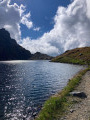
A spectacular hike to the iconic Croix de Belledonne. As well as the most varied alpine landscapes, the numerous stunning lakes along the route and the wonderful encounters you’ll have along the way, the end of this hike offers a breathtaking view of the Vercors, the Chartreuse and the Écrins. Starting at an altitude of 1,100 m and finishing at 2,926 m.
Enjoy!
The Batteries Hautes circular loop
 4.15 mi
+1,188 ft
-1,184 ft
2h 55
Average
Departure from Saint-Martin-d'Hères (Isère)
4.15 mi
+1,188 ft
-1,184 ft
2h 55
Average
Departure from Saint-Martin-d'Hères (Isère)
The advantage of Grenoble is that just 15 minutes from the city centre, you can go for a hike in the low mountains. Here’s a short circular route to get fit before spring, or a family walk to get up high and enjoy the views.
A walk around the haberts of Valombré and Malamille
 3.99 mi
+597 ft
-614 ft
2h 20
Easy
Departure from Saint-Pierre-de-Chartreuse (Isère)
3.99 mi
+597 ft
-614 ft
2h 20
Easy
Departure from Saint-Pierre-de-Chartreuse (Isère)
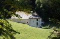
The ‘haberts’ form an integral part of the Chartreuse landscape. They have witnessed the major events that have shaped history. This walk allows you to appreciate the importance these buildings—particularly those at Valombré and Malamille—held during the Second World War.
The Charmant Som circular loop from Valombré
 10.48 mi
+3,999 ft
-4,003 ft
8h 20
Difficult
Departure from Saint-Pierre-de-Chartreuse (Isère)
10.48 mi
+3,999 ft
-4,003 ft
8h 20
Difficult
Departure from Saint-Pierre-de-Chartreuse (Isère)
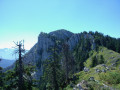
Le Charmant Som is very busy due to the access road to its sheepfold coming from the Col de Porte. Its other sides, however, offer a wilder approach, particularly when coming from Valombré and Malamille. This route offers a relatively long but varied circular route, featuring ridge walks and crossings over slabs and sharp limestone pavements, whose wild character contrasts with the crowds at the summit arriving via the mountain pastures.
On the heights of Herbeys
2.62 mi
+627 ft
-627 ft
1h 45
Easy
Departure from Herbeys (Isère)
A leisurely stroll in the hills above Herbeys with a magnificent view of the Vercors.
Pinéa and Charmant Som via the Vermorel trail
 9.62 mi
+3,481 ft
-3,474 ft
7h 25
Difficult
Departure from Proveysieux (Isère)
9.62 mi
+3,481 ft
-3,474 ft
7h 25
Difficult
Departure from Proveysieux (Isère)
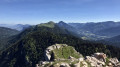
A very beautiful circular route linking two of the peaks overlooking the Col de Porte, via a picturesque and relatively quiet route. The peaks and ridges offer superb views of the Chartreuse and the surrounding mountain ranges: Vercors, Dévoluy, Taillefer, Oisans, Grandes Rousses and Belledonne.As the ascent is mainly in the shade, this hike—ideal for hot weather—presents no technical difficulties; however, care should be taken on the Vermorel path.
A lovely hike to Som via La Cochette and back via the Arête de Bérard
9.11 mi
+4,669 ft
-4,672 ft
8h 15
Difficult
Departure from Saint-Pierre-de-Chartreuse (Isère)
A lovely circular route on a wild slope of the Charmant Som. Following the Combe d’If – an area untouched by human activity – then passing La Rochette, you emerge onto the mountain pasture, where you rejoin a north-south ridge offering a magnificent panorama of Belledonne, Mont Blanc… and everything else! After three hours of solitude, you emerge amongst many walkers who have arrived from the south via the mountain chalet, but the descent down the eastern face, with its limestone slab, quickly restores the charm of this beautiful hike in the Chartreuse!
Grande Sure from Col de la Charmette
 5.99 mi
+2,349 ft
-2,323 ft
4h 50
Average
Departure from Saint-Pierre-de-Chartreuse (Isère)
5.99 mi
+2,349 ft
-2,323 ft
4h 50
Average
Departure from Saint-Pierre-de-Chartreuse (Isère)
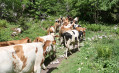
A fairly easy route to reach this summit in the Chartreuse mountains. However, the final ascent requires a bit of energy.
At Col de la Sure, you can enjoy a peaceful stroll through the mountain pastures.
La Grande Sure circular starting from the Col de la Charmette
 8.76 mi
+2,877 ft
-2,864 ft
6h 30
Difficult
Departure from Saint-Pierre-de-Chartreuse (Isère)
8.76 mi
+2,877 ft
-2,864 ft
6h 30
Difficult
Departure from Saint-Pierre-de-Chartreuse (Isère)
Magnificent view of the Chartreuse and the plain from the summit of the Grande Sure. The first part, from the car park to the summit of the Grande Sure, is the most difficult with scree. The descent from the summit to the Col de la Vache must be undertaken with caution. The rest is easier. The return after the Col d'Hurtières is through the woods.
Charmant Som via Pré Batard
 5.20 mi
+2,054 ft
-2,054 ft
4h 10
Average
Departure from Saint-Pierre-de-Chartreuse (Isère)
5.20 mi
+2,054 ft
-2,054 ft
4h 10
Average
Departure from Saint-Pierre-de-Chartreuse (Isère)
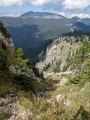
This pretty circular starting from the Col de la Charmette allows you to climb the Charmant Som via a fairly uncrowded route (but you won't avoid the crowds at the summit...). The final climb up a chimney requires caution, but does not present any particular difficulties.
The Col d'Hurtières circular route via Vararey and the Goulet d'Hurtières
 7.09 mi
+1,972 ft
-1,972 ft
5h 00
Average
Departure from Saint-Pierre-de-Chartreuse (Isère)
7.09 mi
+1,972 ft
-1,972 ft
5h 00
Average
Departure from Saint-Pierre-de-Chartreuse (Isère)
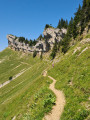
From the Col de la Charmette in Chartreuse, climbing up through the Plaine de Varavey, a magnificent summer pasture, you will reach the Col d'Hurtières to admire the Grande Sure. You will walk along cliffs to pass the Goulet d'Hurtières.
Once past this aerial gully, the descent takes you back to the car park through very varied landscapes.
This route is less steep than the Col de la Grande Vache, and therefore less difficult, but it follows a path on a sloping hillside.
La Grande Sure via the Col d'Hurtière
 8.68 mi
+2,871 ft
-2,871 ft
6h 30
Average
Departure from Saint-Pierre-de-Chartreuse (Isère)
8.68 mi
+2,871 ft
-2,871 ft
6h 30
Average
Departure from Saint-Pierre-de-Chartreuse (Isère)
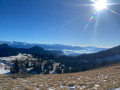
An unmissable walk near Grenoble.
Despite the crowds during these last beautiful days of autumn, we were able to avoid the rush (except on the climb to the summit).
La Grande Sure via the Cols de la Vache
 7.10 mi
+2,828 ft
-2,828 ft
5h 45
Average
Departure from Saint-Pierre-de-Chartreuse (Isère)
7.10 mi
+2,828 ft
-2,828 ft
5h 45
Average
Departure from Saint-Pierre-de-Chartreuse (Isère)
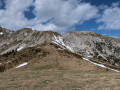
A magnificent loop starting from the Chalet de la Charmette, via the Col de la Grande Vache and Col de la Petite Vache.
An aerial walk with breathtaking views.
Refuge de la Pra – Refuge Jean Collet
 4.45 mi
+2,395 ft
-2,959 ft
4h 10
Difficult
Departure from Revel (Isère) (Isère)
4.45 mi
+2,395 ft
-2,959 ft
4h 10
Difficult
Departure from Revel (Isère) (Isère)
A challenging day’s hike connecting two iconic mountain huts in the Belledone massif. Chamois, moraines and lakes will punctuate the route.
La Pra - Croix de Belledonne - La Pra
 6.06 mi
+2,592 ft
-2,572 ft
5h 05
Difficult
Departure from Revel (Isère) (Isère)
6.06 mi
+2,592 ft
-2,572 ft
5h 05
Difficult
Departure from Revel (Isère) (Isère)
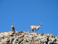
The legendary summit of Belledonne is easily accessible in summer. The entire route is superb, whether it's the view of Lac du Crozet from Col de la Pra, the Lacs des Doménon or the view from the summit.
Loop under the Grande Sure
 4.69 mi
+1,631 ft
-1,634 ft
3h 35
Average
Departure from Saint-Pierre-de-Chartreuse (Isère)
4.69 mi
+1,631 ft
-1,634 ft
3h 35
Average
Departure from Saint-Pierre-de-Chartreuse (Isère)
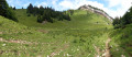
A magnificent, easy walk suitable for young walkers. Magnificent views and an area where you are likely to encounter mouflons and chamois! The passage through the Goulet d'Hurtières is pleasant and less frequented than the other paths leading to the Grande Sure.
Rocher de Lorzier and Rocher de Chalves
 8.94 mi
+3,035 ft
-3,015 ft
6h 45
Difficult
Departure from Saint-Pierre-de-Chartreuse (Isère)
8.94 mi
+3,035 ft
-3,015 ft
6h 45
Difficult
Departure from Saint-Pierre-de-Chartreuse (Isère)
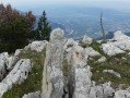
A pleasant hike, half of which is in the magnificent Génieux forest and the other half in the Hurtières and Vararey mountain pastures. The route, which runs off the marked trail along the Crête du Rocher de Lorzier, offers spectacular views of the Gorges de Crossey and the Voironnais, then, from the summit of Rocher de Chalves, of the Chartreuse, Belledonne, Dévoluy, Taillefer and Vercors ranges and peaks.
The trail is poorly marked in the forest, so a GPS is recommended.
Circular Grande Sure with return via Goulet d'Hurtières.
6.38 mi
+2,336 ft
-2,333 ft
5h 00
Difficult
Departure from Saint-Pierre-de-Chartreuse (Isère)
A challenging day hike but very accessible for regular hikers, with varied terrain including scree slopes, cow pastures, forests and chasms, plus superb views of the Isère valley and the Chartreuse mountains.
From the fortified house of La Frette to the Château du Touvet, a circular route
 4.66 mi
+938 ft
-928 ft
2h 55
Average
Departure from Le Touvet (Isère)
4.66 mi
+938 ft
-928 ft
2h 55
Average
Departure from Le Touvet (Isère)
An easy route in the hills above Le Touvet, from one castle to another, with the first part in the forest and the return via the hamlets on the road, including 250 m on the D29, but without any danger.
The Fort of Montavie
5.01 mi
+965 ft
-971 ft
3h 10
Average
Departure from Eybens (Isère)
On the outskirts of the capital of the Alps, a circular route starting from Eybens provides access to the Fort de Montavie overlooking Grenoble. This is more of a walk than a hike, offering remarkable views of the three mountain ranges surrounding the Drac and Isère valleys: Belledonne, Chartreuse and Vercors.