Lac de Crop via Le Rafour – a circular route from Pré Marcel

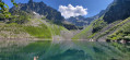
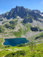
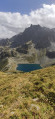
A lovely circular route that takes you above Lac de Crop, offering a bird’s-eye view. The route is partly off the beaten track, but the path is sometimes steep, difficult to follow, and even slightly exposed on a short section just after Le Rafour. You’ll need sure-footedness and good footwear!
I’d also recommend taking a map and a GPS.

Details

40222203
Creation:
Last update:
Last review:
  • Walking
    Activity: Walking
  • ↔
    Distance: 6.89 mi
  • ◔
    Average duration: 5h 50 
  • ▲
    Difficulty: Difficult

  • ⚐
    Back to start: Yes
  • ↗
    Ascent: + 3,035 ft
  • ↘
    Descent: - 3,015 ft

  • ▲
    Highest point: 7,116 ft
  • ▼
    Lowest point: 4,222 ft

Photos

Description of the walk

Park at the Pré Marcel car park.

(S/E) Set off southwards. At the Pré Michu (Michel) junction, continue left, south-east, pass the Source de Michel and follow the signposts towards the Refuge Jean Collet. Climb for a good hour until you reach a right-hand hairpin bend at an elevation of 1640, where you can see the edge of the forest higher up; look out for a path that continues straight on.

(1) Follow it. It is poorly marked in places. Then veer to the right and climb up to a grassy plateau. It is not a problem to leave the path, as various tracks lead to the grassy plateau, where a well-marked path begins. Follow it to the left, almost level with the ground. You’ll then spot a grassy hill directly above, Orionde, to the north-east. You need to climb up to the Col du Rafour, at the foot of this hill.
I chose to climb up the gully on the right-hand side, but the path was often hard to see. It might be better to stick to the path all the way to the waypoint (3); I’d love to hear about anyone’s experiences!
Climb up this valley on the right to join an almost horizontal path, still well below Orionde.

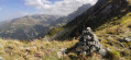
(2) Follow this almost horizontal path south-eastwards, veering to the right, pass a rocky outcrop and emerge onto a scree slope. You must then follow the cairns northwards to reach the Col du Rafour.

(3) At the Col du Rafour, just below Orionde, follow the ridge south-eastwards and climb up to the Rafour via a faintly marked path.

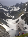
(4) At the summit, take a moment to admire the view, then descend via the well-marked path, taking great care as it is exposed for a short stretch. You will reach Lac de Crop and a fork in the path on the northern side of the lake.

(5) Descend to the left along the main track leading towards Pré Marcel and the Pont de la Betta. When the track enters the forest (alt. 1,650 m), look out for a horizontal path branching off to the left on a slight plateau. A sign attached to a tree points towards Pré Marcel.

(6) Follow this path to the left, heading north-west; it starts off level before descending in the same general direction to join a wide forest track.

(7) Follow it down to the right, then to the left, until you reach the Pré Marcel car park (S/E).


Waypoints

  1. S/E : mi 0 - alt. 4,236 ft - Pré Marcel car park
  2. 1 : mi 1.58 - alt. 5,338 ft - Junction
  3. 2 : mi 2.09 - alt. 6,158 ft - Junction. Below the Col du Rafour
  4. 3 : mi 2.61 - alt. 6,640 ft - Co' du Rafour (1882m)
  5. 4 : mi 2.78 - alt. 7,028 ft - Le Rafour (2180m)
  6. 5 : mi 3.46 - alt. 6,270 ft - Lac de Crop
  7. 6 : mi 4.47 - alt. 5,394 ft - Junction. Signpost indicating Pré Marcel
  8. 7 : mi 6.04 - alt. 4,518 ft - Track junction
  9. S/E : mi 6.89 - alt. 4,236 ft - Pré Marcel car park

Notes

No shelter.

Reviews and comments

3.8 / 5
Based on 3 reviews

Reliability of the description
4 / 5
Ease of following the route
3 / 5
Route interest
4.3 / 5
lightsky
lightsky

Overall rating : 3.3 / 5

Date of your route : Jul 14, 2025
Reliability of the description : ★★★☆☆ Average
Ease of following the route : ★★★☆☆ Average
Route interest : ★★★★☆ Good
Very busy route : No

It's a pretty nice area and route, but not feasible without being connected at some point to avoid getting lost: there are too many different trails

Machine-translated

Tayrone
Tayrone
• Edited:

I set off on this hike knowing there were few signposts, but I didn’t expect there to be certain spots in the forest where there were no signposts at all. I got lost in the forest – you really do need a map and a GPS. There are lots of fallen trees, so you have to step over or even crawl under the trunks lying on the ground. I found some sections rather dangerous, so I’d strongly advise against doing this in the rain or snow.

Machine-translated

XFandre
XFandre

Overall rating : 3.7 / 5

Date of your route : Oct 31, 2024
Reliability of the description : ★★★★☆ Good
Ease of following the route : ★★★☆☆ Average
Route interest : ★★★★☆ Good
Very busy route : No

Hike completed on Tuesday 29 October.
Without the GPS track, I would have got lost, but I’m not exactly a model of good sense of direction.
Quite a lot of woodland for my liking, especially on the way back, with muddy, slippery ground in the shade.
The route has the merit of offering a circular route around Lake Crop rather than a return journey, which is always a bit frustrating, and it covers varied terrain.
It took me 4 hours and 15 minutes, but I didn’t dawdle…

Machine-translated

jluca
jluca

Thank you for your feedback – it’s spot on. Enjoy your walks!

Machine-translated

rdub
rdub

Overall rating : 4.3 / 5

Date of your route : Jul 28, 2024
Reliability of the description : ★★★★★ Very good
Ease of following the route : ★★★☆☆ Average
Route interest : ★★★★★ Very good
Very busy route : No

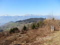
A magnificent hike in the Belledonne range offering superb panoramic views of the Chartreuse and the Vercors. Whilst Lake Crop is a traditional and easily accessible destination in the massif, this alternative route via Le Rafour is certainly unusual and physically demanding!
The off-trail ascent is gruelling, partly due to the steep gradient (the climb is almost perpendicular to the slope) and partly because, despite frequent use of a GPS, the path is often invisible and overgrown.
Please note that the start of the path leading to the Col du Rafour (after point 1) is very inconspicuous, if not invisible; we were alerted to this by the app!
It’s worth noting that the view overlooking the lake makes you forget the difficulties; as is often the case, the reward lies at the end of the trail.
It is true that there are a few (short) tricky sections after point 4 to bear in mind, but as the author points out, sure-footedness and good footwear are essential.
After the lake, the descent – a very standard one – presents no difficulties.

Machine-translated

Other walks in the area

For more walks, use our search engine .

The GPS track and description are the property of this route's author. Please do not copy them without permission.