Country:

 City:
City:



(S/E) Leave the cathedral forecourt by taking Rue Brocherie, opposite. This leads to the charming market at Place aux Herbes and then becomes Rue du Palais de Justice.
(1) Once you reach the Place du Palais de Justice, you can admire the majestic palace on your right.
Opposite, on the left, is the Saint-André Collegiate Church. Head towards it. You’ll go in and come out through a small door on the other side, towards the chancel (if the collegiate church is closed, you’ll need to go round it via the tiny Rue d’Agier). Opposite is the entrance to the city gardens. Go inside (there are children’s play areas) and turn left. Leave the garden through a gateway directly in front of you and you’ll come out onto the famous Place Grenette and its fountain.
(2) Cross the square and turn left onto the Grande Rue, which you’ll leave very quickly to turn right onto the narrow Ruelle Jean-Jacques Rousseau, leading you to Place Sainte-Claire and its delightful market.
(3) Do feel free to pop in (at your own risk… it’s very tempting…). As you leave the market, turn left towards the Tourist Office and the Lycée Stendhal. At the school, turn left again into the arcades of Rue Raoul Blanchard. The street curves naturally to the right, becoming Rue Marchand. You’ll arrive at the Place de la Préfecture de l’Isère.
(4) Leave the square by taking the street to the left of the building, Rue Haxo. Before the end of this street, turn left to visit the Jardin des Plantes. You’ll exit at a 90° angle, to the right of where you entered.
(5) You’ll find yourself facing the imposing Town Hall building (which doesn’t exactly make it a pleasant sight...). Cross the wide Boulevard Jean Pain and turn left. Through the trees, you’ll catch a glimpse of the football stadium. Head towards it. When you see the ‘West’ entrance, go down the steps on the right, which have a handrail that looked to me as though it was made of wood. You’ll come to a small pond. Turn left and walk alongside the stadium. You’ll come out onto a street; cross it and turn left, through a small park. Follow the path which, on your right, leads you to the River Isère. You’ll come to some outdoor fitness equipment and the Voie Verte.
(6) Turn right onto it (with the river on your left).
Caution! The path is used by both pedestrians and cyclists. Keep well to your left so that you can see cyclists approaching.
Another option, which I prefer: head down onto the dirt track below. The first section is very well marked and free of cyclists. Follow the Voie Verte at a leisurely pace until you reach a footbridge.
(7) Once you reach the footbridge (which runs parallel to a tram bridge), cross it and, as you come off it, turn right. You will now have the River Isère on your right. Walk past the waste-to-energy plant. After a short while, you’ll see market gardens and detached houses on your left.
When you see, still on the left, a shed with a wooden wheel hanging from the front, take note: you’ll take the small path that appears on your left (before an old gas tank).
(8) Head down this steep slope. You are now in the Île d’Amour park. Carry on straight ahead. You’ll come to a small building with dry toilets. Shortly afterwards, turn right. To leave the park, take the first path on your right. The aim is to reach the River Isère and the second footbridge.
Once you reach the second footbridge, cross it and turn left (you’ll have the River Isère on your left again). This time, it’s best to stay on the tarmac path. The path below will get narrower and narrower, and you risk missing the arboretum as you go down. You’ll pass some sports pitches.
(9) Once you’ve done that, take the small path leading down to the right. You’re now in the arboretum. Spanning 1.5 hectares, it features around 200 different species of trees. There are also information boards about the cosmos. You can wander around as you please. Once you’ve satisfied your thirst for knowledge, return to the greenway and continue on your way to the right (there’s an entrance/exit at both ends of the arboretum, along the greenway).
The River Isère will remain on your left. You’ll pass under the ring road (not the most pleasant part of the walk...). You’ll pass the tram maintenance depots. Immediately afterwards, take the street on the right to reach the Gières-Plateau des Sports tram stop (S/E).

 Visorando Member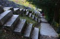
 Moderate
 Very difficult