Country:

 City:
City:


Access by car: from Revel, opposite the church, take the D11 then the D280 and the D280D, always following the signs for Freydières. Once you reach Les Granges de Freydières, pass in front of the bar-restaurant La Gélinote. Continue straight on along the small road opposite for 1.5 km. At the Quatre Chemins car park (alt. 1,290 m), continue along the road to the left which, after 100 m, becomes a dirt track rutted with ruts and potholes, but is still passable. At the end of this, you’ll find the Pré Raymond car park (Refuge de la Pra). Alternatively, park at the first car park at Les Quatre Chemins (alt. 1,370 m), which adds 1 km to the distance and 80 m of elevation gain to the walk.
It is possible to complete the route over two days with a stop at the Refuge de la Pra.
(S/E) From the Pré Raymond car park, at the signpost, take the path uphill (south-east) through the forest, towards Lac du Crozet and the Refuge de la Pra. After 1.5 km, you’ll reach a junction with a signpost.
(1) Leave the Pré Molard path to your left (east) and continue climbing straight ahead (south then south-east). After numerous hairpin bends, the path levels out almost completely, emerges from the woodland and crosses a scree slope. After a long diagonal ascent, you’ll reach a small plateau where you resume the climb (east) and cross the Ruisseau de Mercier. Shortly after a sharp bend to the right, the path turns south-east to climb the ridge of Lac du Crozet and reach another junction with a signpost.
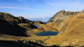
(2) Follow the eastern shore of the lake, towards the Col and Refuge de la Pra (south), for about 300 m.
(3) Follow the GR®738, still heading towards the Col and Refuge de la Pra, and ignore its eastern branch which climbs a scree cone to the left. The path climbs, still following the lake’s shore, then the gradient eases as it follows the bottom of the Vallon du Mercier. Cross the stream of the same name via a footbridge and begin the series of hairpin bends leading to the Col de la Pra (2,167 m), marked by a sign.
(4) Follow the GR®738 to the right (south), descending towards the refuge, and leave the Lacs du Doménon path behind. After a descent alongside the Ruisseau du Doménon, you will reach the Refuge de la Pra (alt. 2,120 m).
(5) Continue along the GR®738, which descends the slope of the terrace before heading south-east. Just after crossing the Doménon stream, you’ll come to a signpost.
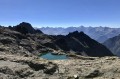
(6) Leave the GR®738 to your right and follow the path to your left towards Lac David. It climbs diagonally (south, then south-west) up the western slope of the Grande Lauzière. It then heads south-west again, above Lac Claret, before reaching a junction marked by a cairn (alt. 2,200 m).
(7) Leave the path on the right towards Lac David (south-west) and follow a track on the left marked by a few red markers (south). With Lac David below you, head towards a small pass.
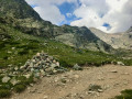
(8) Almost at the top of the small pass, take a track to the right which crosses a small rocky ridge. The track descends into a small valley, then winds its way up its right-hand side, just below the pass of this valley. At the pass, you’ll reach a junction marked by a cairn (alt. 2,330 m).
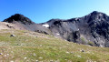
(9) Ignore the path leading down opposite and continue to the left, heading east. Climb in a zigzag pattern up a north-easterly rocky ridge. After about 400 m, the path crosses a less steep grassy area.
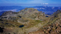
(10) The path, marked by cairns, heads north and, running along the ridge, offers views of Lakes Claret, Longet and Bernard. Climb towards a gap.
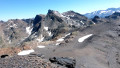
(11) Cross a grassy plateau, then a scree slope from which you can see the trail on the southern flank of the Grande Lauzière. Make your way through loose slate slabs (north-east). Via an ascending detour, reach the Col de la Grande Lauzière and a plateau (2,700 m). To the right is Tête Noire, to the left the Grande Lauzière; opposite is the Pic du Grand Doménon, and further on the Belledonne peaks.
(12) From the pass, follow the path to the left (north-west) which climbs a mound of slate slabs, then turns left. Follow a gentle slope to reach the summit, which offers a magnificent 360° panorama.
(13) Retrace your steps back to the Pré Raymond car park (S/E) .
 Visorando Member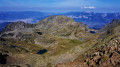
 Very difficult
 Extremely difficult
 Moderate