A walk around the haberts of Valombré and Malamille

The ‘haberts’ form an integral part of the Chartreuse landscape. They have witnessed the major events that have shaped history. This walk allows you to appreciate the importance these buildings—particularly those at Valombré and Malamille—held during the Second World War.

Details

13840903
Creation:
Last update:
Last review:
  • Walking
    Activity: Walking
  • ↔
    Distance: 3.99 mi
  • ◔
    Average duration: 2h 20 
  • ▲
    Difficulty: Easy

  • ⚐
    Back to start: Yes
  • ↗
    Ascent: + 597 ft
  • ↘
    Descent: - 614 ft

  • ▲
    Highest point: 3,071 ft
  • ▼
    Lowest point: 2,513 ft

Photos

Description of the walk

Head to Saint-Pierre-de-Chartreuse to a place known as La Porte de l’Enclos and park near the sewage treatment works.

(S/E) Walk along the D520B to the right of the treatment plant towards the road until you reach the second bridge, where you’ll find the Pont de Valombre on your left.

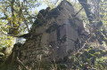
(1) Cross the Guiers on this bridge and continue along the forest track, keeping straight on for 1.5 km. You’ll reach the clearing in the Valombré meadow. The habert has since disappeared and the ruins are visible below the meadow.

(2) Carry on along the same path, which overlooks the Valombré meadow. Opposite, the view looks out over the Grande Chartreuse Monastery. Then go round a second meadow, passing underneath it.

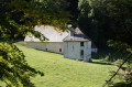
(3) At the end of the meadow, take the path on the right which leads through the forest. Cross the Valombré stream and continue for 500 m. You’ll reach a final clearing with the Habert de Malamille in view, and a barn and an old dairy to the right of the path.

(4) Take the road in the opposite direction to return to the car park (S/E).

Waypoints

  1. S/E : mi 0 - alt. 2,598 ft - Gate of the Enclos - Pont du Grand Logis
  2. 1 : mi 0.12 - alt. 2,582 ft - Valombre Bridge - Guiers (rivière)
  3. 2 : mi 1.08 - alt. 2,851 ft - Valombré Clearing
  4. 3 : mi 1.56 - alt. 3,009 ft - Fork in the road
  5. 4 : mi 1.99 - alt. 3,071 ft - Meadow at the Habert de Malamille
  6. S/E : mi 3.99 - alt. 2,598 ft - Gate of the Enclos - Pont du Grand Logis

Worth a visit

A bit of history: this clearing was once the site of the Habert de Valombré, whose name probably derives from the stream of the same name that flows nearby. Although it no longer exists, photographs from the early 20th century show that it originally consisted of two buildings: a house, which served as a dairy, and a barn.
These postcards enable us to date its rapid disappearance to the period between the early 20th century – when the barn and the farmhouse of the Habert are visible in good condition – and the 1920s, when postcards show the collapse of the Habert’s wooden shingles. It is possible to assume that the stones were reused. Despite the habert’s disappearance by the 1920s, the Valombré meadow continued to be used thereafter, notably during the Second World War when a Resistance camp was set up there.

(4) Historical note: the Habert de Malamille is close to the Habert de Valombré, a few hundred metres further along the path. It stands on the heights above the meadow and is one of the few remaining today to feature a tripartite layout, comprising a barn, a dwelling and a dairy/cheese-making facility built separately.
During the Second World War, the Habert de Malamille was used by members of the Resistance not only as a hiding place but also for training. Before the Resistance arrived, there were already those refusing to take part in the STO (Compulsory Labour Service) living in the habert; some of them later joined the Maquis. Malamille was also used by the youth work camps set up under the Vichy regime. Subsequently, many of these young people joined the Resistance.
Furthermore, on the habert, on the logis – the first building visible on arrival – there is a red-painted chamois on one of the walls: this symbol raises many questions. Indeed, this chamois appears to have been created in 1938 by the École du Ski Français, and was subsequently reused by the Malamille youth work camp, by Resistance fighters from the Vercors, and perhaps by those from the Chartreuse who settled in Malamille a few years after the youth work camp.

Reviews and comments

4.7 / 5
Based on 2 reviews

Reliability of the description
4 / 5
Ease of following the route
5 / 5
Route interest
5 / 5
Crivir
Crivir

Overall rating : 4.7 / 5

Date of your route : May 04, 2026
Reliability of the description : ★★★★☆ Good
Ease of following the route : ★★★★★ Very good
Route interest : ★★★★★ Very good
Very busy route : No

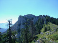
There is a car park at the start of the Mallamille road, just before the barrier, where you can begin the walk. It’s a shame to stop the walk at the Habert. A little further on, you reach the Sangles viewpoint, which overlooks the valley from a height of 400 metres.

Machine-translated

User 3641189

Overall rating : 4.7 / 5

Date of your route : Sep 22, 2025
Reliability of the description : ★★★★☆ Good
Ease of following the route : ★★★★★ Very good
Route interest : ★★★★★ Very good
Very busy route : No

There was a bit of confusion between Habert de Valombré and Habert de Malamille, but the historical point that followed was very interesting!
We continued along the path a little further and arrived at a viewpoint that you didn't mention, which was impressive!

Machine-translated

Other walks in the area

For more walks, use our search engine .

The GPS track and description are the property of this route's author. Please do not copy them without permission.