Col du Coq – Col de Porte

This first stage of the Tour of the Ten Highest Peaks of the Chartreuse links the Col du Coq to the Col de Porte, via Chamechaude, the highest point of the Chartreuse massif. However, with the passage through the Double Arche, situated at the foot of Chamechaude, followed by the Rampe de l’Écureuil (or Pas du Lapin), and the canyon on the descent, these gems of the Chartreuse massif do require sure-footedness, combined with a good sense of direction.

This walk is part of a multi-day hike: Tour des 10 plus hauts sommets de Chartreuse

Details

n°100866224
Creation:
Last update:
Last review:
–
  • Walking
    Activity: Walking
  • ↔
    Distance: 7.76 mi
  • ◔
    Average duration: 6h 10 
  • ▲
    Difficulty: Difficult

  • ⚐
    Back to start: No
  • ↗
    Ascent: + 2,972 ft
  • ↘
    Descent: - 3,219 ft

  • ▲
    Highest point: 6,814 ft
  • ▼
    Lowest point: 4,341 ft

Description of the walk

Coming from Saint-Pancrasse, pass the Col du Coq and park in the car park on the left, slightly below the pass.

(S) Take the path towards a hut with a drinking trough, and head into the forest: look for the yellow and red markings of the GR® de Pays Tour de Chartreuse on the trees.

(1) Take the forest track that continues from the path, ignoring any adjacent paths. You’ll reach the gate marking the entrance to the Émeindras de Dessus pasture.

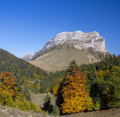
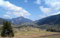
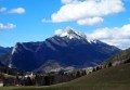
(2) Continue straight on along the path, which follows on from the forest track: as the forest opens up, Chamechaude comes into view; go round it on the left.

(3) Opposite the sheepfold, turn right and finish crossing the Émeindras de Dessus, where cows graze peacefully during the summer grazing season. Reach the Col de l’Émeindras.

(4) Carry on straight ahead, following the signposted path as it climbs, turning first westwards then southwards, until you reach the Habert de Chamechaude.

(5) Turn right to follow the forest track which continues westwards towards the Cabane and the Source de Bachasson. Pass the two paths on your right which climb northwards, one leading to the Brèche Arnaud and the other to the Sangle du Jardin.

(6) About ten metres before reaching an old gate, take a path on the right which climbs along the hillside towards the south-east. Follow this path to a dead tree lying across the path. Climb up to the left to the cliff and look out for the blue marker on the cliff face, which marks the start of a path leading to the right towards the Double Arche.

(7) Pass through the Double Arch and follow the blue markers along the narrow hillside path, which takes a hairpin bend to the left. Go through a gate and continue.

(8) Keep to the right, heading uphill, and about ten metres further on you’ll reach the start of a path marked by cairns. Turn right to follow this fairly well-marked path, which leads from cairn to cairn and takes you to the foot of the rocky outcrop.

(9) Climb a short section of a few metres, known as the Pas du Lapin (or Rampe de l’Écureuil), marked with a blue sign. Then join the panoramic path, heading uphill to the right.

(10) Take a look to the right at the Brèche Arnaud and don’t hesitate to cheer on any daredevils who might emerge from it. Continue along the path.

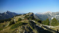
(11) Pass a path on your left that winds down through the scree and head up to the right to reach the ridge. Turn left and follow the ridge up to the summit of Chamechaude via a section fitted with cables: enjoy the exceptional 360° panorama.

(12) Look out for the cairns on the western slope marking the descent towards the canyon. This very steep descent goes straight down the slope.

(13) At the exit of the canyon, follow the path to the left which leads back towards La Folatière, then take a sharp right-hand bend and descend via a series of hairpin bends to reach the Cabane de Bachasson.

(14) With your back to the hut, head left, following the signposted path downhill. Continue to the Col de Porte (E).

Waypoints

  1. S : mi 0 - alt. 4,596 ft - Col du Coq
  2. 1 : mi 1.45 - alt. 4,531 ft - Forest track
  3. 2 : mi 2.21 - alt. 4,636 ft - Barrier
  4. 3 : mi 2.43 - alt. 4,669 ft - Émeindras de Dessus (1,420 m)
  5. 4 : mi 2.79 - alt. 4,511 ft - Col de l'Émeindras
  6. 5 : mi 3.66 - alt. 5,213 ft - Habert de Chamechaude
  7. 6 : mi 4.62 - alt. 5,400 ft - Junction before the old gate
  8. 7 : mi 4.69 - alt. 5,525 ft - Double Arch
  9. 8 : mi 4.76 - alt. 5,591 ft - Junction
  10. 9 : mi 4.82 - alt. 5,719 ft - Rampe de l’Écureuil (Pas du Lapin)
  11. 10 : mi 5.35 - alt. 6,398 ft - Path junction, turn right
  12. 11 : mi 5.49 - alt. 6,601 ft - Junction
  13. 12 : mi 5.67 - alt. 6,811 ft - Chamechaude
  14. 13 : mi 5.86 - alt. 6,335 ft - Exit from the canyon
  15. 14 : mi 6.59 - alt. 5,341 ft - Hollowed-out Tree Trunk Serving as Drinking Trough
  16. E : mi 7.76 - alt. 4,341 ft - Col de Porte

Notes

(S/E) Opposite the car park, on the other side of the road, there is a sheep pen. The flock may also have crossed over to reach the grassy slopes just above the car park. Border collies, but above all Patou sheepdogs, are present, which doesn’t make setting off or arriving on foot any easier. In this case, make sure to go round the back to reach the car park behind the cars. The Patous can see us, but seem to respect motorists.

The entire first section, from (S) to (6), is well signposted. Between (6) and (12), follow the blue markers and the cairns. From the summit of Chamechaude (12), look out for the cairns marking the descent to the upper entrance of the canyon.

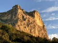
The Double Arch is not visible from the path. You need to look right up at the cliff face to spot it on the right.

(9) Crossing the Rampe de l’Écureuil (Pas du Lapin) requires a short climb of 2 to 3 metres, a sort of staircase with receding steps.

Don’t hesitate to stow your walking poles in your rucksack to cross the Double Arch and the Rampe de l’Écureuil (Pas du Lapin).

(6) An easier alternative to the Rampe de l’Écureuil (Pas du Lapin) is to follow the Chamechaude path to the Cabane de Bachasson (14), then ascend and descend via the normal route, passing through the hollowed-out tree trunk serving as a drinking trough.

(E) Accommodation is available at the Domaine de Rozan.

This route passes through multiple protected areas, which may be subject to special regulations:

Worth a visit

  • The Double Arch.
  • From the summit of Chamechaude, there is a splendid view over the entire massif and beyond.
  • You may spot chamois, provided you set off early in the morning.

Always be cautious and plan ahead when you're outdoors. Visorando and the author of this route cannot be held responsible for any accidents occurring on this route.

The GR® and PR® markings are the intellectual property of the Fédération Française de Randonnée Pédestre.

Other walks in the area

For more walks, use our search engine .

The GPS track and description are the property of this route's author. Please do not copy them without permission.