The Col du Coq from Sappey-en-Chartreuse via the Bec Charvet

The idea behind this ‘challenging’ hike is to reach the Col du Coq as directly as possible from Sappey-en-Chartreuse, enjoying the elevation gain and distance without returning by the same route.
A good sense of direction is essential.

Details

n°1398636
Creation:
Last update:
Last review:
  • Walking
    Activity: Walking
  • ↔
    Distance: 10.81 mi
  • ◔
    Average duration: 7h 50 
  • ▲
    Difficulty: Difficult

  • ⚐
    Back to start: Yes
  • ↗
    Ascent: + 3,330 ft
  • ↘
    Descent: - 3,310 ft

  • ▲
    Highest point: 5,686 ft
  • ▼
    Lowest point: 3,284 ft

Description of the walk

The route starts at the car park of the Sappey-en-Chartreuse cross-country skiing centre.

(S/E) At the top of the car park, take the road on the right, then, at the Croix du Rocher junction, turn left towards Les Combes and continue along the main path (yellow markings).

(1) After a steep climb, the marked path turns left at a right angle. Leave this path and continue straight ahead. 20 metres further on, cross the Vence at the ford and take the steep path directly in front of you.

(2) Cut across a path at the 1,354-metre mark and continue straight on. On the mountain pasture, follow the path towards the buildings, then veer right to climb south-east to the top of the Émeindras de dessus mountain pasture.

(3) Head north-east towards the Col de la Faïta, following the path downhill.

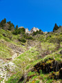
(4) At the pass, continue along the path, which keeps climbing as it follows the ridge (remnants of yellow paint marks), to the summit of the Bec Charvet.

(5) At the summit, head as far east as possible across the treeless area to find the path on the left which descends due north. The path is clearly visible even though it does not appear on maps (a few yellow markings again).

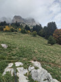
(6) A cairn marks the start of the old ski run. Descend due north through the mountain pasture to reach the Habert du Col du Coq. Continue up the tarmac road to the right until you reach the Col du Coq.

(7) At the pass, turn back and follow the tarmac road to thefirst forest track on the right (1,403 m).
At the fork, turn left.

(8) Take the forest track, turn left and follow it all the way to the end.

(9) When you reach the T-junction at the end, take the path on the right that leads downhill (the left-hand path leads back to the Émeindras mountain pasture). At the next junction, turn left to climb back up towards the Col de l’Émeindras.

(10) At the Col de l’Émeindras, take the path opposite up the slope to reach the lower Émeindras mountain pasture. In the pasture, take the path that descends down the centre, heading south, and continue straight on until you reach the Sappey meadows.

(11) The path turns right and begins its tarmac section. Do not follow it, but turn left onto a sunken track. Walk through the hamlet of Jaillères to the fountain and take another sunken track on the left just past it. This leads onto a village street (in the area known as La Charmette). Turn left to reach the car park (S/E).

Waypoints

  1. S/E : mi 0 - alt. 3,284 ft - Top of the car park at the cross-country ski centre
  2. 1 : mi 1.74 - alt. 3,960 ft - Ford
  3. 2 : mi 2.11 - alt. 4,436 ft - Elevation 1354, straight ahead
  4. 3 : mi 2.65 - alt. 4,862 ft - Top of the Émeindras de Dessus mountain pasture
  5. 4 : mi 3.22 - alt. 4,606 ft - Col de la Faïta
  6. 5 : mi 4.02 - alt. 5,646 ft - Bec Charvet
  7. 6 : mi 4.35 - alt. 5,039 ft - Cairn at the start of the ski run
  8. 7 : mi 4.86 - alt. 4,705 ft - Col du Coq
  9. 8 : mi 5.62 - alt. 4,278 ft - Start of the forest track
  10. 9 : mi 7.69 - alt. 4,626 ft - End of the forest track, turn right
  11. 10 : mi 8.26 - alt. 4,508 ft - Col de l'Émeindras
  12. 11 : mi 10.2 - alt. 3,694 ft - Signpost pointing towards La Charmette
  13. S/E : mi 10.81 - alt. 3,284 ft - Top of the car park at the cross-country ski centre

Notes

Sources:
- Near the car park at Habert du Col du Coq
- Émeindras de Dessous

Worth a visit

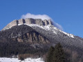
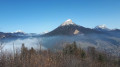
At Bec Charvet, a 360° viewpoint over the Chartreuse and Belledonne ranges.
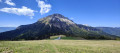
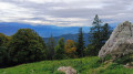
For the return journey from the Col du Coq, I opted for the tarmac road to enjoy the mountain pasture at the pass and its flock of sheep.
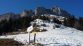
Then, the forest track starting from the ‘8 ’ offers lovely views of the northern and north-eastern parts of Chamechaude, rather than taking the classicGR®9route which runs through the forest.

Always be cautious and plan ahead when you're outdoors. Visorando and the author of this route cannot be held responsible for any accidents occurring on this route.

The GR® and PR® markings are the intellectual property of the Fédération Française de Randonnée Pédestre.

Reviews and comments

4.7 / 5
Based on 1 review

Reliability of the description
5 / 5
Ease of following the route
5 / 5
Route interest
4 / 5
yssappey
yssappey

Thank you for your comment, and I’m really pleased that the GPS track was useful to you

Machine-translated

ronnie38
ronnie38

Overall rating : 4.7 / 5

Date of your route : Sep 30, 2018
Reliability of the description : ★★★★★ Very good
Ease of following the route : ★★★★★ Very good
Route interest : ★★★★☆ Good

A superb hike that starts off gently. Then it gets serious with a steep climb before the Col de la Faita!! There’s a superb view during this climb. Then comes a steep, fairly technical descent.
After a short snack break, we head back onto the forest track, where we can admire Chamechaude for quite some time.
The return journey is rather monotonous along a wide forest track…
Be careful – the signposting isn’t great. Luckily, we had the GPS track on the Visiorando map.

Machine-translated

Other walks in the area

For more walks, use our search engine .

The GPS track and description are the property of this route's author. Please do not copy them without permission.