A circular route via the ridge to the Col de la Cochette

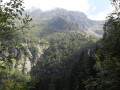
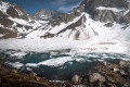
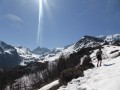
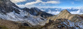
A lovely walk with numerous views of the Chartreuse, Belledonne and Savoie.

Details

23500266
Creation:
Last update:
Last review:
  • Walking
    Activity: Walking
  • ↔
    Distance: 3.15 mi
  • ◔
    Average duration: 2h 30 
  • ▲
    Difficulty: Moderate

  • ⚐
    Back to start: Yes
  • ↗
    Ascent: + 1,207 ft
  • ↘
    Descent: - 1,178 ft

  • ▲
    Highest point: 3,455 ft
  • ▼
    Lowest point: 2,310 ft

Description of the walk

Start: hamlet of Le Mont – La Combe de Lancey
On the D280, park near the hamlet of Le Mont (705m).
It is also possible to park at Place de Boÿs in the hamlet of La Chapelle and walk up to the start of the walk (about 15 minutes’ walk). You can also park at La Croix de Revollat further up the D280 (15 minutes’ walk).

This local trail is signposted with mauve-coloured signs and marked with the number “1” on a white background.

(S/E) Set off eastwards and head up through the hamlet of Le Mont, following a series of hairpin bends: right, left, right.

(1) At the end of the tarmac road, take a path on the left in front of a carport. Head uphill, ignoring a turn-off on the right and then one on the left. Cross a stream and then a steep clearing with a building on the right (Granges Bouillon). Enter the woodland again and you’ll soon reach a junction.

(2) Continue straight on (ignore the path branching off to the right). After about a hundred metres, turn right (east-north-east) onto the main path. Climb steeply to reach the ridge (view of Savoie).

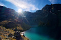
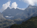
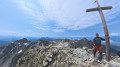
(3) Turn right and climb, following the ridge line and ignoring all side paths (view of Saint-Mury-Monteymont). The slope becomes steeper as you climb Crêt Barnou. After a brief descent, you’ll reach the Col de la Cochette on the edge of the forest (views to the east over the Belledonne peaks and to the west over the Chartreuse).

(4) Then turn right (south-west) towards the Combe de Lancey (Mas Jullien). Follow the lovely PDIR-marked path (yellow signs and markings) and descend to the Fontaine Froide spring (an open area surrounded by a fence).

(5) Leave the PDIPR path here: do not cross the spring’s catchment area, but take the path branching off to the right (north-west), which descends more gently. A little further on, turn right and head north. Descend to the D280, above the hamlet of Le Villard.

(6) Follow the road to the right to return to the hamlet of Le Mont (S/E).

Waypoints

  1. S/E : mi 0 - alt. 2,310 ft - Le Mont
  2. 1 : mi 0.29 - alt. 2,418 ft - Top of Le Mont – End of the tarmac
  3. 2 : mi 0.6 - alt. 2,766 ft - Junction
  4. 3 : mi 0.76 - alt. 2,943 ft - Start of the ridge
  5. 4 : mi 1.36 - alt. 3,432 ft - Col de la Cochette (1041m)
  6. 5 : mi 2.25 - alt. 2,805 ft - Fontaine Froide spring catchment
  7. 6 : mi 2.71 - alt. 2,372 ft - D280 road
  8. S/E : mi 3.15 - alt. 2,310 ft - Le Mont

Reviews and comments

4 / 5
Based on 4 reviews

Reliability of the description
4.3 / 5
Ease of following the route
3.8 / 5
Route interest
4 / 5
User 27571490

Overall rating : 4 / 5

Date of your route : Sep 08, 2025
Reliability of the description : ★★★★★ Very good
Ease of following the route : ★★★☆☆ Average
Route interest : ★★★★☆ Good
Very busy route : No

A nice climb to start with
Don't forget to download the route as there are several paths to avoid (no markings until the pass, except at the start)
Work is currently being carried out on the path

Machine-translated

babarr38
babarr38

Overall rating : 4 / 5

Date of your route : Nov 09, 2024
Reliability of the description : ★★★★☆ Good
Ease of following the route : ★★★★☆ Good
Route interest : ★★★★☆ Good
Very busy route : No

A lovely walk, and as one of the previous reviews mentioned – even though we’d been warned – we got lost on the way back. But it made for a bit of an adventure, which is nice too And we did manage to find the car in the end.
It’s true – the signposts had disappeared, except at the start!

Machine-translated

MARCGRENOBLE
MARCGRENOBLE

Overall rating : 4.3 / 5

Date of your route : Mar 11, 2024
Reliability of the description : ★★★★★ Very good
Ease of following the route : ★★★★★ Very good
Route interest : ★★★☆☆ Average
Very busy route : No

It climbs very steeply at the start (take a look at the contour lines on the map). At the highest point of the route, the Col des Cochettes, there’s a lovely view over a valley with Belledonne in the background. Without a map, you’re bound to get lost. At the spring (end of the walk), take a sharp right, then head straight onto the road, as the path leads onto it. Visorando app: Click on ‘Start’ and it opens Google Maps and takes you straight to the start of the walk without you having to do anything else. Brilliant! Then just follow the route; the distance and elevation (completed/remaining) shown on the screen are spot on. Very happy with the app. A walk full of birds.

Machine-translated

valitzler
valitzler

Great, thank you very much – what a quick response.

Machine-translated

Groupe "Chemins de La Combe"

Hello,
We’re really glad you enjoyed the view on this walk… and we’re sorry that you got lost on the way down. Unfortunately, some people with malicious intent have torn down the signposts, particularly on the descent.
We’ll include more specific details in the description of this walk, highlighting landmarks and ‘critical’ points, as there’s no guarantee that if we put the signs back up, they’ll stay there!
Please do let us know exactly where you got lost.
Thank you again for your feedback.
Cécile
from La Combe de Lancey

Machine-translated

valitzler
valitzler

Overall rating : 3.7 / 5

Date of your route : Jun 17, 2023
Reliability of the description : ★★★☆☆ Average
Ease of following the route : ★★★☆☆ Average
Route interest : ★★★★★ Very good
Very busy route : No

I did this hike on my own; there was a superb view of Belledone, but on the way down I couldn’t find the paths and got lost
There are no signposts at all; you have to rely on the GPS track

Machine-translated

Other walks in the area

For more walks, use our search engine .

The GPS track and description are the property of this route's author. Please do not copy them without permission.