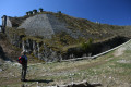

Tackling the Fort du Saint-Eynard

Access on foot to Fort du Saint-Eynard is possible from three sides:
- on the one hand, the route along the ridge or the ascent via the Col de Vence (theGR®9passes through these points),
- secondly, the route suggested here, which follows a well-marked path from La Pillonnière.
This route appears less challenging, even though the gradient is steep on the second half of the journey.
However, you do need to put in some effort to fully appreciate the fort’s defensive value.

Details

n°1275100
Creation:
Last update:
Last review:
  • Walking
    Activity: Walking
  • ↔
    Distance: 2.62 mi
  • ◔
    Average duration: 2h 20 
  • ▲
    Difficulty: Moderate

  • ⚐
    Back to start: Yes
  • ↗
    Ascent: + 1,289 ft
  • ↘
    Descent: - 1,293 ft

  • ▲
    Highest point: 4,350 ft
  • ▼
    Lowest point: 3,235 ft

Photos

Description of the walk

A few grassy parking spaces to the right of the Route de la Bordelière, along the edge of the forest (see ¶ Practical Information).

(S/E) Walk up the road for about 30 metres towards the east; on your right you’ll see a yellow sign indicating “Anciennes batteries 1.7 km, 1h 05” and “Fort du Saint-Eynard – Chemin Saint-Bruno – 1.9 km, 1h 10”.
Follow this path southwards; it is quite steep for the first few metres but then levels out.
Although the forest track has been slightly diverted by a timber operator, carry on straight ahead, following the yellow markings on the trees.

(1) At the crossroads, turn left onto a stony path which climbs steeply, heading south-south-west (do not continue straight ahead on the main forest track). There are no further yellow markings from this point onwards. You’ll reach the hairpin bend on the tarmac road, where you’ll see a path ahead leading to Pas Guiguet – avoid this as the slope is steep.

(2) Walk up along the tarmac road for 50 metres. At the mobile phone mast, the second section of the very wide forestry track begins on your left. Take this track, walking uphill at your own pace; it narrows further up and, 100 metres from the ridge, you’ll reach a Fork in the road.

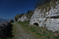
(3) Take the right-hand fork, heading south-west, to emerge a few metres from the car park upstream of the fort. Descend into one of the battery emplacements to admire the view, then head due west to your right and enter an ascending tunnel, hewn into the rock, which leads you to the front of Fort du Saint-Eynard.

(4) For the return journey, head back down the tunnel, pass the seven former battery emplacements and turn north at the last one to rejoin theGR®9, which you follow to the left, heading west, for a few metres. You’ll see a post with a yellow downward-pointing arrow marking the start of the return path. You’ll come to a Fork in the road that you took on the way out.

(3) Follow the path downwards to the north-east to reach the telephone relay station, the tarmac road and the hairpin bend.

(1) At this final Fork in the road, it is best to take the left-hand branch down, although both paths lead to the same spot further down. This will bring you back to the car park where you started (S/E).

Waypoints

  1. S/E : mi 0 - alt. 3,238 ft - La Bordelière
  2. 1 : mi 0.41 - alt. 3,570 ft - Crossroads
  3. 2 : mi 0.7 - alt. 3,862 ft - Hairpin bend
  4. 3 : mi 1.01 - alt. 4,252 ft - Fork
  5. 4 : mi 1.28 - alt. 4,350 ft - Fort du Saint-Eynard
  6. S/E : mi 2.62 - alt. 3,238 ft - La Bordelière

Notes

Arriving by car from Grenoble via the Col de Vence: pass the ‘Le Sappey-en-Chartreuse’ town boundary sign; you’ll see the ‘Fort du Saint-Eynard’ sign on your right.
You’ll pass through a hamlet where wooden chicanes have been set up to reduce speed, and at the end, you’ll see a second ‘Fort du Saint-Eynard’ sign: turn left.
Immediately afterwards, drive up thirty metres and turn left towards La Bordelière. The grassy car park is on your right (max. 6 spaces)

No known water source.

The climb is steep; remember to bring walking poles, as they’ll come in very handy here.
The tunnel crossing is safe but stony; you may be dazzled by the sunlight on the descent in good weather. A torch may be needed to see where you’re putting your feet.

Worth a visit

When you reach the fort, before crossing the bridge, you can take the path to the right of the noticeboard. This path leads in a few minutes to the defences on the Chartreuse side, continuing as far as the start of the path descending to the Col de Vence. It’s interesting from a defensive point of view.
Permanent exhibition on the formation of the Dauphiné and on the construction and intended purpose of Fort Saint-Eynard, located inside the fort
When the fort is open, there’s a restaurant and bar at the far end of the courtyard, where you’ll receive a warm welcome.

On your way back, do visit Sappey-en-Chartreuse – it’s a haven of peace!

Always be cautious and plan ahead when you're outdoors. Visorando and the author of this route cannot be held responsible for any accidents occurring on this route.

The GR® and PR® markings are the intellectual property of the Fédération Française de Randonnée Pédestre.

Reviews and comments

5 / 5
Based on 1 review

Reliability of the description
5 / 5
Ease of following the route
5 / 5
Route interest
5 / 5
kiwi07
kiwi07

Overall rating : 5 / 5

Date of your route : Aug 05, 2020
Reliability of the description : ★★★★★ Very good
Ease of following the route : ★★★★★ Very good
Route interest : ★★★★★ Very good
Very busy route : No

A superb walk, a clear path – a real treat
Thank you to everyone who maintains the trails

Machine-translated

Other walks in the area

For more walks, use our search engine .

The GPS track and description are the property of this route's author. Please do not copy them without permission.