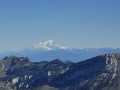
Le Charmant Som from Les Cottaves

You set off from the Saint-Pierre-de-Chartreuse valley and climb to 1,867 metres on the Charmant Som, the central peak of the Chartreuse. You’ll be treated to a panoramic view of all the peaks in the massif and the surrounding area.

Details

1245911
Creation:
Last update:
Last review:
  • Walking
    Activity: Walking
  • ↔
    Distance: 5.83 mi
  • ◔
    Average duration: 4h 55 
  • ▲
    Difficulty: Difficult

  • ⚐
    Back to start: Yes
  • ↗
    Ascent: + 2,608 ft
  • ↘
    Descent: - 2,605 ft

  • ▲
    Highest point: 6,115 ft
  • ▼
    Lowest point: 3,537 ft

Photos

Description of the walk

The start of the walk is on a lay-by along the D512, almost halfway between Saint-Pierre-de-Chartreuse and the Col de Porte, opposite the small road leading to the hamlet of Les Cottaves. There is no public car park in the hamlet of Les Cottaves.

(S/E) Leave the lay-by by crossing the departmental road to take the small road leading to the hamlet of Les Cottaves. As soon as you reach the first houses in the hamlet, take the path leading uphill to the left (signposted ‘Les Cottaves – 1080m’) towards Le Charmant Som ‘4.5km – 2h20’ (which is a bit optimistic).

(1) Quite soon, you’ll pass a path branching off to the right and continue straight ahead.

(2) A little further on, the yellow markings indicate a path on the right (not very obvious; it’s easy to miss). Take this path and head uphill, straight up the slope, crossing wider tracks as you go. Follow your path and the yellow markings.

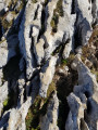
(3) Your path turns sharply to the left (south-west). You’ll lose a little altitude, but you’ll be walking through limestone rocks, still in the woodland. Take care (especially if the rocks are wet).
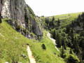
At the edge of the woods, you emerge into the Habert du Charmant Som. The contrast with the forest is striking. Your path turns left, crosses a dry stream, and heads back up into the forest.

(4) You’ll emerge next to the Oratoire d’Orgeval, onto the small road linking the Auberge du Charmant Som to the Col de Porte. Take this road to the right until you reach the inn.

(5) Just before the inn, you’ll pass a fence to the right of the car park. Your path climbs towards the summit.

(6) On your right, you’ll pass a path which, via the flagstones, leads to the Pont de Vallombré.
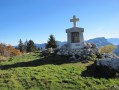
Continue along the path to the cross at the summit.

(7) Enjoy the view, particularly of the monastery. To head back down, veer slightly to the right (south-west).

(8) You’ll soon reach a flat area where you’ll see a path branching off to the right (unmarked). Take this path. After passing a few rocks, it takes you down comfortably through the mountain pasture to the cheese dairy. Walk past the inn.

(5) You’ll rejoin your ascent route, which you’ll follow in the opposite direction to the hamlet of Les Cottaves and your starting point (S/E).

Waypoints

  1. S/E : mi 0 - alt. 3,550 ft - Car park on the D512
  2. 1 : mi 0.44 - alt. 3,750 ft - Ignore the path on the right
  3. 2 : mi 0.56 - alt. 3,957 ft - On the right, a path that’s not very obvious
  4. 3 : mi 0.83 - alt. 4,370 ft - Last bend to the left, start of the sharp limestone pavement
  5. 4 : mi 1.66 - alt. 5,387 ft - Signpost: Oratoire d’Orgeval 1635m
  6. 5 : mi 2.2 - alt. 5,482 ft - Sign for Chalet du Charmant Som 1,670m
  7. 6 : mi 2.51 - alt. 5,709 ft - Path on the right leading towards the rock slabs
  8. 7 : mi 2.94 - alt. 6,102 ft - Charmant Som
  9. 8 : mi 3.13 - alt. 5,892 ft - Path on the right at a flat stretch
  10. S/E : mi 5.83 - alt. 3,550 ft - Car park on the D512

Notes

The ‘Difficult’ rating is due to the nature of the path: one-third of the forest ascent is over unstable pebbles, and another third of the same ascent is over a sort of sharp limestone pavement that’s tricky to navigate (you often have to use your hands to help you along). When wet, this sharp limestone pavement is as slippery as a bar of soap.

The total walking time, calculated by the software, seems very low to me. I’m usually quicker than the computer suggests, and on this occasion it took me 5 hours and a quarter without really taking any breaks, apart from 10 minutes at the summit.
The path is marked in yellow (very discreetly). On the ascent, up to the Oratory, make sure you take in the surroundings for the return journey, which will follow the same route.

In the Habert, there is a mountain inn. It is very popular with people from Grenoble and is often ‘fully booked’. It serves only one hearty set meal. As the inn is accessible by car, it can be ‘overbooked’ on sunny Sundays.

There are no water points along the route.

For the return journey, if there are no animals in the habert, you can, from the inn, rather than taking the road, cut across the habert, heading straight for your destination. It’s easy to spot. It’s shorter and more enjoyable.

Worth a visit

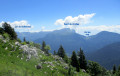
The peaks of the Chartreuse: Granier, Lances de Malissard, Dent des Crolles, Chamechaude, Pinéa, Rochers de Lorzier, Grande Sure and Grand Som are all in view. Behind them, you can see the Alps and the Vercors; to the west, the Bièvre plain.

The magnificent Charmant Som mountain hut, where the cows’ bells ring out.

From the summit, you have a bird’s-eye view of the valley of the Grande Chartreuse Monastery.

In the valley, take a detour to visit the church of Saint-Hugues, decorated in a highly original style by a local painter: Arcabas.

Reviews and comments

4.6 / 5
Based on 3 reviews

Reliability of the description
4.7 / 5
Ease of following the route
4.3 / 5
Route interest
4.7 / 5
M13I9C3H8
M13I9C3H8

Overall rating : 4.3 / 5

Date of your route : May 19, 2025
Reliability of the description : ★★★★☆ Good
Ease of following the route : ★★★★☆ Good
Route interest : ★★★★★ Very good
Very busy route : No

An interesting route that takes you across the slabs beneath the charming Som. The final descent after the oratory requires caution and is difficult due to wet ground.

Machine-translated

M13I9C3H8
M13I9C3H8

I used this route as a basis, but ended up creating something quite different.
I’m putting the finishing touches to this new route and will be publishing it shortly.
Thank you to all my followers for your support.

Machine-translated

bonnerem
bonnerem

Overall rating : 5 / 5

Date of your route : Aug 08, 2023
Reliability of the description : ★★★★★ Very good
Ease of following the route : ★★★★★ Very good
Route interest : ★★★★★ Very good
Very busy route : No

A lovely walk. The view from the summit is extraordinary. The path leading up from the chalet where walkers set off (car park accessible by car) is well-trodden in places. It is essential to stay on the path so as not to damage the surrounding meadows. The descent from the wayside shrine isn’t the most pleasant. There’s a very steep section at the start: you have to scramble down a small rocky outcrop. The rest of the path requires constant attention. Ascent: 2:10. Descent: 2:05. It’s best to set off (very) early to avoid the crowds.

Machine-translated

Souaze
Souaze

Overall rating : 4.3 / 5

Date of your route : Jun 10, 2019
Reliability of the description : ★★★★★ Very good
Ease of following the route : ★★★★☆ Good
Route interest : ★★★★☆ Good

A lovely day and a lovely walk, but as usual there was a very strong wind at the summit. We picked a lovely bunch of daffodils and narcissi. We returned via Les Revols, following part of the route back via La Martinière, so we ended up doing a lovely circular walk. It’s 1 km along the road from Les Revols to Les Cottaves. In total, 11 km and 828 m of elevation gain.

Machine-translated

Other walks in the area

For more walks, use our search engine .

The GPS track and description are the property of this route's author. Please do not copy them without permission.