Circular route via the Col de la Sitre

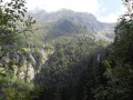
Come and discover this corner of the Belledonne massif in a high-mountain atmosphere, passing from forest to rocky terrain before returning via the mountain pasture and a charming refuge.

Details

39779598
Creation:
Last update:
Last review:
  • Walking
    Activity: Walking
  • ↔
    Distance: 6.09 mi
  • ◔
    Average duration: 5h 15 
  • ▲
    Difficulty: Difficult

  • ⚐
    Back to start: Yes
  • ↗
    Ascent: + 2,825 ft
  • ↘
    Descent: - 2,805 ft

  • ▲
    Highest point: 7,031 ft
  • ▼
    Lowest point: 4,429 ft

Photos

Description of the walk

Drive to the Col de Prélong, then take the forest track to the hamlet of La Souille and park in a hairpin bend.

(S/E) With your back to the road, take the path on the left; there is a hiking sign pointing to the Refuge Jean Collet. Follow the path to the junction with the route leading up to the refuge.

.(1) Take the path branching off to the right, heading south-west towards the Habert du Mousset, then reach the Col de la Sitre via a very steep climb.

(2) From the Col de la Sitre, after a short descent, ignore the path branching off to the left towards Lac du Loup and begin the descent along the side of Mont Saint-Mury until you reach a junction.

(3) Leave the path on your left (which could be a shortcut) and turn right; then, at the next junction, turn left, heading north, before turning west to reach the Refuge du Pré du Molard.

(4) From the refuge, continue north, then, at the junction, turn left to descend to the Col du Pré du Molard car park.

(5) Leave the track on your left and take the path on the right, which very quickly turns northwards to reach the car park at La Souille (S/E).

Waypoints

  1. S/E : mi 0 - alt. 4,449 ft - Car park at La Souille
  2. 1 : mi 2.18 - alt. 5,489 ft - Junction with the path to the Jean Collet refuge
  3. 2 : mi 3.21 - alt. 7,028 ft - Col de la Sitre (1,988 m)
  4. 3 : mi 3.87 - alt. 6,542 ft - Crossroads – Mont Saint-Mury (2,038 m)
  5. 4 : mi 4.74 - alt. 5,705 ft - Refuge du Pré du Molard (1,740 m)
  6. 5 : mi 5.67 - alt. 4,895 ft - Car park at the Col du Pré du Molard (1,485 m)
  7. S/E : mi 6.09 - alt. 4,449 ft - Car park at La Souille

Worth a visit

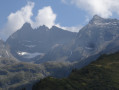
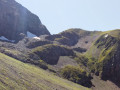
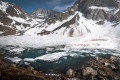
At the Col de la Sitre, enjoy the view of the Grand Pic and the Belledonne cross – a true high-mountain atmosphere is guaranteed.
The Pré du Molard mountain refuge is a great place to stop for a break and a drink.

Reviews and comments

4.3 / 5
Based on 4 reviews

Reliability of the description
4 / 5
Ease of following the route
4.7 / 5
Route interest
4.3 / 5
matei
matei

Overall rating : 5 / 5

Date of your route : Aug 03, 2026
Reliability of the description : ★★★★★ Very good
Ease of following the route : ★★★★★ Very good
Route interest : ★★★★★ Very good
Very busy route : No

A hike undertaken in early August 2026, on a sweltering day in the Grenoble valley. We found some relief from the heat above 1,500 metres, though under a blazing sun that followed us all day. The ascent was steady, becoming increasingly steep, but then for the second half of the route the descent was gentle, and we were treated to the pleasure of admiring the Chartreuse mountain range in all its splendour. On the Belledonne side, during the ascent, we came across a myriad of waterfalls, tempting us to retrace our steps towards Lac Blanc. Please note: for the ascent, make sure you take enough water with you as there’s nowhere to top up your supplies. The only water point is at the chalet on the descent, where you can also buy local artisan products.

Machine-translated

User 20436831

Overall rating : 4.3 / 5

Date of your route : Jul 13, 2026
Reliability of the description : ★★★★☆ Good
Ease of following the route : ★★★★★ Very good
Route interest : ★★★★☆ Good
Very busy route : No

A lovely walk, though quite strenuous on the climb up to the pass. It’s best to do it in the recommended direction rather than the other way round. The climb up to the pass through the scree is quite tough. The descent from the pass is very easy and very pleasant.

Machine-translated

XFandre
XFandre

Overall rating : 3.7 / 5

Date of your route : Oct 08, 2025
Reliability of the description : ★★★☆☆ Average
Ease of following the route : ★★★★☆ Good
Route interest : ★★★★☆ Good
Very busy route : No

The description is still very vague, succinct, and brief! At the start (La Souille? No, it's Pré Conté on the sign! And don't take the "carriage road" if your car is new and/or your partner is about to give birth), it's a path rather than a trail that you take. It's fairly flat, even descending steeply at times. It's also not very "smooth" due to the roots and large stones you encounter. The path becomes a trail and even crosses a cable-assisted passage! It's not dangerous, of course, but why isn't this mentioned? You don't leave the route for Jean Small Pass until very late on. When you come out onto the mountain pastures at Habert du Mousset. There, the climb is quite steep, although perfectly signposted with double markings: yellow and white/red GR. The Col de la Sitre is very beautiful, like a breach. The climb to the peak takes five minutes and is worth it as you reach the summit. The descent is quite tedious and makes you wonder why you wouldn't do the circular in the other direction. A pleasant circular, but, I insist, the description is so laconic that it borders on the unsaid. (3h25, and yet I dawdled on the laborious ascent of the Col de la Sitre).

Machine-translated

Croziflette
Croziflette

Overall rating : 4 / 5

Date of your route : Jul 25, 2025
Reliability of the description : ★★★★☆ Good
Ease of following the route : Not used / Not applicable
Route interest : Not used / Not applicable
Very busy route : No

Hello,

i was going to publish this loop with just the climb to the peak added, which doesn't add much if you go when there are low clouds. I had planned to do the Lac Blanc late in the day and follow this loop, but the low clouds discouraged me because I go to the mountains for the view, and the Lac Blanc without a blue sky (or even in fog) didn't particularly interest me. So I turned off at the ravine towards the pass to do a little loop that I was going to post, but I see it already exists, so I'll just leave my little comment
I put "not very busy", but given the low clouds, that's not surprising. I imagine it's packed on a sunny Sunday.

I can confirm what's been said here, except that it's not really that difficult for anyone who knows what hiking is. It's uphill, that's for sure, but only ~820m of elevation gain (less than 1000), of which about 300m is barely steep, over about 9km (less than 10), really nothing difficult unless you've never done any sport or hiking before. Personally, I would classify it as "moderate", as it's nowhere near the level of difficulty of some of the hikes classified as "difficult" on the same website. But everyone has their own opinion. The slope up to the pass may seem difficult for some and could therefore be enough to classify this walk as such.

However, please note that the Habert du Mousset is supposed to be closed to hikers during the summer grazing season. Unfortunately, this is only indicated at the entrance to the Pré du Molard refuge on the way up. I didn't see anything on the other side. This may be useful to know to avoid any misunderstanding. Personally, I met the friendly local shepherdess and she didn't say a word to me (not even her adorable working dogs ^^). So, who knows? Maybe a sign was forgotten some time ago and is now useless?

Otherwise, it's a short hike, taking around 5 hours to complete, or a little longer for slower walkers (I'm not very fast and I don't race).

In terms of interest, if you want to see the surrounding peaks, avoid low clouds, otherwise it'll be an easy half-day outing for training. That was my case here because there were low clouds everywhere, so → I went for a walk near Gre in the afternoon after much hesitation.

Enjoy your walks and thank you to the author for publishing this ;-)

Machine-translated

Other walks in the area

For more walks, use our search engine .

The GPS track and description are the property of this route's author. Please do not copy them without permission.