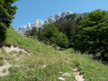
Saint-Pierre-de-Chartreuse – Saint-Pierre-d’Entremont

This third stage of the Tour of the Ten Highest Peaks of the Chartreuse links Saint-Pierre-de-Chartreuse to Saint-Pierre-d’Entremont, via the Grand Som. There are no technical difficulties, unless you decide to follow the southern ridge of the Grand Som, which offers some very beautiful and exposed rock climbing.

This walk is part of a multi-day hike: Tour des 10 plus hauts sommets de Chartreuse

Details

n°100888241
Creation:
Last update:
Last review:
–
  • Walking
    Activity: Walking
  • ↔
    Distance: 9.00 mi
  • ◔
    Average duration: 7h 45 
  • ▲
    Difficulty: Difficult

  • ⚐
    Back to start: No
  • ↗
    Ascent: + 4,160 ft
  • ↘
    Descent: - 4,633 ft

  • ▲
    Highest point: 6,624 ft
  • ▼
    Lowest point: 2,129 ft

Description of the walk

(S) Follow the Route de la Diat (D511) for 100 m and turn left onto the Chemin de Bernière (tarmac). You’ll reach the hamlet at a hairpin bend.

(1) Take the path on the left, running alongside a house.

(2) Turn right uphill and carry on straight ahead, heading generally north. You’ll come out onto a forest track and negotiate the hairpin bend.

(3) Leave the forest road by turning left, still heading north, onto a path that crosses the road several times. Continue uphill and navigate a long series of very tight hairpin bends before reaching the Col du Frenay, where there is a sign pointing towards the Pas de la Suiffière: yellow markings.

(4) Continue along the path until you reach a three-way junction.

(5) Turn right (north-east), following the yellow markings. Take another sharp right at the next junction and head for the Pas de la Suiffière.

(6) Follow the yellow markings to cross the pass without turning left into the small gap through which you can reach the southern ridge of the Grand Som via an exposed rock-climbing route. Join the path below and continue north-east until you reach a three-way junction.

(7) Ignore the path on the right leading to the Col des Aures and take the one on the left, climbing up to the Grand Som: 360° panoramic view.

(8) Turn right onto the Sentier des Moutons: marked in yellow. You’ll reach a Fork in the road.

(9) Stay on the Sentier des Moutons, turning right.

(10) Cross a gap (alt. 1,860 m), then continue along the Sentier des Moutons, which branches off further on to the left at a right angle. Continue to the Col de Bovinant (alt. 1,645 m), where five paths meet.

(11) Turn right, then veer left a few metres further on.

(12) Look out for some ancient engravings on a rock depicting the oratory of Nère Fontaine or Nerfond. Continue straight on to reach the Source des Oiseaux.

(13) Continue down into the Combe des Éparres until you reach the car park at the end of the Route du Château.

(14) Follow this tarmac road to the hamlet of Château.

(15) Pass the wash house and carry on along the same road, which passes through the hamlet of Pâquet before becoming winding again and joining the Route du Planolet (D102b).

(16) Turn left and follow the departmental road carefully as far as Saint-Pierre d’Entremont (E).

Waypoints

  1. S : mi 0 - alt. 2,608 ft - Saint-Pierre-de-Chartreuse
  2. 1 : mi 0.37 - alt. 2,854 ft - Turn left at the fork
  3. 2 : mi 0.51 - alt. 2,913 ft - Junction to the right at the hairpin bend
  4. 3 : mi 1.5 - alt. 3,898 ft - Turn off the RF, take the path to the left
  5. 4 : mi 2.5 - alt. 5,299 ft - Col du Frenay (1600m)
  6. 5 : mi 2.75 - alt. 5,656 ft - Turn right at the fork
  7. 6 : mi 2.9 - alt. 5,909 ft - Pas de la Suiffière
  8. 7 : mi 3.24 - alt. 5,866 ft - Three-way junction, on the left
  9. 8 : mi 3.61 - alt. 6,604 ft - Grand Som (2026m)
  10. 9 : mi 4 - alt. 6,362 ft - Three-way junction, on the right. Sentier des Moutons
  11. 10 : mi 4.32 - alt. 6,063 ft - Notch
  12. 11 : mi 4.77 - alt. 5,390 ft - Col de Bovinant (1646m)
  13. 12 : mi 5.55 - alt. 4,731 ft - Nère Fontaine Oratory
  14. 13 : mi 6.18 - alt. 4,042 ft - Source des Oiseaux
  15. 14 : mi 6.97 - alt. 3,419 ft - Return via tarmac – car park
  16. 15 : mi 7.52 - alt. 3,048 ft - Le Château – Lavoir - Château de Montbel
  17. 16 : mi 8.55 - alt. 2,349 ft - D102b, on the left
  18. E : mi 9 - alt. 2,129 ft - Saint-Pierre-d’Entremont

Notes

It is possible to reach the Grand Som via the southern ridge: exposed rock climbing. To do this, just after the Pas de la Suiffière, climb up a small gap to the left and follow the red arrows as best you can – they are not always visible – to the summit.

(E) Accommodation available at L’Herbe Tendre.

Worth a visit

  • From the summit of the Grand Som, there is a magnificent view over the entire massif and the Grande Chartreuse monastery.
  • In the Vallon des Éparres (11), there are engravings from the former Oratory of Nère Fontaine (Nerfond).
  • You can visit the ruins of Montbel Castle, 100 metres above the hamlet of Le Château (14).
  • Saint-Pierre-d’Entremont.

Other walks in the area

For more walks, use our search engine .

The GPS track and description are the property of this route's author. Please do not copy them without permission.