Country:

 City:
City:


Reach Sappey-en-Chartreuse either from Grenoble, via the Col de Vence, or from Saint-Pierre-de-Chartreuse via the Col de Porte. Car parks are available either at the cross-country ski start point at Les Combes, or opposite the town hall, near the church, in front of the school.
(S/E) From the car park on Rue des Écoles, cross the Route du Col de Porte and take the Route de la Charmette opposite; follow it down for 100 metres to the junction with Rue des Noisetiers.
If setting off from the cross-country ski car park, at the far end of the car park (east), take Route de la Charmette on the left, until you reach the junction mentioned above.
(1) Head north-east up the small road, which soon becomes a track, climbing up to the hamlet of Jaillères.
(2) Carry on straight ahead, crossing the hamlet via the road which continues as a track running alongside fields on your right, until you reach the stony Bruchet road.
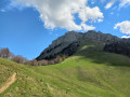
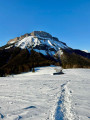
Just before that, at a junction, there’s a view of Chamechaude and La Pinéa as you walk out into the meadow.
(3) Carry on straight ahead along the track which climbs up to the Chalet de Montjalat and the junction with the track ascending to the left towards the Col de Palaquit.
(4) Continue straight on up the slope; at the next junction (Pied de Velouse), let the path to Emeindras branch off to the right and take the path to the left towards the Habert de Chamechaude.
The slope gradually becomes steeper; the path crosses a stream and, shortly afterwards, winds its way up to the left in hairpin bends to the Habert de Chamechaude, on the edge of the forest.
(5) Climb a further 50 m to the signposted junction and turn right, heading once again towards L’Émeindras de dessus. The marked path, which is barely visible in winter, cuts across several gullies (a tricky crossing, which may even be prone to avalanches depending on conditions) before reaching the summit of a more passable ridge.
Descend along its ridge, following the markings. Halfway down the slope, veer right to make a few switchbacks, then continue the descent to the Col de l’Émeindras.
(If you lose the path lower down, it’s not a major problem, as the paths to the right lead to the Chalet de l’Émeindras de Dessous, from where it is easy to climb back up to the Émeindras de Dessus).
(6) Opposite, to the south-east, take the path leading up to the Émeindras de dessus meadow, which you follow initially up to the chalets.
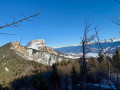
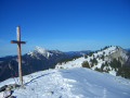
(7) Continue the climb to the top of the mountain pasture and carry on until just before the descent, for a view of the Dent de Crolles and Mont Blanc.
(8) Turn back and descend the Émeindras de dessus mountain pasture by whichever route you prefer, to the low point south-west of the chalets, where the main access path begins. Follow it down through the forest.
(9) After a right-hand bend, at a junction, instead of continuing straight on towards the Émeindras de Dessous, turn left onto a straight path that descends quite steeply through the forest to a ford across the Ruisseau du Ravin de Vence.
(10) Cross the stream and take the forest track that runs alongside it on the right bank, heading downstream. It joins a forest road which serves as a cross-country ski trail in winter (Planibert). Follow it downstream until you emerge from the forest and reach the hamlet of Les Combes, the starting point for cross-country skiing.
(11) Continue on foot along the road through the hamlet and, at the junction, turn right onto the Route de la Charmette to head back up to the church and the starting point (S/E).

 Association / Club / Walk leader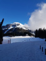

 Visorando Member
 Very difficult