Country:

 City:
City:


Park at the Perquelin car park, a 5-minute drive from Saint-Pierre-de-Chartreuse, accessible from Grenoble via the T40 bus.
(S/E) Set off along the forest track.
(1) When you reach a clearing at an elevation of 1061, leave the track and take the well-signposted path on the right towards the sources of the Guiers: this path heads eastwards through the heart of the forest. Pass the Fontaine Noire on your left and continue to the first fork.
(2) Leave the path that continues south towards the source of the Guiers and turn left. Then cross a forest track and rejoin the path opposite, just a little further to the left. Continue along this well-marked path.
(3) Stop briefly at the large, unnamed cave, then take the path that winds steeply through a beautiful gorge between two cliffs. Do not linger too long in this gorge, which is exposed to the risk of rockfalls.
(4) At the top of this gorge, make sure you take the path that heads north and soon reaches the cliff edge. Do not head south, unless you want to quickly reach theGR®9a little further up, particularly to avoid the section through the Chaos de Bellefont. You’ll come to a fork in the path.
(5) Turn right, following the old blue and red arrows; this section is marked all the way along with blue dots (not particularly attractive but very practical). Heading this way, you can follow the dots visually almost the entire way, which is sometimes quite helpful. Geology characteristic of the massif.
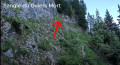
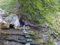
(6) Cross the slightly tricky section of this walk. It’s quite easy to get through, rather fun, with a real mountain feel: you’ll need to take off your rucksack, though, and it’s a bit exposed. Best avoided with young children. You’ll then join theGR®9.
(7) Take it to the left, heading north, towards the Cabane de Bellefont, which you’ll see after a short descent. Once you reach this magnificent mountain pasture (the names of the Patou sheep are helpfully displayed on the access path opposite – 2024), please respect the animals, the shepherds’ work and their magnificent sheepfold, which is situated right by the path.
(8) Before reaching this hut, turn right.
(9) Join the beautifulGR®9andGRP® trail, which winds its way in numerous hairpin bends towards the Col de Bellefont (north-east).
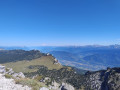
(10) Once you reach the pass, take in the view: you can continue south-east as far as the Dôme at an altitude of 1,975 metres. Head back down the same path to the previous junction.
(9) Turn right until you reach another junction.
(11) Turn right to follow theGR® de Pays Tour de Chartreuse. You’ll reach the Col de la Saulce, which marks the end of the mountain pasture and your return to the forest.
(12) Turn left, heading south, to begin the descent.
(13) At the junction, continue left for a few dozen metres, then take the path on the right.
(14) Go straight on along the path, which immediately makes a first turn to the left; join a cross-path and follow it to the left.
(15) At the junction near the Ruisseau de Bellefont, carry on straight ahead, cross the stream and rejoin the woodland area you passed on the way up: the descent can be particularly muddy.
(1) Turn right and retrace the ascent route in the opposite direction to return to the car park (S/E).




 Visorando Member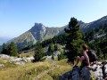
 Very difficult
 Moderate