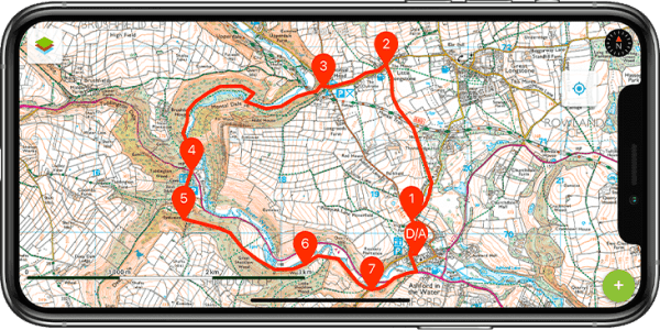
Find a walk/hike
Draw your walk on the map
Linear from Whitecraig to Bilston, via Dalkeith, Hardengreen, outskirts of Bonnyrigg, Springfield, Polton Mill and Bilston Burn. Walk around the outskirts of Edinburgh and through its hinterland. This is leg 2/5 of the Edinburgh Circumnavigation Walk.
This route follows the path of the first quarter of the Lakes District Challenge 2022. It takes some parts of part of the Dales Way, magnificent views of Longsleddale, climbs up to Garburns Pass with views into Troutbeck and Windermere.
Circular route (in five sections) around the outskirts of Edinburgh. Walk around the outskirts of Edinburgh and through its hinterland. The full circuit has been designed as a quiet, almost traffic-free, scenic route along quiet footpaths and lanes through outer Edinburgh and its ever-varied suburban, post-industrial and Greenbelt/rural hinterland.
Linear via Docks, Swing Bridge, Leith Links, Sewage Works, Portobello, Joppa, Musselburgh and River Esk. Walk around the outskirts of Edinburgh and through its hinterland.The aim of this walk is to follow the coast to Musselburgh, while avoiding busy roads and streets. This is leg 1/5 of the Edinburgh Circumnavigation Walk.
This delightful circular walk starts from The Hollybush public house in Priors Marston. It mostly goes across flat farmland and passing through splendid woodland. There are only a few inclines. This is walk 22 from the 44 composing the Millenium Way.
This circular walk incorporates two idyllic villages, quiet country lanes, pleasant woodland, open countryside, and an interesting church at Hellidon. A small section of the walk crosses Hellidon Lakes Golf Course, so extra care should be taken near the fairways. This is arguably one of our most scenic walks. This is walk 21 from the 44 composing the Millenium Way.
A pleasant 5½ mile circular walk from Broughton Hackett with the opportunity to enjoy the delights of the Worcestershire countryside. This is walk 20 from the 44 composing the Millenium Way.
This gentle circular walk starts in the pleasant village of Upper Boddington, and meanders across mostly flat farmland & open countryside. This is walk 19 from the 44 composing the Millenium Way.
Here's a collection of routes starting or finishing at a YHA in The Lakes. Along the way, there are one Wainwright, two lakes and one pub. Explore Rydal Cave.
This is a walk from the Borrowdale Valley over to Easdale Valley but it's also a ridge walk with great views over Far Easedale Gill and the surrounding landscape. Helm Crag is also known as The Lion and The Lamb due to it's profile when seen from the A591. Here's a collection of routes starting or finishing at a YHA in The Lakes. Along the way, there are three Wainwrights, one lake and one pub.
Here's a collection of routes starting or finishing at a YHA in The Lakes. Along the way are one Wainwright, one waterfall and one pub. This is a fairly simple route and a good way to say goodbye to The Lakes. The Stockghyll Falls are impresive and a certain Victorian atmosphere surrounds the place.
This walk takes in the England Coast Path from Scalby Mills to Scarborough Harbour as well as some of the North Bay attractions making this a full day walk if you wish to visit some of these attractions.
This delightful walk starts from the 15th-century church of St John the Baptist, situated on the corner of the High Street and Beaudesert Lane in Henley-in-Arden. This is walk 18 from the 44 composing the Millenium Way.
This circular starts from the 15th Century church of St John the Baptist in the centre of the lovely town of Henley in Arden. It has a couple of short steep climbs with resulting fine views. This is walk 17 from the 44 composing the Millenium Way.
Whilst in the village of Straiton you cannot help but wonder about the monument atop Craigengower (331m / 1086ft). This circular walk takes you up it’s steep slopes to the summit before a more gentle descent towards the Water of Girvan, returning to the start via pleasant riverside and woodland trails.
This is a really pleasant walk on the outskirts of Kilmarnock. After crossing Caprington Golf Course past the historical ruin of Blackskye Tower you will follow a former railway track bed across a field to reach the small hamlet of Earlston. The next stop is Caprington Castle and surrounding woodlands finishing with a wander through the residential part of Caprington.
A walk along a wide grass ridge with stunning views of the long, white sandy beaches of West Harris and the wild inland area of the island.
This is a circular walk around High Spy, Maiden Moor and Cat Bells. The scenery is good and the walk is made interesting by the old mine workings, both on the way up and also at Goldscope Mine. The return leg, through the woods above Derwent Water, is a nice contrast to the first half of the walk.
It is a useful walk when the tops are in mist and walking the ridge would give you no views or when the tops are covered in snow and you don't have ice axe and crampons to hand.
The route circles the North East of England covering parts of County Durham and the former Tyne and Wear showcasing some of the best countryside the area has to offer from woodlands to the coast, passing through towns and former mining villages villages, the variety of landscapes passed on the way is constantly changing.
Starting at the magnificent Lumley Castle, this walk winds its way through woodlands along the Lumley Park Burn before heading through Fenchouses and along bridlepaths through open fields before reaching Rainton Meadows Nature Reserve.
The path continues along the C2C cycle route then passes through the new village of Rickleton and the old village of Picktree before passing the Lambton estate with its ornate castle then winding its way through the grounds of Lumley Castle on the banks of the Wear.
Starting at the ferry slip on the Isle of Cumbrae, you will head uphill to the Glaid Stone, the island’s highest point, before descending into Millport. From here you walk back via the quiet Ferry Road. Along the way enjoy the views across to the Isle of Bute, Isle of Arran, Little Cumbrae and the hills of Ayrshire. You will pass several small lochs, a mineral well and the Cathedral of the Isles (Britain’s smallest cathedral). Not forgetting the famous Crocodile Rock!
This walk begins at Causey Arch and ends at Beamish following woodland paths for the majority of the route with one small section across fields linking two historically important locations. Be sure to explore Causey Arch and Tanfield Railway before beginning the walk.
Best experienced after a period of sustained rainfall, this section of the River Clyde is pretty spectacular. Starting in the historical village of New Lanark, the track forms the last section of the Clyde Walkway and is basically a woodland walk with viewpoints to the waterfalls along the river, the most photographed of these being Corra Linn which plunges down 26m over the rocks!
A pleasant circular walk from Egdon, with the opportunity to ramble over open fields and enjoy the beautiful countryside of Worcestershire. If time allows explore White Ladies Aston and visit it's church with interesting spire. This is walk 16 from the 44 composing the Millenium Way.
Visorando is the reference website and mobile app for outdoor activity routes. Our main focus is about walking, cycling and mountain biking tracks in the United Kingdom and France, and we include routes in other countries too. The site covers a wide range: from Sunday strolls to strenuous mountain hikes, long-distance trails and urban walks. The quality of the tracks we offer is more important than everything else for us: each track is precisely described and accompanied by a route map. The mobile app helps you to follow the hike on the ground by showing your GPS location in real-time. With these features, millions of people enjoy new routes each year thanks to Visorando.
The website was built on a participative model: everyone from private individuals to tourism professionals can share their own routes. Each track is checked by a team of moderators before being published. Users are then invited to give their opinion on the routes they have followed. By collecting information from the field, we are able to keep the tracks up to date. It is this specific model that has allowed us to build a collection of routes whose quality is currently unrivalled on the free web.
Our website is also available in French : click here to visit the French version of Visorando.
Visorando is managed by a team of eight full-time employees based in Alsace, at the bottom of the Vosges in France, plus about fifteen moderators across the country.