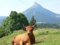
The Flin Plateau and the Chartreuse peaks

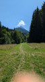
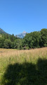
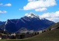
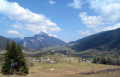
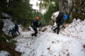
This is an easy walk, ideal for families. The setting: views of three peaks in the Chartreuse range – the Charmant Som, Chamechaude and the Grand Som. The walk can be done on foot in summer or on snowshoes in winter.

Details

58708715
Creation:
Last update:
Last review:
  • Walking
    Activity: Walking
  • ↔
    Distance: 2.55 mi
  • ◔
    Average duration: 1h 25 
  • ▲
    Difficulty: Easy

  • ⚐
    Back to start: Yes
  • ↗
    Ascent: + 292 ft
  • ↘
    Descent: - 289 ft

  • ▲
    Highest point: 3,068 ft
  • ▼
    Lowest point: 2,769 ft

Photos

Description of the walk

The walk starts from Saint-Hugues-de-Chartreuse at the cross-country skiing centre. There are plenty of parking spaces near the cemetery or the church.

(S/E) Take the path that runs past the cemetery and continue to the junction at the end of the path before reaching the wooded area.

(1) Turn left, following the sign for “Cherlieu – Calvaire”. The path is wide and pleasant, crossing meadows and passing barns. Carry on until you reach a wide forest track.

(2) Keep to the right on this track, which takes you to the hamlet of Clos Perrier, where it joins a tarmac road.

(3) Turn right and head downhill past several houses. Walk past the factory, through a farm and then through the hamlet of Les Michallets.

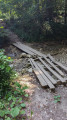
(4) As you leave the hamlet, turn right into the large meadow, where you’ll approach the Ruisseau des Corbeilles. You’ll alternate between shaded and sunny sections, with the Grand Som ahead of you and Chamechaude behind. Cross two small makeshift bridges.

(5) Take the rocky, uphill path on the right to head back towards Saint-Hugues.

(1) Carry on straight ahead to reach the cemetery and the car park (S/E).

Waypoints

  1. S/E : mi 0 - alt. 2,894 ft - Saint-Hugues-de-Chartreuse – cemetery
  2. 1 : mi 0.18 - alt. 2,904 ft - Junction of the circular loop
  3. 2 : mi 0.64 - alt. 2,940 ft - Forest track
  4. 3 : mi 1.13 - alt. 3,068 ft - Clos Perrier
  5. 4 : mi 1.66 - alt. 2,881 ft - Les Michallets, meadow on the right
  6. 5 : mi 2.2 - alt. 2,769 ft - Bridge
  7. S/E : mi 2.55 - alt. 2,894 ft - Saint-Hugues-de-Chartreuse – cemetery

Notes

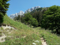
It is a circular path and can be done in either direction; the ascent is probably more pleasant in the direction indicated, through the forest on a stony path but without any difficulty.

There are no particular difficulties, apart from the bridges, which are worn, so do take care.

On the day we did the walk, the meadows had been mown to allow walkers through; we do not know if this is the case for the rest of the year. The route is signposted for snowshoeing and trail running.

Worth a visit

Reviews and comments

4.2 / 5
Based on 3 reviews

Reliability of the description
4 / 5
Ease of following the route
5 / 5
Route interest
3.7 / 5
Marie 1107
Marie 1107

Overall rating : 4.7 / 5

Date of your route : Sep 08, 2025
Reliability of the description : ★★★★★ Very good
Ease of following the route : ★★★★★ Very good
Route interest : ★★★★☆ Good
Very busy route : No

A very beautiful and easy hike.

Machine-translated

EvyC
EvyC

Overall rating : 4.3 / 5

Date of your route : Apr 20, 2025
Reliability of the description : ★★★★☆ Good
Ease of following the route : ★★★★★ Very good
Route interest : ★★★★☆ Good
Very busy route : No

A short, easy walk with some lovely views of the peaks.
One downside: the two little ‘bridges’, which are actually just planks laid across stones; not easy for an elderly person.

Machine-translated

madydou
madydou ★

Thank you for your feedback,
The altitudes have just been recalculated.

Machine-translated

Dominol
Dominol

Overall rating : 3.7 / 5

Date of your route : Feb 17, 2018
Reliability of the description : ★★★☆☆ Average
Ease of following the route : ★★★★★ Very good
Route interest : ★★★☆☆ Average
Very busy route : No

There is a problem with the altitudes and the elevation gain:
the start is at an altitude of 876 m, which seems correct, but the finish is at the same point at 941 m
the positive elevation gain is given as 664 m, which, in my opinion, is 10 times the actual figure.
Otherwise, it’s a lovely little walk on snowshoes and suitable for families.

Machine-translated

Other walks in the area

For more walks, use our search engine .

The GPS track and description are the property of this route's author. Please do not copy them without permission.