Country:

 City:


By car: from the centre of Revel 38, follow the signs for Freydières, take the D11 then the D280 and the D280d. Once you reach Les Granges de Freydières, drive past the La Gélinote bar and restaurant. Continue straight on along the small road opposite for 1.5 km. At the Quatre Chemins car park (alt. 1,290 m), continue along the road to the left which, after 100 m, becomes a dirt track rutted with ruts and potholes, but is still passable. At the end of this, you’ll find the Pré Raymond car park. Alternatively, park at the first car park at Les Quatre Chemins (alt. 1,370 m), which adds 1 km to the distance and 80 m of elevation gain to the walk.
(S/E) From the ‘Pré Raymond’ sign, at the south-eastern corner of the car park, take the path uphill (south-south-east) through the forest towards Lac du Crozet and the Refuge de la Pra. After about 1.5 km, turn left then right and shortly afterwards you’ll reach a junction (signposted ‘Les trois Ruisseaux’).
(1) Continue up the slope straight ahead (south; leave the Pré Molard path on your left, which you will take on the way back). After a few hundred metres, at the junction, keep left (south-east). A series of hairpin bends then begins.
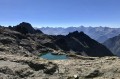
(2) The path then levels out almost completely, emerges from the forest and crosses a scree slope. Climb two long, diagonal traverses to reach a small plateau. The path resumes its ascent and crosses the Ruisseau de Mercier (east). Shortly after a sharp bend to the right, it turns south-east to climb the ridge of Lac du Crozet and reach a signpost overlooking the lake.
(3) Follow the eastern shore of the lake towards the Col and Refuge de la Pra (south) for about 300 m until you reach the junction with theGR®738.
(4) Turn left (east), towards the Jean Collet Refuge, following a path that climbs up a scree cone. The path, marked in white and red, is clearly signposted and easy to follow. Once over the small pass, you’ll come to a small valley rising towards the east. Take the upper part of its left-hand flank to avoid the scree slope at the bottom. At an altitude of around 2,210 m, gradually head south to cross the ridge above the Petit Lac du Loup.
(5) As the lake comes into view, turn left (north-east) towards a rocky ridge to the left of the Col du Loup. Climb in a zigzag pattern over the rocks on its right-hand side to reach the Col du Loup.
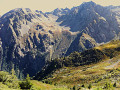
(6) Descend on the other side (snowfields may be present). Make a wide arc to the left and cross the valley of the Sistre Glacier. Reach the foot of the rocky ridge of the Rocher Boulon opposite. Follow it along and reach the top of a steep slope overlooking Lac de la Grande Sitre.
(7) At this narrow, overhanging section, choose one of the routes below, depending on snow conditions:
- Avoid it if it is covered in frozen snow. Retrace your steps and descend towards the lake via a gentler slope, then climb back up (north) to rejoin the path.
- Otherwise, as shown on the map, cross this steep section and head for a fork in the path a little further on.
(8) At the “Col de la Sitre” signpost, take the path on the left (north-west) above Lac de la Grande Sitre, heading towards the Pré Mollard mountain hut (leave the GR®). You will soon reach a junction (signposted “Sous la Pointe”).
(9) Continue north-west towards the Pré Mollard refuge (ignore the path leading down to the left towards Lac de la Sitre). Ignore the tracks leading down to the left, and keep to the right to reach a junction.
(10) Carry on straight ahead (ignore the path on the left towards the Habert de la Sitre). Follow the top of a valley and reach another junction.
(11) Pass the path on the left towards Habert de la Sitre. Continue straight ahead towards the summit of Mont Saint-Mury (north-west). Just before the summit, you’ll reach a fork.
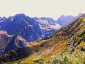
(12) Turn right (east) and continue along the marked path winding down the north-eastern ridge. At an altitude of around 1,850 m, turn left and head west. At the next Fork in the road, continue straight on (leaving the path to the Habert des Sabottes on your right).
(13) At the next junction, carry on straight ahead (east) and downhill. This will take you to the lovely Pré du Molard mountain refuge.
(14) Go round the refuge and follow the access road for about 200 m until you reach a junction.
(15) Turn left (west) onto the signposted downhill road which, after two hairpin bends, heads north. You’ll reach the Col du Pré du Molard.
(16) Take the first path on the left towards Pré Raymond. Cross a meadow, go through a fence and enter the forest. After about 500 m, you’ll reach a junction (signposted ‘Bois Renove’).
(17) Then turn left (south-east) onto a marked, undulating path down the forest slope towards Pré Raymond. Cross the Grande Sitre stream, then the Jas Vieille stream, and finally, via a footbridge, the Mercier stream (the outlet of Lac du Crozet). Further on, you’ll reach the Trois Ruisseaux junction you passed on the way there.
(1) Continue straight on (north) and, following the same path as on the way there but in the opposite direction, return to the car park (S/E).


 Visorando Member

 Very difficult
 Extremely difficult
 Moderate