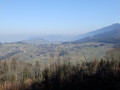
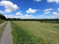
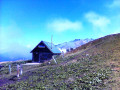
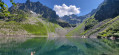
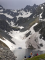
Pré Marcel as seen from the Col des Mouilles

A circular walk in the mid-mountains, offering beautiful views of Belledonne and Chartreuse. The walk presents no difficulties apart from the slightly steep climb.

Details

5714442
Creation:
Last update:
Last review:
  • Walking
    Activity: Walking
  • ↔
    Distance: 4.22 mi
  • ◔
    Average duration: 2h 55 
  • ▲
    Difficulty: Moderate

  • ⚐
    Back to start: Yes
  • ↗
    Ascent: + 1,109 ft
  • ↘
    Descent: - 1,106 ft

  • ▲
    Highest point: 4,449 ft
  • ▼
    Lowest point: 3,340 ft

Photos

Description of the walk

Access the start point via the D280 from Sainte-Agnès or Prabert. Park at the Col des Mouilles car park.

(S/E) Take the main tarmac road, running perpendicular to the D280.

(1) At the main junction, continue along the road on the left, which becomes a wide track. Admire the views of Belledonne: Prabert, Prapoutel, the Cime de la Jasse and the Grand Ferrouillet.

(2) Leave the main track and take a path on the right (yellow signposts) towards Les Chères. Steep slope!

(3) When you reach a large clearing, take a wide track right at the very far end. From here on, the circular route is all downhill. Further on, ignore another track branching off to the left and keep to the right, continuing downhill to the Pré Marcel chalet.

(4) Join the road by veering slightly to the right 100 m after the chalet. Head back down the small tarmac road opposite the Chartreuse.

(1) At the junction, turn left and head for the Col des Mouilles (S/E).

Waypoints

  1. S/E : mi 0 - alt. 3,340 ft - Col des Louilles (1015m)
  2. 1 : mi 0.43 - alt. 3,527 ft - Crossroads marking the start and finish of the circular route
  3. 2 : mi 0.75 - alt. 3,675 ft - Junction with the GR Tour du Balcon des Sept Laux
  4. 3 : mi 1.32 - alt. 4,423 ft - Les Chères Clearing
  5. 4 : mi 2.25 - alt. 4,255 ft - Pré Marcel car park. Leave the GRT
  6. S/E : mi 4.22 - alt. 3,343 ft - The Col des Mouilles

Notes

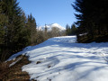
Sturdy walking shoes are recommended. The road to Pré Marcel is closed to cars during the winter months, from November to April, making for a very pleasant walk.

Worth a visit

At the Col des Mouilles, there is a refreshment kiosk (in summer).
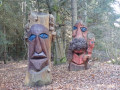
At the start of the walk, take a moment to admire the sculptures painted on tree trunks. I understand that the talented artist (Jean Rosset) is from Saint-Agnès.

Reviews and comments

4.1 / 5
Based on 3 reviews

Reliability of the description
5 / 5
Ease of following the route
4.7 / 5
Route interest
2.7 / 5
emilie.M19
emilie.M19

Overall rating : 3 / 5

Date of your route : Oct 16, 2023
Reliability of the description : Not used / Not applicable
Ease of following the route : ★★★★★ Very good
Route interest : ★☆☆☆☆ Very disappointing
Very busy route : Yes

Hello, I should have read the description more carefully, as I was really very disappointed with this walk. There were virtually no views; the climb is straight up between points 2 and 3, between 3 and 4 it’s a forest track, and finally it’s just tarmac from that point to the finish.

Machine-translated

francois 38
francois 38
• Edited:

Overall rating : 4.3 / 5

Date of your route : Feb 05, 2023
Reliability of the description : ★★★★★ Very good
Ease of following the route : ★★★★☆ Good
Route interest : ★★★★☆ Good
Very busy route : Yes

We went for a lovely little walk in our snowshoes
no difficulty

Machine-translated

TaX38
TaX38

We have mapped out this mid-mountain walk for the winter or spring months, when the snow makes it too difficult to reach the summits. It’s therefore a lovely way to explore and take in the beautiful scenery (especially whilst the trees aren’t too leafy).

Machine-translated

oryx38
oryx38

Overall rating : 4.3 / 5

Date of your route : Jun 18, 2021
Reliability of the description : ★★★★★ Very good
Ease of following the route : ★★★★★ Very good
Route interest : ★★★☆☆ Average
Very busy route : No

a rather uninteresting walk (along paths and roads)

Machine-translated

Other walks in the area

For more walks, use our search engine .

The GPS track and description are the property of this route's author. Please do not copy them without permission.