A circular route around Les Arcelles starting from Eybens

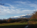
A leisurely stroll starting from Eybens church, offering a view of the Grenoble conurbation as you pass the Belvédère du Sabot orientation table.

Details

1737339
Creation:
Last update:
Last review:
  • Walking
    Activity: Walking
  • ↔
    Distance: 1.96 mi
  • ◔
    Average duration: 1h 15 
  • ▲
    Difficulty: Easy

  • ⚐
    Back to start: Yes
  • ↗
    Ascent: + 407 ft
  • ↘
    Descent: - 407 ft

  • ▲
    Highest point: 1,211 ft
  • ▼
    Lowest point: 804 ft

Photos

Description of the walk

Park in the large car park in front of Eybens church.

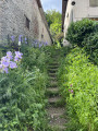
(S/E) Walk past the church, cross Avenue de la République and head down the street opposite. At the next junction, turn right onto Rue des Arraults. Leave this street shortly afterwards to take the path on the left, which consists of wooden log steps, with a signpost and yellow markings. The path climbs steeply to reach a wide track at the edge of the woods.
Take this path to the right to reach the junction by a water reservoir.
Turn left onto the steeply ascending path and, at the next junction, keep left to reach the Belvédère du Sabot.

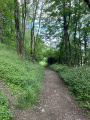
(1) Continue along the path, following the yellow markings. When you reach the edge of the woodland, head back into the woodland and you’ll soon come to another junction with signposts.

(2) Take the path on the left and begin the descent. Pass close to a water reservoir, stay on the path on the left and reach the edge of the woods again at the junction marked ‘Tonnellerie’.

(3) Let thePR® trail continue straight ahead and turn right onto the tarmac road – this is Rue des Pellets. Walk slightly downhill until you reach the junction with Avenue de la République.

(4) Turn left onto it and follow the pavement back to the church car park (S/E).

Waypoints

  1. S/E : mi 0 - alt. 804 ft - Eybens church car park
  2. 1 : mi 0.47 - alt. 1,056 ft - Belvédère du Sabot
  3. 2 : mi 0.81 - alt. 1,168 ft - Arcelles crossroads
  4. 3 : mi 1.03 - alt. 1,004 ft - Tonnellerie crossroads
  5. 4 : mi 1.38 - alt. 915 ft - Junction with Avenue de la République
  6. S/E : mi 1.96 - alt. 804 ft - Eybens church car park

Notes

This walk allows you to explore the chestnut forest overlooking the large village of Eybens, south of Grenoble.

Worth a visit

(1) The orientation board at the Belvédère du Sabot lists the peaks of the Northern Vercors. The view over the Grenoble conurbation helps you to identify the city’s key landmarks.

Always be cautious and plan ahead when you're outdoors. Visorando and the author of this route cannot be held responsible for any accidents occurring on this route.

The GR® and PR® markings are the intellectual property of the Fédération Française de Randonnée Pédestre.

Reviews and comments

4.3 / 5
Based on 3 reviews

Reliability of the description
4.7 / 5
Ease of following the route
4.7 / 5
Route interest
3.7 / 5
lauree
lauree

Overall rating : 4.7 / 5

Date of your route : May 08, 2023
Reliability of the description : ★★★★★ Very good
Ease of following the route : ★★★★★ Very good
Route interest : ★★★★☆ Good
Very busy route : Yes

A really lovely walk – I’ve got some lovely photos but I don’t know how to upload them.
The walk was lovely; you can also see the houses in Eybens towards the end of the route.

Machine-translated

AALEX
AALEX

Overall rating : 4.7 / 5

Date of your route : May 10, 2021
Reliability of the description : ★★★★★ Very good
Ease of following the route : ★★★★★ Very good
Route interest : ★★★★☆ Good
Very busy route : No

A lovely little walk.

Machine-translated

opale
opale

Overall rating : 3.7 / 5

Date of your route : Feb 17, 2019
Reliability of the description : ★★★★☆ Good
Ease of following the route : ★★★★☆ Good
Route interest : ★★★☆☆ Average

A lovely little walk on a spring Sunday afternoon.
We extended the circular path by heading up to the second viewpoint
(signposted at the fork in the road where we were due to start the descent),
then we continued down the small road to the village below (in the commune of Brié)
where, after crossing the road, we came across a sign pointing to Eybens-le-Bourg.
We therefore made our way back to Eybens via small roads, passing by the arboretum and the château, to arrive near the swimming pool and the tennis courts. From there, you can see the bell tower nearby.
This roughly doubles the distance and duration of the walk.
(You can also walk through the château’s arboretum to reach the area above the velodrome, which is near the tennis courts.)

Machine-translated

Other walks in the area

For more walks, use our search engine .

The GPS track and description are the property of this route's author. Please do not copy them without permission.