Country:

 City:
City:


By car: on leaving Villard-Bonnot via the D523 heading north, take the D290 towards Sainte-Agnès. After Sainte-Agnès, join the D280 and turn left towards the Col des Mouilles. At the pass, leave the D280 towards Allevard and turn right, before the wooden buildings, onto the Route de Pré Marcel. After 850 m, at the junction, follow the road to the right for 2.4 km and, at the Fork in the road, head left to the car park in a shaded meadow.
(S/E) Return to the fork in the road at the car park entrance, turn left (east) onto the forest track. Note a track on the right leading uphill in the opposite direction, marked with a hiking sign. Follow this track towards the Refuge Jean Collet.
(1) At the wide left-hand bend, ignore the old path branching off to the right (south-east – the IGN map is out of date and this path is still shown as the access route to the refuge). Following the edge of the woodland, take the left-hand bend, climb 150 m and then turn right. After about 400 m, you’ll reach a junction at a left-hand bend.
(2) Leave the track. Take the path on the right (south) which, shortly afterwards, enters the forest for a good two kilometres before rejoining the old path (alt. 1,500 m).
(3) Leave this path to your right and continue straight on. After a few hairpin bends, you’ll reach a junction on a flat stretch (altitude 1,640 m).
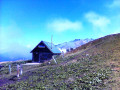
(4) At the sign for “Sous le Rafour” (a severed post with no sign). Ignore the path on the left towards “Sous Orionde”. Follow the path on the right (south-west) towards the refuge. After crossing through the forest and a few hairpin bends, you’ll reach an open, rocky area (alt. 1,800 m) and cross (south) several gullies and steep sections, some of which are secured with cables, before reaching the Jean Collet Refuge (alt. 1,950 m).
(5) Walk past the refuge and continue along the path (south-east) for about a hundred metres until you reach a three-way junction. Ignore the GR®738 on the right towards the Col de la Sitre and the middle path towards Lac Blanc. Follow theGR®738on the left towards the Col de la Mine de Fer, which climbs diagonally parallel to the path leading to the lake. Cross a small hill, then head up the gently sloping, grassy valley floor. At an altitude of around 2,150 m, begin the final ascent along a steep, zigzagging path through rocks and scree, eventually reaching the Col de la Mine de Fer (2,400 m).
(6) At the ‘Col de la Mine de Fer’ sign, descend 50 metres down the opposite slope of the pass (north-east) to a junction. At the second ‘Col de la Mine de Fer’ sign, leave the GR®738 on your right towards the Brèche de la Roche Fendue. Continue left along the yellow-marked path towards Lac de Crop. Descend (north-east), passing between a steep slope on the left and a rock face on the right, until you reach a precipice.
(7) Turn left (north-west) and descend the rocky terraces via two hairpin bends. Cross a scree slope, then a field of large boulders (west). Do not attempt to head straight down towards the lake but keep level. After a narrower passage between a cliff face and large boulders, gradually turn right (north).
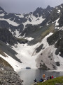
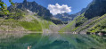
(8) On the path, which remains level, across a wider scree slope, head towards a gap. Once through this, the path becomes clearer again and, on the scree, resumes its descent in switchbacks towards Lac de Crop (alt. 1,910 m), which it follows along the eastern shore.
(9) Shortly after the end of the lake, you’ll come back to vegetation. Pass a few hairpin bends in the lake’s headwall and reach a junction (alt. 1,830 m).
(10) Ignore the path on the right towards Habert du Ferrouillet. Continue along the path to the left (west-north-west) for about 800 m. Leave the forest and reach a junction (elevation 1,706).
(11) At the sign for “Sous Orionde”, ignore the path on the left towards “Sous le Rafour”. Continue along the path straight ahead towards “Pont de la Betta”. After 400 m (alt. 1650 m), turn sharply right into the woods onto a path winding downwards, with the bends marked by large cairns. Follow the Ruisseau de Crop and cross it via a small bridge.
(12) Follow a gently sloping, shaded path to a fork (alt. 1,390 m).
(13) Ignore the track straight ahead. Keep to the sunken, damp and stony path on the left. At the bottom, join a level path (alt. 1,310 m).
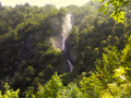
(14) At the sign for “Pont de la Betta”, ignore the sign for “Parking du Pont de la Betta” and instead turn left against the direction of traffic onto a wide track. You’ll reach the Waterfall des Avoux (alt. 1,320 m)
(15) Climb gradually until you reach a Fork in the road (alt. 1,380 m). Stay on the almost level track to reach a junction (alt. 1,370 m)
(16) At the signpost, follow the level track straight ahead towards “Pré Marcel” and, 300 m further on, join the hairpin bend of another track (alt. 1,365 m).
(17) Follow the track descending to the right, which, after 1 km, joins the car park (S/E).

 Visorando Member
 Moderate