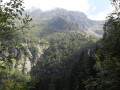
Col du Loup and Pointe de la Sitre

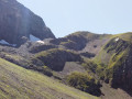
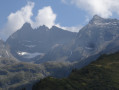
A lovely day’s hike in Belledonne at the foot of some of its legendary peaks: Grand Pic de Belledonne, Petite and Grande Lance de Domène ...

Details

n°3491443
Creation:
Last update:
Last review:
  • Walking
    Activity: Walking
  • ↔
    Distance: 6.17 mi
  • ◔
    Average duration: 5h 30 
  • ▲
    Difficulty: Moderate

  • ⚐
    Back to start: Yes
  • ↗
    Ascent: + 3,081 ft
  • ↘
    Descent: - 3,071 ft

  • ▲
    Highest point: 7,746 ft
  • ▼
    Lowest point: 4,852 ft

Description of the walk

Car park near the Col du Pré du Molard, which is reached via a track that can be a bit rough in places.

(S/E) Begin the ascent via the track.

(1) Soon, leave the track and head south along a good path to reach the Pré du Mollard mountain hut, which you’ll reach after a few hairpin bends.

(2) Continue the ascent, passing to the right of the refuge.

(3) Keep straight ahead on the signposted route. The route follows a contour line for a while, passes above the Habert des Sabottes and then reaches a junction.

(4) From there, heading south, begin a steep climb to reach a small pass.

(5) Turn left for a long climb, with a few sections where you’ll need to use your hands.

(6) Leave the path on your right that descends to Lac de la Grande Sitre and continue to the left.

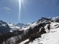
(7) A little further on, pass the junction to the left for the Col de la Sitre. Continue the ascent; snowfields may still be present in June. Reach the Col du Loup.

(8) Descend via the same route you took on the ascent.

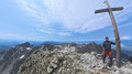
(7) Turn right towards the Col de la Sitre. From the pass, make a round trip to the Pointe de la Sitre.

(9) Descend back to the pass and rejoin the route taken on the way up.

(7) Follow it back down.

(5) Take the path on the left for a slightly wilder route; on the IGN map, the path is marked with small black dashes. Rejoin the route you took on the way up near the refuge.

(3) Follow it to reach the car park (S/E).

Waypoints

  1. S/E : mi 0 - alt. 4,856 ft - Car park near the - Col du Pré du Molard (1485m)
  2. 1 : mi 0.11 - alt. 4,934 ft - Towards the mountain pasture
  3. 2 : mi 0.91 - alt. 5,679 ft - Refuge du Pré du Molard (1740m)
  4. 3 : mi 1.08 - alt. 5,850 ft - Junction for both outward and return routes
  5. 4 : mi 1.47 - alt. 6,129 ft - Junction after Le Habert
  6. 5 : mi 1.74 - alt. 6,519 ft - Small pass – Junction for both outward and return routes
  7. 6 : mi 2.14 - alt. 6,791 ft - Keep to the left
  8. 7 : mi 2.34 - alt. 6,939 ft - Pointe de la Sitre round trip
  9. 8 : mi 3.15 - alt. 7,736 ft - Near the - Col du Loup (2380m)
  10. 9 : mi 4.07 - alt. 7,142 ft - Pointe de la Sitre (2195m)
  11. S/E : mi 6.17 - alt. 4,852 ft - Car park near the Col du Pré du Molard

Notes

Pré Mollard mountain hut.

Worth a visit

Ibex near the pass.

Reviews and comments

5 / 5
Based on 1 review

Reliability of the description
5 / 5
Ease of following the route
5 / 5
Route interest
5 / 5
Mitchcomb
Mitchcomb

Overall rating : 5 / 5

Date of your route : Jul 20, 2024
Reliability of the description : ★★★★★ Very good
Ease of following the route : ★★★★★ Very good
Route interest : ★★★★★ Very good
Very busy route : Yes

A lovely day’s walk. The drive to the car park along the forest track is a bit long but passable. Busy in summer, but varied and pleasant. You pass close to snowfields (where you can spot ibex) and get to enjoy views of three valleys, each with its own character (climbing to the Pointe de la Sitre is a must, if only for that!) Lovely views across the whole of Grésivaudan and, of course, the Chartreuse. There’s a fair bit of elevation gain, yes, but nothing exposed or particularly difficult. Take care in summer – there are rockfalls in the scree slopes. A truly beautiful day’s walk with a clearly marked route. Please note: there’s no shade beyond the refuge.

Machine-translated

Other walks in the area

For more walks, use our search engine .

The GPS track and description are the property of this route's author. Please do not copy them without permission.