Belvédère de Nonne

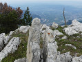
A visit to a viewpoint overlooking the village of Saint-Laurent-du-Pont.

Details

n°3147459
Creation:
Last update:
Last review:
  • Walking
    Activity: Walking
  • ↔
    Distance: 8.24 mi
  • ◔
    Average duration: 6h 20 
  • ▲
    Difficulty: Difficult

  • ⚐
    Back to start: Yes
  • ↗
    Ascent: + 2,956 ft
  • ↘
    Descent: - 2,943 ft

  • ▲
    Highest point: 3,930 ft
  • ▼
    Lowest point: 2,822 ft

Description of the walk

Park in the car park at the barrier on the Route Forestière de la Charmette after passing the Col de la Charmette.

(S/E) Continue along the road, go through the Tenaison tunnel and, a few metres further on, you’ll reach a junction with a track.

(1) Take the path on the left – this is the Chemin de la Petite Vache. After two bends – thefirst to the left and thesecond to the right – you’ll come to another junction.

(2) Leave the Chemin de la Petite Vache and take the path on the right downhill, passing at the foot of the Rochers de la Petite Vache and the Rochers des Agneaux, before rejoining the previous road further on.

(3) Turn left onto this road and follow it for about a hundred metres until you reach a car park. Turn left onto the track – this is the Chemin de Nonne. Continue uphill until you reach the Nonne viewpoint.

(4) Follow the same route back to the previous junction.

(3) Keep left on the road, passing through the Agneaux and then the Galère tunnels. You will then return to the original junction.

(1) Stay on the road and follow the same route as on the way out to reach the car park at the barrier (S/E).

Waypoints

  1. S/E : mi 0 - alt. 3,497 ft - Car park by the barrier
  2. 1 : mi 1.1 - alt. 3,209 ft - Crossroads at the end of the circular loop
  3. 2 : mi 1.77 - alt. 3,898 ft - Chemin de la Petite Vache
  4. 3 : mi 2.93 - alt. 2,858 ft - Road junction. Near the - Chartreuse de Currière (Saint-Laurent-du-Pont)
  5. 4 : mi 4.54 - alt. 3,822 ft - Belvédère de Nonne
  6. S/E : mi 8.24 - alt. 3,494 ft - Car park by the barrier

Worth a visit

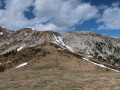
(4) Belvédère offers a remarkable view of Saint-Laurent-du-Pont
Sadly, a tragic event took place in this village in the Chartreuse region that cannot be ignored. It was on 1 November 1970

Reviews and comments

4.7 / 5
Based on 1 review

Reliability of the description
5 / 5
Ease of following the route
5 / 5
Route interest
4 / 5
Deuxpattes
Deuxpattes

Overall rating : 4.7 / 5

Date of your route : Oct 02, 2023
Reliability of the description : ★★★★★ Very good
Ease of following the route : ★★★★★ Very good
Route interest : ★★★★☆ Good
Very busy route : No

General note: This walk takes place entirely within the municipality of St Laurent du Pont; consequently, it is incorrect to list ‘St Pierre de Chartreuse’ as the starting point. I am pointing this out because it misled us when calculating the journey time to reach the start.

A specific note for those coming from northern Isère (like me) or Savoie: the starting point is well to the south of St Laurent du Pont and is a long way from the village itself. All access roads to this starting point go via Voreppe, which considerably increases the journey time (a waste of time and fuel).
If this concerns you, I would therefore suggest that those coming from the north of St Laurent du Pont start the walk at point 3, setting Currière as your destination; or, once you’re in the village of St Laurent du Pont, set ‘Route forestière de la Charmette’ as your destination and follow this road to Currière. You’ll save at least an hour’s journey time.

Apart from that: we really enjoyed this walk. It’s very shady (perfect when it’s hot), but there are no viewpoints apart from the Belvédère de Nonne (which is lovely). Personally, that doesn’t bother me as I quite like the ‘intimate’ atmosphere of the woodland.
The hamlet of Currière is lovely.
Thanks for this post!

Machine-translated

Other walks in the area

For more walks, use our search engine .

The GPS track and description are the property of this route's author. Please do not copy them without permission.