Croix de Belledonne via the Waterfall de l’Oursière

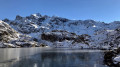
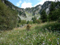
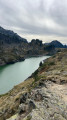
A spectacular hike to the iconic Croix de Belledonne. As well as the most varied alpine landscapes, the numerous stunning lakes along the route and the wonderful encounters you’ll have along the way, the end of this hike offers a breathtaking view of the Vercors, the Chartreuse and the Écrins. Starting at an altitude of 1,100 m and finishing at 2,926 m.
Enjoy!

Details

25052109
Creation:
Last update:
Last review:
  • Walking
    Activity: Walking
  • ↔
    Distance: 14.85 mi
  • ◔
    Duration according to the author: 12 hrs 
  • ▲
    Difficulty: Extremely difficult

  • ⚐
    Back to start: Yes
  • ↗
    Ascent: + 5,866 ft
  • ↘
    Descent: - 5,866 ft

  • ▲
    Highest point: 9,491 ft
  • ▼
    Lowest point: 3,645 ft

Photos

Description of the walk

The walk is situated in the south-western part of the Belledonne Massif. To get there by car, drive via Domène, Revel and then Saint-Martin d’Uriage. Take the Route de la Gâte, which is clearly signposted before the hairpin bend on the D111. A large, spacious car park means you can park your car with no trouble.

(S/E) Set off on foot along the Route de la Gâte (you’ll also see ‘Gafe’ on some signs…) at the far end of the car park.

(1) At the 1140 m – Pierre Molle signpost, follow the signs for the Oursière waterfall.

(2) At the sign for 1,489 m – Waterfall de l’Oursière, follow the signs for the Refuge de la Pra.

(3) At the sign for 1,610 m – L’Oursière, follow the signs for the Refuge de la Pra.

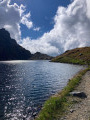
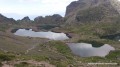
(4) A few metres before an unmarked fork at the 1948-metre mark, take the path leading uphill to the right. This route allows you to climb up and enjoy the view of Lakes Bernard, Longet and Claret.
You will soon catch sight of the Refuge de la Pra (do not take the path that crosses the Domènon stream).

(5) At the sign for 2078 m – Roc de l’Hôpital, continue towards the Refuge de la Pra.

(6) At the sign for 2109 m – Refuge de la Pra, carry on towards the Col de la Pra.

(7) At the sign for 2186 m – Col de la Pra, follow the signs for the Pic de Belledonne.

(8) At Lac du Petit Domènon – 2,355 m, walk along its left-hand side.

(9) At Lac du Grand Domènon – 2,385 m, continue with the lake on your right.

(10) At the 2,474-metre mark – at the foot of the Névé de la Grande Pente – head firmly towards the Col de Freydane before beginning the ascent up the scree slope on the right. Please note that in the height of summer, the snowfield is sometimes completely absent. The path is just about visible in the scree. Caution: this is certainly one of the most technical sections; the slope is steep and can reach 40% in places!

(11) At an altitude of 2,640 m, continue towards the Croix de Belledonne.
Please note, for those wishing to reach Lac Blanc, that there is a pass hidden here leading to the Col de Freydane at Isoplèthe. The route presents no technical difficulties but is very exposed in places.

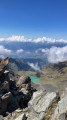
(12) At the Croix de Belledonne – 2,926 m – you’ve made it! Take in the view. A 360° view of the Écrins, the Chartreuse and the Vercors; below, Lac Blanc. In the height of summer, you’ll be able to see, here too, the ravages of global warming: the Freydane Glacier had disappeared by mid-August 2022.
Turn back towards the 2078 m sign – Roc de l’Hôpital.

(5) On the descent, follow the signs to the right towards the Oursière waterfall (a refreshing alternative route for the return journey). Reach the unmarked junction at an elevation of 1,948 metres.

(4) Continue straight downhill, following the route in reverse to the one taken on the way up, to reach the car park on Route de la Gâte (S/E).

Waypoints

  1. S/E : mi 0 - alt. 3,645 ft - Route de la Gâte. Car park
  2. 1 : mi 0.22 - alt. 3,671 ft - Pierre Molle (1,140 m)
  3. 2 : mi 1.8 - alt. 4,829 ft - 1,489 m - Cascade de l'Oursière
  4. 3 : mi 2.07 - alt. 5,249 ft - L’Oursière (1,610 m)
  5. 4 : mi 3.41 - alt. 6,385 ft - Unmarked junction (1,950 m). Return - Lac Bernard
  6. 5 : mi 4.26 - alt. 6,814 ft - Roc de l’Hôpital (2,078 m) - Lac Claret
  7. 6 : mi 4.52 - alt. 6,916 ft - (2,109 m) - Refuge de la Pra
  8. 7 : mi 4.71 - alt. 7,113 ft - Col de la Pra (2,186 m)
  9. 8 : mi 5.38 - alt. 7,772 ft - Lac du Petit Domènon (2,355 m)
  10. 9 : mi 5.72 - alt. 7,867 ft - (2,385 m) - Lac du Grand Doménon
  11. 10 : mi 6.36 - alt. 8,110 ft - Base of the Névé de la Grande Pente (2,472 m)
  12. 11 : mi 6.66 - alt. 8,665 ft - Junction. Possible route to the - Col de Freydane (2645m)
  13. 12 : mi 7.42 - alt. 9,465 ft - (2,926 m) - Croix de Belledonne
  14. S/E : mi 14.85 - alt. 3,645 ft - Route de la Gâte. Car park

Notes

(6) Refreshments and drinking water are available at the Refuge de la Pra.

In the height of summer, this hike requires only standard hiking kit: good walking boots, a cap and walking poles, which can be your best friends on the descent.

The walk includes a few tricky or exposed sections, though none present any significant technical difficulty.
It is still advisable to check the snow conditions on the route beforehand.
A very good level of fitness is essential to tackle the elevation gain and loss of this route.

Allow at least 12 hours for the entire hike.

Located halfway along the route, the Refuge de la Pra is a key safety feature. What’s more, you can enjoy some lovely seasonal specialities there (blueberry tart, kefir), always served with the warmest of welcomes.
Enjoy!

Worth a visit

Lake Claret and Merlat

Camping prohibited: within a 50-metre radius of the lake in order to
preserve the fragile wetlands that are home to remarkable and, in some cases, protected fauna and
remarkable and sometimes protected flora – Municipal Order No. 53-2020 of the commune of Revel
No open fires: Prefectural Order No. 38-2017-04-28-007 of the Isère department
Swimming prohibited: Municipal Order No. 2024-92 of the municipality of Revel
Fishing permitted with a fishing licence

Lake Longet – Bernard – David
Camping permitted: from 7.00 pm to 9.00 am
No open fires: Prefectural Order No. 38-2017-04-28-007 of the Isère department
Swimming prohibited: Municipal Order No. 2024-92 of the municipality of Revel
Fishing permitted with a fishing licence

Lakes Petit Domènon and Grand Domènon
Camping permitted: from 7.00 pm to 9.00 am
Municipal Order No. 53-2020 of the municipality of Revel
Open fires prohibited: Prefectural Order No. 38-2017-04-28-007 of the Isère department
Swimming prohibited: Municipal Order No. 2024-92 of the municipality of
Revel
Fishing permitted with a fishing licence

La Pra mountain pasture

Special provisions for the period from 14 July to 31 August, which coincides with the presence of the herd and the peak in visitor numbers in the La Pra mountain pasture area: Camping is prohibited throughout this area. It is restricted to designated sites located near the refuge (please enquire with the
mountain hut).

Livestock grazing in the La Pra mountain pasture area: the herd is protected by Patou-type dogs.
See the link for the interactive map: Pasto Kézako.

Reviews and comments

5 / 5
Based on 2 reviews

Reliability of the description
5 / 5
Ease of following the route
5 / 5
Route interest
5 / 5
Amos Mumu
Amos Mumu

Overall rating : 5 / 5

Date of your route : Aug 31, 2024
Reliability of the description : ★★★★★ Very good
Ease of following the route : ★★★★★ Very good
Route interest : ★★★★★ Very good
Very busy route : Yes

I completely agree that it’s a gruelling route – the fatigue and the climb really do require you to be in excellent physical shape. Between the elevation gain and the number of kilometres, it’s quite a challenge. But fortunately, there are some flat sections and some magnificent scenery. There aren’t any sections through car parks or the like, just the odd relatively steep slope (my calves and thighs can certainly attest to that) and a bit of ‘climbing’ that doesn’t require any special kit! But the reward at the summit is well worth it and makes the trip worthwhile. I think walking poles might come in handy – I didn’t have any, but everyone else on this hike did! I highly recommend it as it’s stunning, though I found it very tiring.

Machine-translated

denisvallee
denisvallee

Overall rating : 5 / 5

Date of your route : Sep 13, 2022
Reliability of the description : ★★★★★ Very good
Ease of following the route : ★★★★★ Very good
Route interest : ★★★★★ Very good
Very busy route : Yes

Very well.

Machine-translated

Other walks in the area

For more walks, use our search engine .

The GPS track and description are the property of this route's author. Please do not copy them without permission.