3 October 2023 Message from the moderators: some paths and trails are off-limits – see practical information.


 Country:

 City:


From Saint-Pierre-de-Chartreuse, take the D512 towards Saint-Pierre d’Entremont. Shortly afterwards, turn right towards La Scia. Head to the starting point, located at the hairpin bend, just before the hamlet of Les Essards. This is the car park for the climbing site.
(S/E) Turn right onto the path leading to the Mollard climbing site. Follow the yellow markings. Climb up through the forest, then begin the descent over the rocks. There are cables to help you secure yourself.
(1) Once you reach the bottom of the rocks on a small platform, head left, then immediately take the narrow path leading down to the right. The path is not very visible and is unmarked; you have to make out where it is rather than see it clearly.
Carry on until you reach a junction with a wider path. This is aGRP® (marked in red and yellow)
(2) From here, head left for about 20 metres, then turn right and continue to follow the red and yellow markings.
Carry on along this path until you reach the junction with the Scia path.
(3) Carry on to the right along theGR® to the Col de la Saulce.
(4) Head up the slope opposite towards the Bellefond hut, staying on the GRP®.
(5) Turn left towards the Col de Bellefond. The path is quite steep as it climbs to the pass.
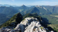
(6) Turn right towards the Dôme de Bellefond. Follow the ridge to the top. From there, you’ll enjoy a superb panoramic view of the Belledonne massif, the Grésivaudan valley and, with a bit of luck, you might even spot Mont Blanc.
(7) To return to the Bellefond hut, you can simply retrace your steps.
If you’re still feeling up to it and are a fairly keen walker, you can follow the ridge southwards. Some sections are quite steep. Take care. Along this ridge, you’ll be treated to some lovely views.
Carry on until you reach the path that descends to the left towards the Pas de Montbrun.
(8) Head down to the right across the meadow. There is no marked path. Join a track and then turn right towards the Bellefond hut.
The path is still not very visible; follow the terrain.
Soon, you’ll rejoin the path you took on the way up, which climbs towards the Col de Bellefond. Head back down towards the hut.
(5) Set off again towards the Col de Saulce.
(4) Follow the same route as on the way there until you reach the Scia crossroads you passed earlier.
(3) Take the path leading uphill to the right. Follow it to the chairlift station.
Turn left and walk under the chairlift. Then turn left and head down the path, which soon takes a sharp right-hand bend.
Pass under the second chairlift and follow the winding path.
Pass under the first chairlift again and, after about 80 metres, turn right. Walk downhill to a junction.
(9) Head slightly to the left and go through the small fence. You’ll soon reach a wider path; turn right here. All that remains is to walk down to the car park (S/E).

 Visorando Member
 Moderate

 Tourist office
 Easy
 Very difficult
 Association / Club / Walk leader