Country:

 City:
City:


Start from the Domaine de Rozan.
(S) Follow the Route du Charmant Som. Turn left at the junction after the telecoms mast.
(1) Leave the road and take the path running parallel to it, rejoining the road further up. Continue to the left, taking the path on the left which serves as a shortcut before rejoining the road once more.
(2) Follow it for a long way along its course. You’ll reach a series of bends.
(3) Take the shortcut to the left, cross the road and rejoin the path opposite. Further on, you’ll come back onto the road; cross it, then take the path opposite which runs alongside it at a distance before rejoining it for good at the Oratoire d’Orgeval, where it joins the GR®9 and the GR® de Pays Tour de Chartreuse.
(4) Turn right, following the dual signposting, and continue to the end of the road at the Charmant Som chalets.
(5) Pass between the cheese dairy and the inn to join the path that branches off to the right and climbs up to Le Charmant Som.
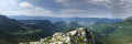
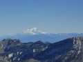
(6) Leave the GR® and GRP® markings and take a very steep path that winds steeply upwards to the left in tight hairpin bends to reach Le Charmant Som: exceptional views.
(7) After the summit cross, take a small, poorly signposted path that heads off to the left and then descends into a gap. Cross a large scree slope, ignore a path on the right leading up to Pré Bâtard, and arrive at a drinking trough.
(8) Continue straight on along the path marked with white stripes. Reach the Col de la Charmette after crossing the forest road of the same name.
(9) Take the path on the right, then turn left onto the track that leads into the forest. Pass the Chalet de la Charmette and continue towards the Col de la Grande Sûre. You’ll reach a junction.
(10) Carry on to the right past the Pas de l’Âne timber yard and head towards it.
(11) Take the track on the right and proceed to another junction.
(12) Keep left towards the Col de la Grande Vache.
(13) Cross the Col de la Grande Vache straight ahead to quickly reach the star-shaped junction at the Col de la Sure.
(14) Carry on straight ahead to reach the Grande Sure.
(15) Return to the pass.
(14) Take the second path on the left, heading diagonally, and carry on to the Col de la Petite Vache.
(16) Head left, due north, and make your way to the Col des Charmilles.
(17) Head down the track on the right to reach the Petite Vache timber yard.
(18) Continue to the right along the Route Forestière de la Charmette to the Tenaison Tunnel, where you’ll rejoin the tarmac road.
(19) Go through the tunnel and carry on to the ‘Four’ timber yard.
(20) Take a hairpin bend path that climbs to the left. At the sign for Saint-Pierre-de-Chartreuse / Tenaison, continue to the left towards Saint-Pierre-de-Chartreuse. Then go round a rocky outcrop before following the hairpin bends up a steep slope to the Col de la Cochette.
(21) Cross the pass and begin the descent by following the path leading to the Habert de Malamille.
(22) Leave this path on your left and continue straight ahead along the winding track which approaches the Guiers Mort, then crosses it at the Valombre bridge before joining the D520b.
(23) Follow it to the right for about a hundred metres, then turn right again to cross the footbridge over the Guiers Mort and rejoin the road. All that remains is to follow this road to the right to reach La Diat and your accommodation (E).
 Visorando Member
 Difficult
 Extremely difficult
 Moderate