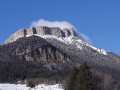
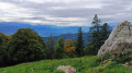
Tour de l’Écoutoux

An ideal forest walk in hot weather for those looking to cool off a little.
The plus: you can go for a swim halfway along the route.
Downside: you have to cross the road on the way back (if anyone knows an ‘easy’ route through the rocky outcrop at Le Bret to avoid the road, I’d love to hear about it).

Details

2254519
Creation:
Last update:
Last review:
  • Walking
    Activity: Walking
  • ↔
    Distance: 6.63 mi
  • ◔
    Average duration: 4h 50 
  • ▲
    Difficulty: Moderate

  • ⚐
    Back to start: Yes
  • ↗
    Ascent: + 2,008 ft
  • ↘
    Descent: - 2,031 ft

  • ▲
    Highest point: 3,707 ft
  • ▼
    Lowest point: 2,005 ft

Photos

Description of the walk

Park in the car park at the Sappey-en-Chartreuse cross-country ski centre.

(S/E) At the top of the car park, turn left onto Route de la Charmette. Cross the D512, continue straight on past the school and follow the path through the playground. Cross Route de l’Achard towards Les Beauches. At the end of the path, after crossing the stream, take the path on the left.

(1) Leave the track and take a path on the right that leads uphill. Follow it to a crossroads.

(2) Follow the path straight ahead downhill for about 150 metres. When you can see the riding centre’s quarry, leave the path to reach it, then go round it on the left. Cross the riding centre to the turning area. Take the path on the left towards the Col de Bens.

(3) Continue down the path towards Le Fa.

(4) When you reach the Le Fa junction, leave the track and take the path on the left, then immediately the one on the right, heading downhill. Continue downhill until you reach the tarmac road and the first houses. Quickly take the path on the left. Cross the D57 and head straight down the track opposite. Carry on straight ahead until you cross the D57 again. Continue alongside the road until you reach the Pont de Vence.

(5) Cross the bridge and head up the road on the left-hand side. About a hundred metres further on, take the path leading uphill on the left. Follow it until you reach the Chemin de la Frette. Leave the path and take the footpath on the left.

(6) Follow the footpath to the hamlet of Vence. Take the path on the right that leads uphill, just round the corner from the last house. Stay on the path and then continue straight on along the footpath until you reach the water tower and the D512.

(7) Walk along the road on the left until you reach the first street on the left (former cement works).
Take great care on this section. Continue to the junction with the road leading to La Bordelière.

(8) Turn right onto the road that runs through the hamlet of La Pillonnière until you reach the junction with the D57a (the road leading to Fort du Saint-Eynard).

(9) Turn right, then immediately left towards the hamlet of La Bordelière. Walk through the hamlet. At the left-hand bend, leave the road and take the dirt track uphill. Cross the ski runs. Head into the forest until you reach the Grand Sommard ski lift pylon, then take the path leading downhill to the left. Continue along the path until you reach the treetop adventure park.

(10) Follow the path on the left – this is theGR®9, marked in red and white. Walk through La Vence and continue straight on to the car park at the cross-country ski centre (S/E)

Waypoints

  1. S/E : mi 0 - alt. 3,287 ft - Car park at the cross-country ski centre
  2. 1 : mi 0.72 - alt. 3,314 ft - Turn right at the fork
  3. 2 : mi 0.96 - alt. 3,655 ft - Crossroads opposite
  4. 3 : mi 1.39 - alt. 3,694 ft - Towards Le Fa
  5. 4 : mi 1.8 - alt. 3,251 ft - Hairpin bend to the left at Le Fa
  6. 5 : mi 3.37 - alt. 2,008 ft - Vence Bridge
  7. 6 : mi 4.02 - alt. 2,408 ft - T-junction on the left
  8. 7 : mi 4.4 - alt. 2,644 ft - Water tower
  9. 8 : mi 5.23 - alt. 3,025 ft - Former cement works
  10. 9 : mi 5.49 - alt. 3,196 ft - Calvary
  11. 10 : mi 6.31 - alt. 3,353 ft - Leisure park
  12. S/E : mi 6.63 - alt. 3,284 ft - Car park at the cross-country ski centre

Notes

(5) Water point: La Vence.

Worth a visit

(5) Pont de Vence: For those who want to go for a swim, cross the D57 just before the bridge and head down the right bank. There are some small pools there.
(10) Indian Forest Chartreuse Leisure Park (treetop adventure course for all levels / outdoor battle arena).
(10) La Grange Restaurant

Always be cautious and plan ahead when you're outdoors. Visorando and the author of this route cannot be held responsible for any accidents occurring on this route.

The GR® and PR® markings are the intellectual property of the Fédération Française de Randonnée Pédestre.

Reviews and comments

3.6 / 5
Based on 4 reviews

Reliability of the description
3.8 / 5
Ease of following the route
4 / 5
Route interest
3 / 5
cec maurin
cec maurin
• Edited:

Overall rating : 2.7 / 5

Date of your route : Sep 17, 2022
Reliability of the description : ★★★☆☆ Average
Ease of following the route : ★★★★☆ Good
Route interest : ★☆☆☆☆ Very disappointing
Very busy route : No

Definitely not suitable for children. This route involves walking around the Ecoutoux without ‘climbing’ it; the entire descent takes place at the start. The return journey along the departmental road is long, sometimes with no hard shoulder, and on a very busy route. In my view, this walk has no place in a hiking app; this is my first negative experience.

Machine-translated

christianplanchon@yahoo.fr

Overall rating : 3.7 / 5

Date of your route : Apr 26, 2021
Reliability of the description : ★★★★☆ Good
Ease of following the route : ★★★★☆ Good
Route interest : ★★★☆☆ Average
Very busy route : No

I only did part of the route, walking up to point 2 and doing a round trip up the Ecoutoux. This route is interesting and avoids the road climb up to the peatlands. I plan to carry on towards the hamlet of Vence and stop at the Col de Vence, as the road climb doesn’t appeal to me at all. I sometimes cycle it, holding my breath, as the traffic has become really heavy and dangerous.

Machine-translated

palmidou
palmidou

Overall rating : 4 / 5

Date of your route : Aug 19, 2020
Reliability of the description : ★★★★☆ Good
Ease of following the route : ★★★★☆ Good
Route interest : ★★★★☆ Good
Very busy route : No

a route with very few signposts, difficult to follow
poorly maintained, with lots of fallen trees
The final section on the D512 is very tedious and dangerous due to the heavy traffic
Otherwise, a pleasant walk through the woodland

Machine-translated

pmx38
pmx38
• Edited:

Overall rating : 4 / 5

Date of your route : Nov 16, 2019
Reliability of the description : ★★★★☆ Good
Ease of following the route : ★★★★☆ Good
Route interest : ★★★★☆ Good

A lovely hike through 20 cm of fresh snow, particularly in the first section, which made finding our way a bit tricky on paths that were barely visible or not visible at all. This little Écoutoux massif is well worth a walk around.
The only major downside was the unavoidable stretch along the D512, which was far from pleasant due to the heavy traffic on this essential route linking Grenoble to Le Sappey.

Machine-translated

Other walks in the area

For more walks, use our search engine .

The GPS track and description are the property of this route's author. Please do not copy them without permission.