La Pliou – Lac du Crozet – Col de la Pra – Croix de Belledonne

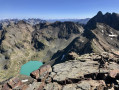
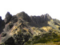
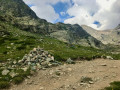
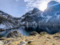
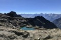
A lovely hike in the Belledonne massif leading to the Croix de Belledonne, following a route with a significant elevation gain. The route takes in the beautiful Lac du Crozet and the equally stunning Lacs du Doménon. It is possible to split the hike into two stages, spending the night at the very pleasant Refuge de la Pra.

Details

63558789
Creation:
Last update:
Last review:
  • Walking
    Activity: Walking
  • ↔
    Distance: 12.58 mi
  • ◔
    Average duration: 10h 25 
  • ▲
    Difficulty: Very difficult

  • ⚐
    Back to start: Yes
  • ↗
    Ascent: + 5,292 ft
  • ↘
    Descent: - 5,292 ft

  • ▲
    Highest point: 9,491 ft
  • ▼
    Lowest point: 4,478 ft

Photos

Description of the walk

Coming from Grenoble or Chambéry, take the Domène exit. At Domène, follow signs for Revel, then Allevard/Saint-Martin d’Uriage. Follow the signs for Allevard and, at the hamlet of Les Rousset, follow signs for Freydières. Pass the Quatre Chemins car park and, on a stonier track, reach the Pré Raymond car park.

(S/E) Take the path heading south, towards Lac du Crozet.

(1) Leave the path leading to the Refuge du Pré du Mollard on your left and carry on straight ahead. Reach Lac du Crozet and walk along its eastern shore.

(2) Ignore the path on the left, heading towards the Refuge Jean Collet, and follow the path that continues to skirt the lake on the right. Head up the Vallon du Mercier and reach the Col de la Pra, whose sign can be seen from quite a distance.

(3) Ignore the path straight ahead, which leads to the Refuge de la Pra, and turn left towards the Grand Pic de Belledonne. You’ll reach the Verrous des Doménons, a tricky and slippery section in wet weather.

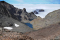
(4) Walk alongside Lac du Petit Doménon, then Lac du Grand Doménon, and carry on. You’ll reach a landmark at the top of a rock, about 10 metres high, at an elevation of 2,474 metres.

(5) Head right (south-east) along the path that winds its way through boulders and scree beneath the Névé de la Grande Pente, then head east-north-east (elevation 2580), as the slope levels out. Pass at the foot of the Rochers Rouges on the left: the path is clearly visible in the summer months.

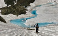
(6) Pass between two unnamed lakes (which are increasingly small or snow-covered depending on the season) and continue on to reach the Col de Belledonne: the Croix de Belledonne can be seen in the distance.

(7) Complete the ascent to reach the Croix de Belledonne and take in the surrounding area with a 360° view.

(8) Return via the same route, in the opposite direction, to reach the car park (S/E).

Waypoints

  1. S/E : mi 0 - alt. 4,478 ft - Pré Raymond La Pliou car park
  2. 1 : mi 0.53 - alt. 4,951 ft - Junction with the Pré du Mollard refuge path
  3. 2 : mi 2.6 - alt. 6,509 ft - Junction with the Jean Collet small pass refuge
  4. 3 : mi 3.49 - alt. 7,110 ft - Col de la Pra
  5. 4 : mi 4.17 - alt. 7,766 ft - Verrous des lacs du Doménon
  6. 5 : mi 5.15 - alt. 8,097 ft - Elevation 2474 – Landmark
  7. 6 : mi 5.68 - alt. 8,921 ft - Passing the unnamed lakes
  8. 7 : mi 5.97 - alt. 9,144 ft - Col de Belledonne
  9. 8 : mi 6.29 - alt. 9,452 ft - Croix de Belledonne
  10. S/E : mi 12.58 - alt. 4,478 ft - Pré Raymond La Pliou car park

Worth a visit

When passing the Col de la Pra, either on the way there or on the way back, stop off briefly at the refuge below.

Reviews and comments

4.7 / 5
Based on 3 reviews

Reliability of the description
4.5 / 5
Ease of following the route
4.5 / 5
Route interest
5 / 5
Jemzolo
Jemzolo

Overall rating : 5 / 5

Date of your route : Sep 10, 2026
Reliability of the description : ★★★★★ Very good
Ease of following the route : ★★★★★ Very good
Route interest : ★★★★★ Very good
Very busy route : Yes

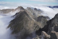
A lovely walk. It was a shame that, on that particular day, a sea of clouds high up and very thick fog at times spoiled the view.
A physically demanding walk but without any major difficulties… it’s a steep climb in places, and the descent really puts your knees to the test.
On the way back, I took a short detour to the Pra refuge, which was shrouded in fog, for a coffee. I’ll be back to enjoy the view from the summit in clear weather.

Please note: between the 4 Chemins car park and the Pré Raymond car park, the forest track is quite bumpy in places.

Machine-translated

Banks12
Banks12

Overall rating : 4 / 5

Date of your route : Jun 24, 2026
Reliability of the description : ★★★★☆ Good
Ease of following the route : ★★★★☆ Good
Route interest : Not used / Not applicable
Very busy route : Yes

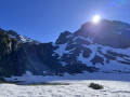
A hike that requires the right kit, as there is still plenty of snow around the Domenon Lakes.
A very popular hike up to Lac Crozet.
A very beautiful hike

Machine-translated

JODIDO
JODIDO
• Edited:

Overall rating : 5 / 5

Date of your route : Aug 23, 2024
Reliability of the description : Not used / Not applicable
Ease of following the route : Not used / Not applicable
Route interest : ★★★★★ Very good
Very busy route : Yes

One of the most beautiful hikes I’ve done in the Belledonne Massif – and I’ve done it twice: 23 August 2020 and 23 August 2024. My second ascent of the Croix de Belledonne, exactly four years to the day after the first time!
As the route description wasn’t available on Visorando at the time, I used the one provided by “AltitudeRando”.
The walk starts from the 4 Chemins car park, which is below the Pré Raymond car park.
A steady climb to Lac du Crozet, then on to the Col de la Pra. It was the day of the “L’Échappée Belle” Ultra Trail, and hundreds of runners overtook me on the climb to Lac du Domènon and the Croix de Belledonne, which I reached in 4 hours 45 minutes, including a 40-minute break. Lots of trail runners were checking in before setting off again, so it was impossible to stay at the summit for very long!
I took a good hour’s break to eat and began the descent at around 1.30 pm. I passed the last few trail runners who were still making their way up to the Croix de Belledonne… It took me 3 hours 30 minutes to reach the 4 Chemins car park.
Over 20 km for the round trip, nearly 1,600 metres of elevation gain, taking about 7 hours 30 minutes of walking and 2 hours’ break for this magnificent hike in the Belledonne Massif…
The ‘Very difficult’ rating seems a bit excessive to me! The length might indeed put some walkers off, but the only part I’d describe as difficult is the steep climb after the two Domènon lakes, before coming out onto a sort of plateau offering a lovely view of the Croix de Belledonne...

Machine-translated

Other walks in the area

For more walks, use our search engine .

The GPS track and description are the property of this route's author. Please do not copy them without permission.