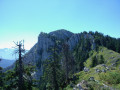
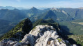
From Saint Pierre-de-Chartreuse to the Arcabas Museum

As you follow the streams, change valleys and visit the church of Saint-Hugues de Chartreuse, decorated by the painter Arcabas.

Details

22866894
Creation:
Last update:
Last review:
  • Walking
    Activity: Walking
  • ↔
    Distance: 5.66 mi
  • ◔
    Average duration: 3h 10 
  • ▲
    Difficulty: Easy

  • ⚐
    Back to start: Yes
  • ↗
    Ascent: + 600 ft
  • ↘
    Descent: - 597 ft

  • ▲
    Highest point: 3,091 ft
  • ▼
    Lowest point: 2,595 ft

Description of the walk

Park in the Place de la Mairie, near the Tourist Office.

(S/E) With your back to the Tourist Office, turn left and walk to the end of the square. Pass to the left of the fountain, then turn right onto the street. Continue along the Sentier des Quatre Chemins.

(1) Cross the departmental road and take the path opposite. You’ll come out onto the Route de la Diat; follow it to the right.

(2) At the start of the left-hand bend, leave the road and turn left onto the Chemin du Couzon, which leads to the junction between the D520b and the D512 at La Diat.
(3) Cross the junction, following the D520b towards Saint-Laurent-du-Pont. Cross the bridge over the Guiers Mort, then turn left onto the Chemin de la Piscine. Continue to the picnic area, turn right and follow the path through the willow trees to the footbridge, where you should turn right again onto a winding path that climbs through the forest (marked with yellow and red signs forthe GRP® Tour de Chartreuse).

(4) Enter the meadow and walk along its right-hand side for about 200 metres until you come to Chamechaude, the highest point in the Chartreuse, and the Saint-Hugues valley. Leave the meadow on the right via the gap in the fence (yellow and red markings). Follow the path to the hamlet of La Martinière.

(5) Take the road on the left called Chemin du Grand Logis, which runs through the hamlet, whilst admiring the Carthusian architecture: stone houses, barns and stables, a pond and a bread oven. Also admire the sculpture by a Peruvian artist by the roadside and the slabs of Le Charmant Som towering above you on the right. At the end of the hamlet, cross the departmental road again and follow it to the left for about 200 metres. Then take the path on the right towards the Ravelle bridge.

(6) Leave the footbridge on your right and cross the bridge to climb back up onto the Flin plateau. At the edge of the meadow, join the path 20 metres further up, which skirts the forest to the left towards the cemetery. Please respect the hay meadows and pastures by staying on the path. Walk along the right-hand side of the cemetery and join the road leading to the Museum of Contemporary Sacred Art, situated 20 metres to the right.

(7) Continue to the right along the village road. Cross the bridge over the Ruisseau de l’Herbetan.

(8) At the right-hand bend, go straight on towards Mollarière, then Gontière.

(9) At Mollard Bellet, go straight on along the road and continue to the bridge over the Ruisseau du Guiers Mort.

(10) Cross the bridge and follow the Route de Perquelin, which leads directly to the Place de la Mairie and the car park (S/E).


Waypoints

  1. S/E : mi 0 - alt. 2,907 ft - Car park
  2. 1 : mi 0.18 - alt. 2,812 ft - La Diat, a crossroads
  3. 2 : mi 0.38 - alt. 2,638 ft - Chemin du - Couzon (cours d'eau) - Affluent du Guier
  4. 3 : mi 0.49 - alt. 2,602 ft - Cross the junction. Towards the bridge over the - Guiers (rivière)
  5. 4 : mi 1.11 - alt. 2,835 ft - Pre
  6. 5 : mi 1.51 - alt. 2,890 ft - Chemin du Grand Logis
  7. 6 : mi 1.93 - alt. 2,769 ft - Ravelle Bridge
  8. 7 : mi 2.36 - alt. 2,900 ft - Arcabas Museum
  9. 8 : mi 2.87 - alt. 2,930 ft - Turn, go straight on
  10. 9 : mi 4.16 - alt. 3,012 ft - Mollard Bellet
  11. 10 : mi 4.94 - alt. 3,015 ft - Bridge
  12. S/E : mi 5.66 - alt. 2,910 ft - Car park

Worth a visit

The Arcabas Museum is situated in the heart of Saint-Hugues Church; do feel free to step inside this unique building.

Reviews and comments

3.2 / 5
Based on 3 reviews

Reliability of the description
3.3 / 5
Ease of following the route
3 / 5
Route interest
3.3 / 5
Les Marmottes
Les Marmottes
• Edited:

Overall rating : 2.3 / 5

Date of your route : Jul 27, 2026
Reliability of the description : ★★★☆☆ Average
Ease of following the route : ★★☆☆☆ Disappointing
Route interest : ★★☆☆☆ Disappointing
Very busy route : No

We were disappointed by this walk for several reasons.
The starting point was very difficult to find. In fact, you have to walk away from the town hall, take the pavement on the left as far as the medical centre, then turn right, walk past a craft shop and the Victoria Hotel, and go down the narrow lane between the buildings to reach the path.
This walk mainly follows a tarmac route, which wasn’t what we were looking for in the beautiful Chartreuse mountains. On the way back, we took a detour to walk along some footpaths.
However, the Arcabas Museum is well worth a visit. The staff gave us a very warm welcome.

Machine-translated

TOIX
TOIX

Overall rating : 4 / 5

Date of your route : Sep 04, 2023
Reliability of the description : ★★★★☆ Good
Ease of following the route : ★★★★☆ Good
Route interest : ★★★★☆ Good
Very busy route : No

The starting point in the village is at the corner of a hotel on the same square, on the left, opposite two benches.

Machine-translated

Coeur de Chartreuse Tourisme

Hello

Thank you for your feedback; we’ll update the description to improve our walk.

Have a lovely day

Laetitia

Machine-translated

RABATEL
RABATEL

Overall rating : 3.3 / 5

Date of your route : Aug 12, 2022
Reliability of the description : ★★★☆☆ Average
Ease of following the route : ★★★☆☆ Average
Route interest : ★★★★☆ Good
Very busy route : Yes

Incorrect directions at the start —go to the end of the square!) Which end? North, south, east or west?
At No. 2 (cross the bridge over Léguer Mort) – the first one or the second one?
? There are two bridges
After that, it’s pretty straightforward


**

Machine-translated

Other walks in the area

For more walks, use our search engine .

The GPS track and description are the property of this route's author. Please do not copy them without permission.