A lovely hike to Som via La Cochette and back via the Arête de Bérard

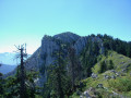
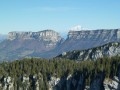
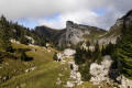
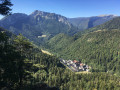
A lovely circular route on a wild slope of the Charmant Som. Following the Combe d’If – an area untouched by human activity – then passing La Rochette, you emerge onto the mountain pasture, where you rejoin a north-south ridge offering a magnificent panorama of Belledonne, Mont Blanc… and everything else! After three hours of solitude, you emerge amongst many walkers who have arrived from the south via the mountain chalet, but the descent down the eastern face, with its limestone slab, quickly restores the charm of this beautiful hike in the Chartreuse!

Details

64192488
Creation:
Last update:
Last review:
  • Walking
    Activity: Walking
  • ↔
    Distance: 9.11 mi
  • ◔
    Average duration: 8h 15 
  • ▲
    Difficulty: Difficult

  • ⚐
    Back to start: Yes
  • ↗
    Ascent: + 4,669 ft
  • ↘
    Descent: - 4,672 ft

  • ▲
    Highest point: 6,112 ft
  • ▼
    Lowest point: 2,523 ft

Description of the walk

Park in the car park situated 300 m from the Pont de Valombre on the road leading from Saint-Laurent-du-Pont to Saint-Pierre-de-Chartreuse, either before or after the Porte de l’Enclos, depending on the direction from which you are approaching. Access to the forest road is then restricted to authorised users.

(S/E) Head due west along this forest track, which winds its way through woodland and meadows, for a pleasant warm-up.

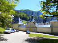
(1) As you go, enjoy a lovely view of the Grande Chartreuse Monastery and La Corerie, then carry on.

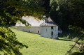
(2) Pass the Habert de Malamille – a beautiful old building – on your right, and carry on along the forest track that branches off to the left. You’ll reach a timber yard (wood storage area) a little further up.

(3) Leave the forest track on your left and head straight ahead to rejoin the path leading towards the Col de la Cochette. The path climbs quite steeply and runs alongside the Combe de l’If on your right, reaching the pass via the final hairpin bends along some attractive stone retaining walls.

(4) Head down the west-facing slope of the pass: watch out for slippery patches and falling rocks for about a hundred metres. Then turn left (south) to climb back up the western slope via the Chemin de la Cochette. After a long traverse due south, rejoin the path that climbs up from the Col de la Charmette.

(5) Follow it, veering left along the stream. At the water intake, continue along this lovely path heading east, then north, which leads to the edge of the Pré Bâtard mountain pasture.

:6:: Begin the traverse across the mountain pasture.

(7) Leave the path and head towards the north-south ridge on your right as you climb: aim for the northern part of the wooded area. In any case, there is a path running along this ridge and you must join it.

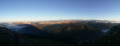
(8) Reaching the ridge offers a magnificent view of the mountain ranges: Belledonne, Oisans, Mont Blanc, etc. Follow this path, which appears and disappears at regular intervals, staying on the western side of the ridge.

(9) At the end of the ridge, join the steeper path coming from the west and follow it to reach the summit via a narrow, somewhat exposed path that requires you to use your hands once or twice.

(10) Once at the summit, begin the descent via the main southern path.

(11) At the paragliding take-off point, head down the path cutting due south to join theGR® du Tour de Chartreuse. Follow thisGR® to the left (north-east).

(12) Pass beneath the eastern rock slab of Le Charmant Som and continue on to Le Small Pass.

(13) Turn left to cross over onto the north-western slope and descend for a few dozen metres. Very soon, turn right at the fork beneath the Arête du Bérard. The section ahead may be dangerous as it is exposed to rockfalls: therefore, avoid periods of heavy rain, thunderstorms or strong winds. Descend along this ridge to reach its end and begin the final section via a series of lovely switchbacks that will lead you back to the forest road where you started. Turn right to reach the car park about a hundred metres further on (S/E).


Waypoints

  1. S/E : mi 0 - alt. 2,533 ft - Car park near the - Guiers (rivière)
  2. 1 : mi 0.92 - alt. 2,953 ft - View of the Grande Chartreuse Monastery
  3. 2 : mi 1.62 - alt. 3,081 ft - Habert de la Malamille
  4. 3 : mi 1.99 - alt. 3,314 ft - Forest car park
  5. 4 : mi 2.54 - alt. 4,072 ft - Col de la Cochette (1250m)
  6. 5 : mi 3.94 - alt. 4,295 ft - Junction at Col de la Charmette. Near a spring and - Fontaine de l'Oursière (Grande Chartreuse)
  7. 6 : mi 4.35 - alt. 4,738 ft - Gate to the mountain pasture
  8. 7 : mi 4.71 - alt. 5,167 ft - Turn right off the path
  9. 8 : mi 4.93 - alt. 5,561 ft - Arrival on the ridge
  10. 9 : mi 5.38 - alt. 5,784 ft - Junction
  11. 10 : mi 5.52 - alt. 6,106 ft - Charmant Som
  12. 11 : mi 5.67 - alt. 5,994 ft - Paragliding take-off
  13. 12 : mi 6.08 - alt. 5,400 ft - Below the eastern slab
  14. 13 : mi 6.55 - alt. 5,007 ft - Small pass
  15. S/E : mi 9.11 - alt. 2,536 ft - Car park near the - Guiers (rivière)

Notes

Avoid in wet or very windy weather, as some sections are exposed to rockfalls (4) and along the Arête de Bérard on the return journey.

An alternative route to avoid this long ridge on the return journey is to descend directly to the bottom of the valley from the small pass and head for Habert de Valombré via the path you took on the way up (2).

I recommend doing this hike in this direction to avoid the long stretch along the forest track on the return journey.

Always be cautious and plan ahead when you're outdoors. Visorando and the author of this route cannot be held responsible for any accidents occurring on this route.

The GR® and PR® markings are the intellectual property of the Fédération Française de Randonnée Pédestre.

Reviews and comments

4.8 / 5
Based on 2 reviews

Reliability of the description
4.5 / 5
Ease of following the route
5 / 5
Route interest
5 / 5
manubruas
manubruas

Thanks for the comment and glad you enjoyed the hike!
Beyond the slide, the descent below the ridge is exposed to rockfalls...
This is the mountains!

Machine-translated

User 26787494
• Edited:

Overall rating : 4.7 / 5

Date of your route : Aug 16, 2025
Reliability of the description : ★★★★☆ Good
Ease of following the route : ★★★★★ Very good
Route interest : ★★★★★ Very good
Very busy route : No

I did this hike in summer, on the weekend of 15 August.
The entire first part of the route was empty; we didn't see anyone. Until the summit, of course
Then on the way down, there were a few more people, but it wasn't crowded either.

Overall, a very good route with very useful explanations. Thank you very much for this hike!

The only downside: be careful at point (4), on the west side of the Col de la Cochette, where the description says "beware of slipping and falling rocks for about a hundred metres". I cannot stress this enough, and I would even say that this is a dangerous section, especially if you are carrying a heavy load (~10kg) on your back. The slope is very steep, the ground is covered with earth, dead leaves and small stones, and in some places there is nothing to hold on to. So it is slippery, please be careful.

Machine-translated

manubruas
manubruas

Thank you!
Glad to have shared!

Machine-translated

Rubicapra
Rubicapra

Overall rating : 5 / 5

Date of your route : Jul 07, 2025
Reliability of the description : ★★★★★ Very good
Ease of following the route : ★★★★★ Very good
Route interest : ★★★★★ Very good
Very busy route : No

A less travelled route to Charmant Som with some magnificent views.

Machine-translated

Other walks in the area

For more walks, use our search engine .

The GPS track and description are the property of this route's author. Please do not copy them without permission.