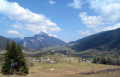
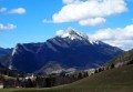
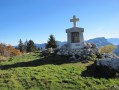
The Charmant Som in a circular pattern from Les Revols

A beautiful circular route away from the beaten track to one of the most beautiful peaks in the Chartreuse.
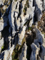
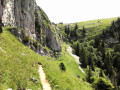
This hike takes you along the spectacular but very passable Chemin des Dalles, which runs along the rock face below the summit.

Details

3267185
Creation:
Last update:
Last review:
  • Walking
    Activity: Walking
  • ↔
    Distance: 6.24 mi
  • ◔
    Average duration: 5h 15 
  • ▲
    Difficulty: Moderate

  • ⚐
    Back to start: Yes
  • ↗
    Ascent: + 2,772 ft
  • ↘
    Descent: - 2,762 ft

  • ▲
    Highest point: 6,115 ft
  • ▼
    Lowest point: 3,494 ft

Photos

Description of the walk

Park at the entrance to the village of Les Revols.

(S/E) Take the wide path that goes around the village, follow the yellow markings and the signs for the summit of Charmant Som. Follow these yellow markings to the summit of Charmant Som.
Reach the Grand Pleynan crossroads.

(1) Turn left and continue the ascent along a pleasant forest path that winds its way up to the small pass.

(2) Turn left. Follow the path that leaves the forest and runs along the ridge through the rocks, known as Les Dalles. Reach the crossroads of a path leading to the summit.

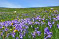
(3) Leave the Chemin des Dalles by turning right to reach the summit through a magnificent meadow, which is full of flowers in spring. You will arrive at the summit of Charmant Som.

(4) Turn around and head towards the chalets, descending through the meadows on the right to avoid the main access road, which can be a bit busy in good weather. Reach the chalets.

(5) Take the path slightly below the road to reach the Oratoire d'Orgeval.

(6) Turn left into the forest via the path that descends rapidly through the woods. The descent is fast and sometimes quite steep, but the forest path remains very pleasant and passable. Join a wide path that follows the riverbed and leads to the hamlet of Les Cottaves.

(7) Turn left onto the small tarmac road and return to the Revols car park (S/E).

Waypoints

  1. S/E : mi 0 - alt. 3,553 ft - Hameau des Revols
  2. 1 : mi 0.66 - alt. 3,707 ft - Le Pleynan
  3. 2 : mi 1.89 - alt. 5,010 ft - Col du Small Pass
  4. 3 : mi 2.58 - alt. 5,692 ft - Chemin des Dalles
  5. 4 : mi 2.97 - alt. 6,083 ft - Summit of Charmant Som
  6. 5 : mi 3.6 - alt. 5,463 ft - The Chalets
  7. 6 : mi 4.18 - alt. 5,387 ft - Oratoire d'Orgeval
  8. 7 : mi 5.63 - alt. 3,556 ft - Les Cottaves
  9. S/E : mi 6.24 - alt. 3,556 ft - Hameau des Revols

Notes

(5) Refreshments available at Chalets de Charmants Som, at the foot of the summit.

Worth a visit

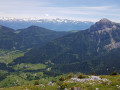
(2) Small Pass: take a few steps to the right to admire the magnificent view to the north and the cliffs, with a superb view of the Grande Chartreuse monastery on the right.

Reviews and comments

4.4 / 5
Based on 18 reviews

Reliability of the description
4.4 / 5
Ease of following the route
4.2 / 5
Route interest
4.8 / 5
User 10236316

Overall rating : 4.3 / 5

Date of your route : Aug 24, 2026
Reliability of the description : ★★★★☆ Good
Ease of following the route : ★★★★☆ Good
Route interest : ★★★★★ Very good
Very busy route : No

A brilliant route up the hill, with lovely woodland and stunning views. There was no one around until the final few metres before the summit (families drive up to the chalet and then only walk for half an hour to the summit).

However, at km 8, even though we were clearly on the track and the path, the path just disappeared. We had to head back down a little way to find another one.

Machine-translated

User 14318985

Overall rating : 4.7 / 5

Date of your route : Aug 09, 2026
Reliability of the description : ★★★★★ Very good
Ease of following the route : ★★★★☆ Good
Route interest : ★★★★★ Very good
Very busy route : No

A lovely walk with views of the other peaks in the Chartreuse range: Chamechaude, Grand Som … Very shaded, so pleasant during a heatwave. No dangerous or particularly vertiginous sections on the ascent. At the summit, a stunning view of the Grande Chartreuse monastery. The descent is very steep, technical and physically demanding; best avoided in wet weather.
Don’t forget to stop off at the mountain farm at the start of the descent to stock up on some delicious cheeses.

Machine-translated

chevalierpaysan
chevalierpaysan

Overall rating : 4 / 5

Date of your route : Aug 09, 2026
Reliability of the description : ★★★★☆ Good
Ease of following the route : ★★★☆☆ Average
Route interest : ★★★★★ Very good
Very busy route : No

A magnificent route, both along the way (forest and rocky outcrops) and at the finish (it’s no coincidence that this Som is called ‘Charmant’). However, I found it much more difficult than indicated, both on the ascent (quite steep rocks) and on the descent (slippery ground in the forest). Furthermore, the signposting is inadequate near the Oratory (don’t hesitate to follow the path well to the right).
In short, a very beautiful hike that’s more ‘technical’ than ‘family-friendly’ – thanks to the author.

Machine-translated

Ober75
Ober75

Overall rating : 5 / 5

Date of your route : Aug 07, 2026
Reliability of the description : ★★★★★ Very good
Ease of following the route : ★★★★★ Very good
Route interest : ★★★★★ Very good
Very busy route : No

Hike done in August, in fine weather. An easy climb on sections 1–3. A little more challenging on sections 2–3 (Chemin des Dalles: hot, no trees; but a breathtaking view). The summit was indeed busy, unlike on previous stages. Sections 6–7 were less strenuous than I’d expected; steep, certainly, but in my view much less challenging than retracing the Chemin des Dalles on the descent. Best avoided, however, in wet weather (it’s really steep) and with children. It’s also possible to head back down via the road, as suggested in one of the reviews.
A very beautiful hike, completed in 4 hours, excluding the lunch break at the summit.

Machine-translated

User 10084642

Overall rating : 5 / 5

Date of your route : Jul 06, 2026
Reliability of the description : ★★★★★ Very good
Ease of following the route : ★★★★★ Very good
Route interest : ★★★★★ Very good
Very busy route : No

A route with few visitors, except at the summit; excellent cheese at the Charmant Som farm 😁

Machine-translated

User 9276112

Overall rating : 4.3 / 5

Date of your route : Jul 27, 2025
Reliability of the description : ★★★★☆ Good
Ease of following the route : ★★★★☆ Good
Route interest : ★★★★★ Very good
Very busy route : No

A beautiful hike from Revols. Greeted by a beautiful view of Chamechaude, the ascent of Charmant Som is well worth the effort through the forest and along the Chemin des Dalles. The walk between the Orgeval oratory and the hamlet of Les Cottaves can be exhausting. The descent is steep and requires stamina and, above all, caution. A very beautiful circuit on the slopes of Charmant Som with its wooded slopes and summer pastures offering spectacular panoramic views of the Chartreuse.

Machine-translated

Chamois38
Chamois38

Overall rating : 4.3 / 5

Date of your route : May 15, 2025
Reliability of the description : ★★★★☆ Good
Ease of following the route : ★★★★☆ Good
Route interest : ★★★★★ Very good
Very busy route : Yes

Departure from Les Revolts, with Visorando, as the foresters have been busy, the path is broken and the signpost is missing. Steady climb through the forest, fairly steep. On leaving the forest, passage through slabs, well-marked path, a little exposed, on a balcony with superb views. Passage at the Auberge du Charmant Som, always a pleasant place to stop for a break. Arduous descent below the Oratory to Les Cottaves, where the first 100 metres in a narrow passage require a little caution (slippery in wet weather) and the rest in the forest but quite steep. This remains a hike for good walkers, well equipped (high-top boots and walking sticks), but so beautiful and varied.

Machine-translated

shapiro
shapiro
• Edited:

Overall rating : 4.3 / 5

Date of your route : May 10, 2025
Reliability of the description : ★★★★☆ Good
Ease of following the route : ★★★★☆ Good
Route interest : ★★★★★ Very good
Very busy route : Yes

A beautiful hike, but not very easy.

Steady climb, not too steep, mostly ((1) – (3)) on a GR (so quite busy). Magnificent views, interesting geology. Summit without difficulty.

Descent (6) – (7): through a beautiful deciduous forest, but very steep and very long. Very tricky in wet weather (but not really dangerous). Follow the yellow markings carefully as the path is not obvious. We didn't meet anyone on this section.

Yellow markings from start to finish. We completed the entire loop in 6 hours, without rushing.

On 9/5/2025, the Charmant Som chalet was not yet open.

Machine-translated

defayet
defayet

Overall rating : 4 / 5

Date of your route : Aug 10, 2024
Reliability of the description : ★★★★☆ Good
Ease of following the route : ★★★★☆ Good
Route interest : ★★★★☆ Good
Very busy route : No

Beautiful hike,
I would not recommend it with young children as the terrain is sometimes difficult with stones and tree roots, and some parts are a bit steep. Most of the route is through woodland.
Personally, I found it a bit long.

Machine-translated

Alex6942
Alex6942
• Edited:

A very beautiful route. The opportunity to stop at the Charmant Som inn for food or drink is much appreciated.
The descent after the oratory is passable with good shoes and walking sticks if there has been no recent rain, and it is very beautiful. However, it is very long and requires great caution. The most "technical" part is quite short. It is not suitable for children.

Machine-translated

maryse14
maryse14

Overall rating : 3.7 / 5

Date of your route : Jul 15, 2023
Reliability of the description : ★★★★☆ Good
Ease of following the route : ★★★★☆ Good
Route interest : ★★★☆☆ Average
Very busy route : No

A very beautiful (strenuous) hike to the oratory, but the 1.5-hour descent through the forest to Les Cottaves is very difficult (roots and sharp limestone pavement), with no respite, which spoils the whole thing! Admittedly, the reviews mentioned this... We wanted to do the circular (more enjoyable than a return trip) and it's the only option, but it was a mistake and I recommend just doing a return trip unless you're looking for pure technicality! However, the road between the chalets and the oratory is very beautiful (1 km), as is the one that leads from Les Cottaves to Les Révols.

Machine-translated

stilla
stilla

Overall rating : 5 / 5

Date of your route : Jun 26, 2023
Reliability of the description : ★★★★★ Very good
Ease of following the route : ★★★★★ Very good
Route interest : ★★★★★ Very good
Very busy route : No

Caution: very difficult descent... otherwise a very beautiful walk...

Machine-translated

geraldinelgl
geraldinelgl

Overall rating : 4 / 5

Date of your route : Aug 20, 2022
Reliability of the description : ★★★★☆ Good
Ease of following the route : ★★★★☆ Good
Route interest : Not used / Not applicable
Very busy route : No

We set off in overcast weather...
Nice route in the forest, but after climbing 500 metres, heavy rain caught up with us... We had to turn back... Too bad we couldn't continue... 2½ hours of walking, completely soaked 🙃
However, it was a pleasant start to the route in the woods in warm weather. Be careful of falls in rainy weather!
Worth doing again. Thank you.

Machine-translated

bebert38
bebert38

Overall rating : 4 / 5

Date of your route : Jul 30, 2022
Reliability of the description : ★★★★☆ Good
Ease of following the route : ★★★☆☆ Average
Route interest : ★★★★★ Very good
Very busy route : No

A superb walk along a varied and shaded path in its first section. Magnificent view at the pass (monastery), then a path at the foot of the cliff with superb unobstructed views. Quite a few people at the summit and at the mountain chalets (chalets accessible by car on Saturdays and during holidays).
To descend from Charmant Som, I took a path on the right on the first flat section to make a circular loop towards the Charmant Som chalet. For the return trip, climb back up towards Charmant Som for about 500 metres, then take a path on the right to join
the path you took on the way up at the climb in the meadow towards Charmant Som to avoid the long descent after the oratory and the road at the end of the route; 10 km, elevation gain 876 m, duration 4½ hours.

Machine-translated

bernardbertignat
bernardbertignat

Overall rating : 4 / 5

Date of your route : Jul 09, 2022
Reliability of the description : ★★★★☆ Good
Ease of following the route : ★★★★☆ Good
Route interest : ★★★★☆ Good
Very busy route : No

Hello,
I went hiking last week. It was quite enjoyable. The view from the summit was beautiful, and there weren't many people.
Just one downside: the descent isn't easy, from the viewpoint to "aux revols", lots of big steps and rocks. In my opinion, it's difficult for "amateur" hikers.
Thanks anyway, I wanted a slightly challenging route, and I found it...

Machine-translated

Other walks in the area

For more walks, use our search engine .

The GPS track and description are the property of this route's author. Please do not copy them without permission.