Country:

 City:
City:



Warning:
?️ Information on how to reach the starting point, as well as details regarding ?♀️ difficulty levels, ? alternative routes and ⚠️ safety precautions, is summarised in the ‘Practical Information ’ and ‘During the Hike’ sections. Any difficult hike requires preparation, and this very difficult hike is no exception.
Signposting:
- ? Yellow by default
- ?⬜️ Red and white on the section between points 7 and 10, then back to point 1 (GR®®738).
- No markings between points 3 and 7, except for a few cairns between points 3 and 4.
Park at the Souille car park.
(S/E) From the hairpin bend at the Souille car park, take the almost level forest track heading south-east (it starts between two other forest tracks, one going downhill, the other uphill). This track rises and falls slightly along the mountainside before turning into a footpath. After turning due south after about 2.5 km, it crosses the junctions leading down towards Le Pleynet and Saint-Mury: continue along the path heading uphill, following the signs for the Refuge Jean Collet or Lac Blanc.
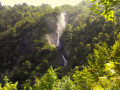
After a section of scree, the path offers a fine view of the Cascades du Boulon before climbing out of the forest and reaching the Vors torrent.
(1) Cross the footbridge (at the start and end of the season, this is dismantled, so you will need to take off your shoes to wade across the icy water of the stream upstream of the path). Do not continue on theGR®®738towards the Refuge Jean Collet, but take the path to the right (south-east) immediately after the torrent; this path is initially marked with a Red Cross and a White Cross and a ‘jJune’ cross. Climb the switchbacks to join the Jean Collet–Lac Blanc route at the top of the Ravin des Excellences at around 1,870 m.
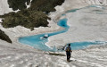
(2) Take this path to the right (south) and follow it to Lac Blanc, which it reaches after a series of wide hairpin bends. Walk along the northern shore (right bank) of the lake, staying on the path that runs above it. This will take you to the eastern end of the lake and the first tributary coming from the Ravin de la Lauzière.
(3) Leave the path and follow the stream bed on the right bank. A faintly cairned track climbs up this bank, passes a narrow gorge and then crosses a field of large boulders, heading towards the Col de Roche Noire. Reach this pass, keeping to the right bank throughout.
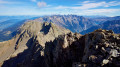
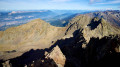
(4) At the pass, stow your walking poles in your rucksack and follow the ridge northwards, keeping to its left or right to avoid the few rocky outcrops. This will take you to the small summit platform. Admire the 360° view (interactive photo).
(5) From the summit, descend back down to the pass.
(4) Continue slightly below the pass and head off along the north-north-west-facing slope towards a clearly visible pass.
(6) At the pass, descend directly down the steep slope, due north. If there is snow, put on your crampons and use your ice axe. Both couloirs are passable, but the one furthest to the east (see track) is easier. Reach the valley floor below and climb a few metres to join theGR®®738at around 2100 m.
(7) Follow theGR®® downwards, generally heading west, until you reach another path near a large boulder, beneath which lies the Habert de la Pierre. Turn right (north) to pass in front of the shelter.
(8) Continue the descent and, after the first hairpin bend, reach another one where there is a junction.
(9) Turn right (north-west) onto theGR®® to descend the hairpin bends and reach the junction leading to the Refuge Jean Collet.
(10) Stay on theGR®® to descend towards the footbridge
(1). After the footbridge, leave theGR®® to return to the original route and rejoin it (S/E).


 Visorando Member
 Difficult


 Moderate