Lac Blanc and Col de la Sitre circular route from La Souille

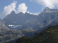
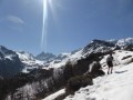
A walk leading to Lac Blanc and then on to the Col de la Sitre through a very open landscape of waterfalls.

Details

n°56789986
Creation:
Last update:
Last review:
  • Walking
    Activity: Walking
  • ↔
    Distance: 7.92 mi
  • ◔
    Average duration: 7h 35 
  • ▲
    Difficulty: Difficult

  • ⚐
    Back to start: Yes
  • ↗
    Ascent: + 4,534 ft
  • ↘
    Descent: - 4,534 ft

  • ▲
    Highest point: 7,238 ft
  • ▼
    Lowest point: 4,432 ft

Photos

Description of the walk

Coming from Grenoble or Chambéry, at Lancey take the Route de Saint-Mury-Monteymond. On reaching Saint-Mury, take the Route du Pré Long. After Pré Long, head up a track that is barely passable by car to the Pré Comté car park (La Souille).

(S/E) Take the path opposite the car park towards Lac Blanc-Jean Collet. Follow this path along the hillside without gaining much altitude.

(1) At a fork in the road, follow the path on the right. Head eastwards and climb steadily. Then head south.

(2) Continue south-east, gaining height, and leave the Sentier de la Gorge on your left.

(3) At the next junction, turn left and take the footbridge over the Vors. On the other side, turn right, leaving theGR® to head off to the left. Climb up the Ravin des Excellences and join a path coming from the north.

(4) Follow this southwards, turning right at the fork. Continue climbing, following a series of hairpin bends. This will take you to Lac Blanc. Panoramic views of the surrounding peaks: the Grand Pic de Belledonne, the Pic Central and the Croix de Belledonne, rising above the remains of the Freydanne Glacier.

(5) Descend via the same route back to the previous junction.

(4) Be sure to veer left to descend the Ravin des Excellences. Cross the footbridge over the Vors once more and you’ll immediately reach the junction you’ve already passed.

(3) Follow theGR®738to the left (red and white markings). Head uphill and pass a shelter (Habert du Mousset) on the left. The slope becomes steeper.

(6) Turn sharply right, continue climbing, head west and reach the Col de la Sitre.

(7) Follow theGR® to the left (south) for a few dozen metres.

(8) Turn sharply right towards the Refuge du Pré du Molard. Head west then north-west, ignoring a track on the right

(9) At the junction, take the path on the right and ignore the other two.

(10) At the next junction, veer right (north) and leave the path leading to Lac de la Grande Sitre on your left. Follow the ridge north-west, then turn right and descend via a series of hairpin bends.

(11) At the fork, keep to the left, leaving the Habert des Sabottes on your right. Continue west-south-west to reach the Refuge du Pré du Molard.

(12) Turn right onto the track leading downwards. Take a hairpin bend to the left. Cut across the next hairpin by taking a path to the right. Join the track again, follow it to the right and you’ll soon reach another hairpin bend.

(13) Leave the track and take a path on the right, descending in hairpin bends. Join the track further down and follow it to the right. At a junction, turn right to reach the Pré du Molard car park straight away.

(14) Leave the car park by taking a path on the right towards Pré Comté: be careful, as this path is difficult to spot at the start. After a left-hand bend, head north and descend to the Souille car park (S/E).


Waypoints

  1. S/E : mi 0 - alt. 4,439 ft - Pré Comté car park – La Souille
  2. 1 : mi 0.52 - alt. 4,514 ft - Fork
  3. 2 : mi 1.74 - alt. 4,948 ft - Junction
  4. 3 : mi 2.11 - alt. 5,479 ft - Crossroads – Vors footbridge
  5. 4 : mi 2.5 - alt. 6,191 ft - Junction
  6. 5 : mi 3.27 - alt. 7,238 ft - Lac Blanc (Belledonne)
  7. 6 : mi 4.85 - alt. 6,037 ft - Turn right
  8. 7 : mi 5.3 - alt. 7,031 ft - Col de la Sitre (1988m)
  9. 8 : mi 5.36 - alt. 6,942 ft - Junction
  10. 9 : mi 5.48 - alt. 6,854 ft - Junction of three paths
  11. 10 : mi 5.57 - alt. 6,831 ft - Crossroads
  12. 11 : mi 6.41 - alt. 5,948 ft - Junction
  13. 12 : mi 6.83 - alt. 5,702 ft - Refuge du Pré du Molard (1740m)
  14. 13 : mi 7.16 - alt. 5,397 ft - Hairpin bend – Start of the path
  15. 14 : mi 7.51 - alt. 4,882 ft - Pré du Molard car park
  16. S/E : mi 7.92 - alt. 4,439 ft - Pré Comté car park – La Souille

Always be cautious and plan ahead when you're outdoors. Visorando and the author of this route cannot be held responsible for any accidents occurring on this route.

The GR® and PR® markings are the intellectual property of the Fédération Française de Randonnée Pédestre.

Reviews and comments

4.9 / 5
Based on 3 reviews

Reliability of the description
5 / 5
Ease of following the route
4.7 / 5
Route interest
5 / 5
Jemzolo
Jemzolo

Overall rating : 5 / 5

Date of your route : Oct 05, 2026
Reliability of the description : ★★★★★ Very good
Ease of following the route : ★★★★★ Very good
Route interest : ★★★★★ Very good
Very busy route : Yes

A lovely walk.
Once you’ve come down from Lac Blanc, the climb up to the Col de la Sitre may seem daunting, but the path is fairly easy going.
Once you reach the pass, do make sure to climb up to the Pointe de la Sitre, a broad, grassy summit that’s very easy to reach – just 5 minutes from the pass – to enjoy a lovely view… and it’s the perfect spot for a snack break!
The return journey from the pass is also quite easy going and very pleasant, with open landscapes and beautiful autumn colours.
Thanks to the author for the route

Machine-translated

User 27639903

Overall rating : 4.7 / 5

Date of your route : Sep 28, 2026
Reliability of the description : ★★★★★ Very good
Ease of following the route : ★★★★☆ Good
Route interest : ★★★★★ Very good
Very busy route : No

A really lovely hike, though quite a challenge. I set off from the car park right at the bottom at around 11.30 am and must have reached Lac Blanc at around 3 pm – which is absolutely stunning. I carried on via the Col de Sistre and set up camp just below the pass, arriving there at around 6.30 pm; finally, I had to walk for a couple of hours the next day. All in all, a brilliant hike, though quite a physical challenge nonetheless.

Machine-translated

sempervivum
sempervivum

Overall rating : 5 / 5

Date of your route : Jun 11, 2026
Reliability of the description : ★★★★★ Very good
Ease of following the route : ★★★★★ Very good
Route interest : ★★★★★ Very good
Very busy route : Yes

A lovely hike, with views of Lac Blanc in the midst of the spring thaw, with the Pic de Belledonne in the background. There are still snowfields to cross in mid-June. I had the pleasure of using the new footbridge currently under construction, as the previous one had been washed away. A few people by the lake, and some trail runners. An original route with a circular loop passing via the Col de Sitre (a challenging climb) and its lake, then on to the refuge. Thanks to Visorandonneur for sharing.

Machine-translated

Other walks in the area

For more walks, use our search engine .

The GPS track and description are the property of this route's author. Please do not copy them without permission.