


 Country:

 City:
City:


Start from the free car park at La Souille: plenty of parking spaces.
(S/E) Take the path furthest to the left, which descends slightly through scrub, in the undergrowth and in the shade. Ignore the paths branching off on either side and continue along the path, which heads south before reaching a viewpoint over the Boulon waterfalls.
(1) Carry on, continuing to climb, until you reach a junction.
(2) Leave the path on your left that descends towards another car park and head for the footbridge over the Vors.
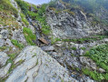
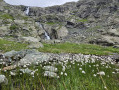
(3) Cross the footbridge and, a few metres further on, turn right at the junction, leaving the path to the Refuge Jean Collet on your left. Continue climbing through the Ravin des Excellences until you reach a small waterfall.
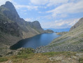
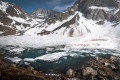
(4) Pass the waterfall carefully, as the ground is slippery, and reach the magnificent setting of Lac Blanc with its turquoise waters.
(5) Walk round the lake on the left and resume the ascent diagonally across the slope facing the Freydane Glacier.
(6) Cross the torrent, paying attention to the small cairns which help you find the best spot – where there are plenty of stones – to avoid getting your feet wet. Continue climbing and keep a close eye on your surroundings, looking out for any chamois in the area. Reach the Col de Freydane.
(7) Carry on until you reach the junction with the return route.
(8) Turn left and reach the foot of a snowfield.
(9) Cross this with extreme caution due to its length, the slope and the risk of slipping. Snow crampons are strongly recommended. Reach the Col de Belledonne.
(10) The final section of the ascent is challenging. As there is no clearly marked path, you must follow the cairns to reach the Croix de Belledonne and its magnificent panoramic views.
(11) Descend back to the junction with the ascent route.
(8) Head left and take care on the steep slope leading to the Grande Pente snowfield.
(12) Cross it carefully: snow crampons are strongly recommended. Then head right, northwards: there are several possible routes. Descend to Lac du Grand Doménon.
(13) You’ll soon reach Lac du Petit Doménon.
(14) Continue descending.
(15) Cross a difficult rocky section: keep well to the right as the path has been diverted due to a rockslide. Continue along the Ruisseau du Doménon until you reach the junction with the path leading to the Refuge de la Pra.
(16) Turn right and make the long descent through the Vallon du Mercier to reach Lac du Crozet.
(17) Turn right to begin the final steep ascent: 300 metres of elevation gain. Don’t forget to look to your right during this climb: there are plenty of marmots on the opposite slope. Pass the tiny Lac du Loup and reach the pass of the same name.
(18) Cross the pass and begin the descent, which is very difficult for the first 200 metres but then becomes gentler.
(19) Leave the Col de la Sitre on your right and continue down, ignoring the Habert de la Sitre on your left. Pass Mont Saint-Mury and arrive at a path junction.
(20) Turn right. Further on, turn left at a 90° angle to pass below the Habert des Sabottes and reach the Refuge du Pré du Mollard.
(21) Continue the descent to reach the Col du Pré du Mollard and its small car park.
(22) Ignore the forest track and turn right onto the path that leads directly back to the starting car park (S/E).


 Visorando Member

 Difficult
 Moderate
