Montrond via the forest track

A short variation on the Montrond route published by the Uriage Tourist Office, which allows you to avoid most of the muddy paths in autumn, winter and spring.
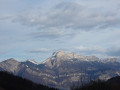
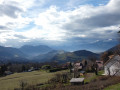
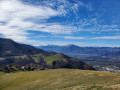
Beautiful views of the Chartreuse and the Vercors around Le Pinet.

Details

4448577
Creation:
Last update:
Last review:
  • Walking
    Activity: Walking
  • ↔
    Distance: 4.30 mi
  • ◔
    Average duration: 2h 45 
  • ▲
    Difficulty: Easy

  • ⚐
    Back to start: Yes
  • ↗
    Ascent: + 889 ft
  • ↘
    Descent: - 883 ft

  • ▲
    Highest point: 3,540 ft
  • ▼
    Lowest point: 2,651 ft

Photos

Description of the walk

Park in the car park in front of the school or, in the event of a Vigipirate security alert, in the car park of the community hall on Route de Montrond.

(S/E) Head right along the Route de Montrond, taking in the scenery.

(1) Turn right onto the tarmac road known as the ‘Chemin des Trois Pommiers’ towards Montrond/Les Seiglières: the yellow signpost is there, though the post has currently been knocked over. After a few houses, the road climbs gently through the forest before reaching the hamlet of Le Replat du Pinet.

At the fountain, carry on straight ahead, then turn left and go round the hairpin bend. Shortly afterwards, the tarmac road gives way to a forest track that climbs towards Les Seiglières.

(2) Pass a small power station and continue climbing gently, ignoring the path on the left which leads to Montrond. Shortly afterwards, you’ll reach a crossroads known as Les Quatre Chemins, although more than four paths actually meet there.

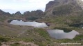
(3) Make sure you take thesecond path, slightly to the left, signposted towards Les Seiglières. You’ll soon reach the large car park at the Auberge des Seiglières. Turn left onto the tarmac forest road, which isn’t cleared of snow in winter and is rarely used, especially if there’s still a light covering of snow. On your right, you’ll see the Étang des Marais Chauds and you’ll also have a lovely view of Chamrousse.

Carry on, ignoring the numerous side paths.

(5) At this point, you can turn right onto a forest track that descends quite steeply towards the Croix de Pinet, which will extend your walk. Otherwise, carry on along the forest track and join the Chemin de Montrond, signposted by the Tourist Office, as it comes in from your right.

(6) A beautiful view of the Chartreuse mountains then opens up before you. Continue down towards Le Pinet on the Montrond road and you’ll soon reach the junction you passed on the way out.

(1) Carry straight on to reach the car park where you started (S/E).

Waypoints

  1. S/E : mi 0 - alt. 2,651 ft - School car park
  2. 1 : mi 0.3 - alt. 2,746 ft - Junction of the circular loop
  3. 2 : mi 1.09 - alt. 3,169 ft - Small power station
  4. 3 : mi 1.38 - alt. 3,389 ft - Les Quatre Chemins, 2nd path on the left
  5. 4 : mi 1.57 - alt. 3,494 ft - Seiglières car park
  6. 5 : mi 2.83 - alt. 3,176 ft - Possible turn-off towards the Croix du Pinet
  7. 6 : mi 3.75 - alt. 2,844 ft - Rejoining the original Montrond path
  8. S/E : mi 4.3 - alt. 2,657 ft - School car park

Notes

There are few muddy sections on this alternative route, but walking boots are recommended.
In winter, you may find snow when you reach the Seiglières car park.

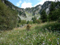
(4) This is where this alternative route differs from the one recommended by the Uriage Tourist Office. If you wish to continue along this signposted path through the forest (particularly pleasant in summer), it starts right next to the sign on the right-hand side of the forest road.

Reviews and comments

4 / 5
Based on 3 reviews

Reliability of the description
4.7 / 5
Ease of following the route
4.7 / 5
Route interest
2.7 / 5
Chrys69
Chrys69

Overall rating : 4 / 5

Date of your route : Sep 29, 2025
Reliability of the description : ★★★★★ Very good
Ease of following the route : ★★★★★ Very good
Route interest : ★★☆☆☆ Disappointing
Very busy route : No

A somewhat disappointing outing compared to the tarmac road covering two-thirds of the hike, which is downhill, so watch out if you have sensitive knees!
Otherwise, beautiful views and an easy hike accessible to all.
Thank you to the hiker who shared this route.

Machine-translated

Simone claude
Simone claude

Overall rating : 3.7 / 5

Date of your route : Feb 24, 2025
Reliability of the description : ★★★★☆ Good
Ease of following the route : ★★★★☆ Good
Route interest : ★★★☆☆ Average
Very busy route : No

Too much driving

Machine-translated

Lioraw
Lioraw

Overall rating : 4.3 / 5

Date of your route : Mar 01, 2021
Reliability of the description : ★★★★★ Very good
Ease of following the route : ★★★★★ Very good
Route interest : ★★★☆☆ Average
Very busy route : No

I ran this route.
Apart from the fact that I was all on my own, I didn’t really enjoy it. A 3.5 km climb, then the same distance back down. It’s quite chilly in the woods, even though it’s 20 degrees outside.
Mostly tarmac on the first part, then gravel on the way down, so it’s not ideal for running.

Machine-translated

Other walks in the area

For more walks, use our search engine .

The GPS track and description are the property of this route's author. Please do not copy them without permission.