Country:

 City:


Start from the Les Massons car park in Saint-Simier. Parking is limited to a few cars.
To get there from Grenoble via the A41, take exit 25, head for Saint-Ismier centre via the D11, then the D11B via the S14 bypass. At the junction with the D1090, go straight on along the Chemin de Rey Buisson. At the very end, turn right onto the Chemin du Charman Som (passing the cemetery). When you reach the square, turn left immediately and continue uphill: Chemin de Ribotière, Chemin du Mas, then turn left onto Chemin de la Tour d’Arces.
You’ll come to a small vineyard; turn right. You’ll arrive at the Masson car park.
(S/E) Head north-west and cross the Ruisseau de Darguil.
(1) At the Fork in the road on the other side, take the path on the right as indicated by the signposting. Head north-north-east uphill.
(2) At the next Fork in the road, carry on straight ahead (ignore the path on the right). Continue climbing, heading north.
(3) At the Écorchiers junction, keep to the right. Then ignore a path branching off to the right and reach the Ruisseau de Larguit.
(4) Ford the stream and continue climbing along the signposted path. Pass an area where the hillside has collapsed.
(5) At the Courbières junction, turn left and tackle a steep, winding ascent. At the end of the switchbacks, head northwards across the slope.
(6) Cross a ravine (intermittent stream) and continue the ascent via a few hairpin bends.
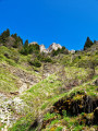
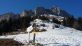
(7) Pass beneath a rocky outcrop and continue climbing. You will then reach the highest point of this walk, La Faîta (altitude 1,425).
(8) Continue north-north-east to quickly reach the Col de la Faîta, situated below.
(9) Follow the same route as on the way up, but in the opposite direction, to return to the Massons car park (S/E).

 Visorando Member
 Moderate

 Tourism professional
 Extremely difficult
 Easy