


 Country:

 City:
City:


(S) Leave the refuge via the path that runs behind it and head up towards the Col de La Pra
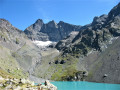
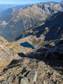
(1) Take in the view of Lac du Crozet (drained in summer 2018 for work on the dam) and begin the climb northwards, following the well-marked path.
300 metres further on, after crossing the stream, you will see the La Pra water distribution structure on your right.
Continue along the left-hand slope, a steep climb over boulders. Well marked with cairns, and featuring some old red and white GR® markings, this section requires a bit of care.
(2) Once you reach Lac du Petit Doménon, continue along the shore; you’ll soon reach Lac du Grand Doménon.
Then, continue along the well-marked path towards the rock that dominates the valley floor.
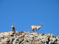
(3) Just under 10 metres high and topped by a post, it is marked on the map at elevation 2474. It is often a gathering place for a herd of ibex.
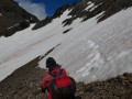
Continue up the valley towards the Col de Freydane (east). A few snowfields still remain in the valley.
Note: A rock stands in the middle of the Col de Freydane; you will cross the pass on the right as you approach via the balcony path that links the Névé de la Grande Pente and the Col de Freydane.
Make your way up the valley, following the tracks and cairns (look carefully) to reach the balcony path visible to the right of the Col de Freydane.
Once you’ve reached the balcony path, continue due north towards the pass. The path, which is not difficult, takes you to the pass.
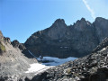
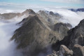
(4) Once you reach the Col de Freydane, walk a good hundred metres further to enjoy the view of the three Belledonne peaks, the Freydane Glacier and Lac Blanc.
Although not shown on the map, the path is well marked and easily visible from above. Nevertheless, the descent is steep. There is now no need to cross the glacier to reach its right bank and the historic path.
Begin the descent with caution. Cairns mark the path.
(5) Cross the stream. You are still on a wide, well-marked path, and you can admire Lac Blanc.
(6) We have chosen to descend to the shore of Lac Blanc (you can continue straight on along the path).
The path then climbs again, though it is not very clearly marked, towards the one we left earlier.
Carry on along this path, which overlooks Lac Blanc, then begin the descent towards the Refuge Jean Collet.
There are no difficulties on this stretch; the refuge is not yet visible. Reach the Ravin des Excellences.
(7) Carry on straight ahead along the high-altitude path and do not descend into the Ravin des Excellences, which leads to the bottom of the valley. 300 metres further on, you will catch sight of the refuge.
You’ll come to a double junction, where the path meets theGR® 738:
- on the left, the long descent to the Col de la Sitre, followed by the climb back up from the valley floor,
- to the right, the path towards the Col de la Mine de Fer.
Head straight ahead and, 10 metres further on, you’ll reach the Refuge Jean Collet (E).
 Lac du Petit Domènon and Lac du Grand Domènon
 Visorando Member
 Moderate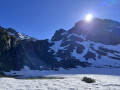
 Very difficult
