Refine your search for walks in Farbus
Farbus walks


 Short route around Farbus
 Visorando Member
 3.29 mi
 +141 ft
 -144 ft
 1h 40
1h 40
 Easy
Easy
 Departure from Farbus (Pas-de-Calais)
A circular route around Farbus, allowing you to explore the village and the surrounding countryside.
Woods and trenches between Thélus and Vimy
7.66 mi
+318 ft
-331 ft
3h 45
 Moderate
Departure from Thélus (Pas-de-Calais)
Moderate
Departure from Thélus (Pas-de-Calais)
Very few roads on this rural route, which becomes quite difficult in wet weather. Although the elevation gain does not seem significant, the Sentier de la Vignette, on the northern edge of Vimy Wood, is very hilly, with steep slopes that will give your calves a good workout. It is, of course, possible to go down into the trenches and wander a little through this labyrinth.
Bois de Berthonval depuis Thélus
 Association / Club / Walk leader
 7.26 mi
+312 ft
-295 ft
3h 35
Moderate
Departure from Thélus (Pas-de-Calais)
7.26 mi
+312 ft
-295 ft
3h 35
Moderate
Departure from Thélus (Pas-de-Calais)
À la decouverte des villages de Thélus et Farbus, en passant par le Bois de Berthonval.
La plaine au Nord d'Arras et le Bois de Vimy
14.48 mi
+663 ft
-673 ft
7h 15
 Difficult
Departure from Thélus (Pas-de-Calais)
Difficult
Departure from Thélus (Pas-de-Calais)
A countryside walk near the town of Arras.Plenty of paths and small roads that are not really suitable for vehicles.
To spice up the route a little, I’ve added a section of the Vignette trail (going in the opposite direction, so there are no signposts) which takes you round the Bois de Vimy. This route is quite challenging but very enjoyable and is now well maintained.
Discover the villages of Thélus, Willerval and Farbus
 8.25 mi
+197 ft
-180 ft
4h 00
Easy
Departure from Thélus (Pas-de-Calais)
8.25 mi
+197 ft
-180 ft
4h 00
Easy
Departure from Thélus (Pas-de-Calais)
You will discover the villages of Thélus, Willerval, and Farbus. These three villages are less than 10 km from Vimy and its Canadian First World War memorial, which is well worth a visit to complement this hike.
Les antennes depuis Vimy
 8.43 mi
+315 ft
-315 ft
4h 10
Moderate
Departure from Vimy (Pas-de-Calais)
8.43 mi
+315 ft
-315 ft
4h 10
Moderate
Departure from Vimy (Pas-de-Calais)
Jolie randonnée qui vous conduira tout d'abord dans la campagne entre Vimy et Farbus, puis vous fera monter à Thelus avant de rejoindre le Mémorial Canadien et la Forêt de Vimy.
Le Champ des Saints depuis Vimy
 7.95 mi
+289 ft
-308 ft
3h 55
Moderate
Departure from Vimy (Pas-de-Calais)
7.95 mi
+289 ft
-308 ft
3h 55
Moderate
Departure from Vimy (Pas-de-Calais)
Venez découvrir les villages de l'Artois par Farbus, Willerval et Vimy. Randonnée entre bois et plaine avec vue sur les terrils de Loos-en-Gohelle
Les Voyettes
 4.53 mi
+164 ft
-167 ft
2h 15
Easy
Departure from Vimy (Pas-de-Calais)
4.53 mi
+164 ft
-167 ft
2h 15
Easy
Departure from Vimy (Pas-de-Calais)
This local hike will introduce you to this charming village in the community of Lens-Lievin. It took in the wounded during the Battle of Lens in August 1648 and many other battles, including the Battle of Vimy Ridge from 9 to 12 April 1917. The ponds around Vimy are former shell holes. Even today, unexploded ordnance can still be found.
The two bridges from Vimy
4.76 mi
+108 ft
-118 ft
2h 15
Easy
Departure from Vimy (Pas-de-Calais)
This short hike around Vimy, between the town, voyettes (small streets in local dialect) and plains, will give you a different perspective on our beautiful region, its heritage and its memory of the Great War
The Goulot from Vimy
 7.34 mi
+295 ft
-299 ft
3h 40
Moderate
Departure from Vimy (Pas-de-Calais)
7.34 mi
+295 ft
-299 ft
3h 40
Moderate
Departure from Vimy (Pas-de-Calais)
This walk, starting from Place de la République, will take you to the Canadian Memorial. It then follows a descent through Thélus and Farbus via the Bois du Goulot. You will pass by the Saint-Ranulphe Fountain. The whole route is on good paths.
The twenty-foot ditch from Bailleul-Sir-Berthoult
8.04 mi
+148 ft
-151 ft
3h 50
Moderate
Departure from Bailleul-Sir-Berthoult (Pas-de-Calais)
This flat hike will take you from Bailleul-sir-Berthout to the villages of Gavrelle and Oppy, along good paths.
Bailleul was completely destroyed during the First World War.
In 1833, Minister Guizot passed a law requiring all municipalities to have a school.
Le sentier du souvenir à Neuville-Saint-Vaast
 8.07 mi
+190 ft
-194 ft
3h 55
Moderate
Departure from Neuville-Saint-Vaast (Pas-de-Calais)
8.07 mi
+190 ft
-194 ft
3h 55
Moderate
Departure from Neuville-Saint-Vaast (Pas-de-Calais)
Cette randonnée vous emmène sur les trace de la Grande Guerre.
The Canadian Vimy Memorial
 3.25 mi
+43 ft
-43 ft
1h 30
Easy
Departure from Givenchy-en-Gohelle (Pas-de-Calais)
3.25 mi
+43 ft
-43 ft
1h 30
Easy
Departure from Givenchy-en-Gohelle (Pas-de-Calais)
This site represents Canada's most impressive memorial to its citizens who fought and gave their lives in the First World War. A strategic high point, offering breathtaking views of the coalfield and Artois hills.
La Vignette depuis Givenchy-en-Gohelle
 6.42 mi
+361 ft
-387 ft
3h 15
Moderate
Departure from Givenchy-en-Gohelle (Pas-de-Calais)
6.42 mi
+361 ft
-387 ft
3h 15
Moderate
Departure from Givenchy-en-Gohelle (Pas-de-Calais)
Cette randonnée est une variante de la Vignette depuis Givenchy-en-Gohelle. Au départ de Givenchy-en-Gohelle, vous montez au Mémorial canadien, avec passage dans la Forêt Domaniale de Vimy, puis vous passez le long des tranchées. Avec un peu de chance, vous pourrez voir les moutons.
Terril de Pinchonvalles, Bois des Bruyères et voyettes de Givenchy
8.65 mi
+535 ft
-509 ft
4h 25
Difficult
Departure from Givenchy-en-Gohelle (Pas-de-Calais)
Peu de goudron sur ce parcours qui permet d'arpenter les chemins du Bois des Bruyères et de faire le tour du Terril de Pinchonvalles.
J'ai dû changer le départ car le beau chemin qui partait à gauche dans la Rue de l'Église est pour le moment (???) en chantier : nouveau lotissement en construction. Malgré toutes les promesses, on continue à bétonner les villes. Prions Ste Godasse et St Croquenot pour que ce chemin réapparaisse après les travaux.
Slag heap 75, Pinchonvalles ridge
 3.39 mi
+272 ft
-272 ft
1h 50
Easy
Departure from Pas-de-Calais
3.39 mi
+272 ft
-272 ft
1h 50
Easy
Departure from Pas-de-Calais
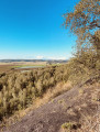
This itinerary takes you to Europe's longest slag heap, which stretches over 2km and fills an ancient valley. You'll enjoy views over the coalfield and the Artois hills. At times, you'll have the impression of walking along a mountain ridge. An entirely wooded terril, it is a reserve for numerous species.
Le Bossu from Avion
6.85 mi
+167 ft
-171 ft
3h 20
Moderate
Departure from Pas-de-Calais
A lovely urban walk that will take you through places you’d never have imagined.
Marc’s walk to Souchez
 4.54 mi
+266 ft
-295 ft
2h 20
Easy
Departure from Souchez (Pas-de-Calais)
4.54 mi
+266 ft
-295 ft
2h 20
Easy
Departure from Souchez (Pas-de-Calais)
This walk takes you in the footsteps of the Great War. At the start, do make sure to visit the memorial dedicated to the Barbot Division and its general, who died for France on 10 May 1915. He is buried in Lorette alongside an ordinary soldier, the ‘stone cross’, the remains of which can be found next to the Crédit Agricole branch in Souchez.
The Vimy Woods
 7.36 mi
+322 ft
-341 ft
3h 40
Moderate
Departure from Souchez (Pas-de-Calais)
7.36 mi
+322 ft
-341 ft
3h 40
Moderate
Departure from Souchez (Pas-de-Calais)
Hike through plains and woods, passing by the Canadian Memorial, which you can visit, as well as the museum and the trenches (by reservation).
Circular around Souchez
7.96 mi
+564 ft
-571 ft
4h 10
Moderate
Departure from Souchez (Pas-de-Calais)
This local hike starting from La Pyramide will take you around Souchez along good paths. You will walk along the Souchez river and then climb up to the site of Notre-Dame de Lorette before returning to the village via Parc Cassin.
The 80 slag heap (Garennes Pont Ampère) along La Souchez
 3.42 mi
+85 ft
-85 ft
1h 40
Easy
Departure from Liévin (Pas-de-Calais)
3.42 mi
+85 ft
-85 ft
1h 40
Easy
Departure from Liévin (Pas-de-Calais)
This route will take you to the top of the flat 80 slag heap (shaped like a plateau), offering a beautiful view of the mining basin and the Artois hills. The rest of the route follows the course of the Souchez river in a green and peaceful setting.
Les talus depuis Souchez
6.01 mi
+338 ft
-341 ft
3h 05
Easy
Departure from Souchez (Pas-de-Calais)
Cette randonnée vous verra découvrir les alentours de Souchez
Les deux terrils à Liévin
6.90 mi
+318 ft
-305 ft
3h 25
Moderate
Departure from Liévin (Pas-de-Calais)
Petite randonnée sur les deux terrils, le premier assez facile mais un peu plus difficile que le Terril de Pinchonval ; entre bois et rivière en passant par le site du Percot et ses étangs.
Les bords de la Souchez à Liévin
 7.59 mi
+207 ft
-184 ft
3h 40
Moderate
Departure from Liévin (Pas-de-Calais)
7.59 mi
+207 ft
-184 ft
3h 40
Moderate
Departure from Liévin (Pas-de-Calais)
Pour cette randonnée vous passerez sur les bords de la Souchez et par le Parc de la Glissoire sur des chemins tranquilles et piste cyclables.
La randonnée de Jean-Michel vers Souchez
 6.41 mi
+571 ft
-568 ft
3h 25
Moderate
Departure from Souchez (Pas-de-Calais)
6.41 mi
+571 ft
-568 ft
3h 25
Moderate
Departure from Souchez (Pas-de-Calais)
Petite randonnée autour de Souchez avec des passages le long de la rivière et des vues sur Notre-Dame-de-Lorette.
At the foot of Pinchonvalles
 7.99 mi
+502 ft
-518 ft
4h 05
Moderate
Departure from Souchez (Pas-de-Calais)
7.99 mi
+502 ft
-518 ft
4h 05
Moderate
Departure from Souchez (Pas-de-Calais)
A walk starting from the Souchez Pyramid, heading towards Angres and its Bois des Bruyères, a haven of peace and tranquillity.
Open-air café and supposed to be from Souchez
 7.08 mi
+466 ft
-472 ft
3h 40
Moderate
Departure from Souchez (Pas-de-Calais)
7.08 mi
+466 ft
-472 ft
3h 40
Moderate
Departure from Souchez (Pas-de-Calais)
A hilly walk that circles the Notre-Dame-de-Lorette site, passing through Aix-Noulette and Ablain-Saint-Nazaire, with some very beautiful views.
Pinchonvalles slag heap via Bois de l'Abime and Givenchy
7.00 mi
+325 ft
-312 ft
3h 30
Moderate
Departure from Liévin (Pas-de-Calais)
This hike between woods and town will take you past the former Fosse n°6 in Liévin, the Bois de l'Abime and Givenchy, before climbing the Terril de Pinchonvalles on good paths. It is a remarkable route for its biodiversity.
The Valley of the Zouaves in Souchez
 4.70 mi
+197 ft
-197 ft
2h 20
Easy
Departure from Souchez (Pas-de-Calais)
4.70 mi
+197 ft
-197 ft
2h 20
Easy
Departure from Souchez (Pas-de-Calais)
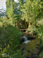
A walk around and through Souchez, taking in Cassin Park and the Bois de Carieul, not forgetting the waterfall.
Val de Souchez et Riaumont
 4.74 mi
+154 ft
-148 ft
2h 20
Easy
Departure from Liévin (Pas-de-Calais)
4.74 mi
+154 ft
-148 ft
2h 20
Easy
Departure from Liévin (Pas-de-Calais)
Belle balade sur les bords de la Souchez et lans e Bois de Riaumont, à faire en famille ou entre amies et amis
In the footsteps of the Great War from Souchez
9.15 mi
+659 ft
-653 ft
4h 45
Moderate
Departure from Souchez (Pas-de-Calais)
This walk, starting from the Pyramide de Souchez, will take you to Notre-Dame-de-Lorette before descending to Ablain-Saint-Nazaire, then through the Bois de Piéton and past the Source du Carency, before joining the GR® 127-145.
Chemin du Marasquay à Athies
8.19 mi
+98 ft
-98 ft
3h 50
Moderate
Departure from Athies (Pas-de-Calais)
Venez découvrir les village de Fampoux, Feuchy et Athies en passant par les bois, étangs et marais.
Les bords de la Scarpe depuis Saint-Laurent-Blangy
 7.62 mi
+43 ft
-39 ft
3h 30
Moderate
Departure from Saint-Laurent-Blangy (Pas-de-Calais)
7.62 mi
+43 ft
-39 ft
3h 30
Moderate
Departure from Saint-Laurent-Blangy (Pas-de-Calais)
Superbe randonnée entre rivière et marais et leur biodiversité
Le Bois de l'Abîme à Givenchy
4.23 mi
+217 ft
-210 ft
2h 10
Easy
Departure from Angres (Pas-de-Calais)
Très belle randonnée dans le Bois de l'Abîme à Givenchy avec sur le parcours une stèle à la mémoire de deux soldats morts lors de la première guerre mondiale.
The walk around the woods from Angres
4.88 mi
+289 ft
-272 ft
2h 30
Easy
Departure from Angres (Pas-de-Calais)
Starting from the pond, this walk takes you around the Bois de l'Abîme via Givenchy-en-Gohelle. After a short climb, the walk takes you back down through the Bois des Bruyères.
From Angres to Pinchonvalles
6.69 mi
+512 ft
-492 ft
3h 30
Moderate
Departure from Angres (Pas-de-Calais)
This walk, starting from the old ponds, will take you to the Pinchonvalles slag heap via the woods of l’Abîme, les Bruyères and Givenchy, all along good paths, before returning via the Ancienne Fosse N°6 in Liévin.
Fampoux from top to bottom
 5.39 mi
+135 ft
-135 ft
2h 35
Easy
Departure from Fampoux (Pas-de-Calais)
5.39 mi
+135 ft
-135 ft
2h 35
Easy
Departure from Fampoux (Pas-de-Calais)
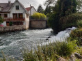
A short walk around Fampoux, best done when the sun isn’t too strong!
The Canadian Vimy Memorial, starting from Souchez
 8.49 mi
+246 ft
-262 ft
4h 05
Moderate
Departure from Souchez (Pas-de-Calais)
8.49 mi
+246 ft
-262 ft
4h 05
Moderate
Departure from Souchez (Pas-de-Calais)
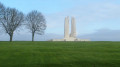
Starting from Place de Souchez, you’ll reach the Canadian memorial.
The Battle of Vimy took place in April 1917.
From the start of the war, the Germans held the heights of Vimy and the entire mining basin.
After numerous unsuccessful attempts by the French and British to recapture these positions, it was the Canadians who drove them back, at the cost of 11,000 dead in their ranks.
The Vimy Ridge, starting from Souchez
 5.47 mi
+469 ft
-443 ft
2h 55
Moderate
Departure from Souchez (Pas-de-Calais)
5.47 mi
+469 ft
-443 ft
2h 55
Moderate
Departure from Souchez (Pas-de-Calais)
This circular route, steeped in history, invites you to discover a historic site paying tribute to the 11,000Canadian soldiers who died during the capture of Vimy Ridge in April 1917. You’ll skirt the Vimy State Forest, where you’ll see the landscape scarred by shelling. The Canadian Vimy Memorial also offers a breathtaking view of the mining basin and the Artois hills
The Souchez embankment circular loop
 5.12 mi
+292 ft
-279 ft
2h 35
Easy
Departure from Souchez (Pas-de-Calais)
5.12 mi
+292 ft
-279 ft
2h 35
Easy
Departure from Souchez (Pas-de-Calais)
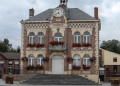
This easy circular route takes you on a discovery of the Carency valley and the commune of Souchez.You will appreciate the role of the embankments, which are essential for agriculture, and admire several buildings that were rebuilt identically after the village of Souchez was completely destroyed during the First World War.
Calm after the storm
16.00 mi
+837 ft
-810 ft
8h 05
Difficult
Departure from Souchez (Pas-de-Calais)
A long route through this countryside that has seen so much suffering.I’ve put together a route using the many signposted trails that criss-cross the area and linked them up with a few lesser-known paths.A long walk with very little flat ground and two steep climbs towards the end. The paths can be difficult in bad weather.
Arras and its monuments
 6.57 mi
+102 ft
-108 ft
3h 05
Moderate
Departure from Arras (Pas-de-Calais)
6.57 mi
+102 ft
-108 ft
3h 05
Moderate
Departure from Arras (Pas-de-Calais)
This walk will introduce you to Arras, starting along the Scarpe river. You will then continue through the town and admire its monuments, from the citadel to the execution wall, the belfry and the main square.
Boutzeu boutzou from Souchez
4.89 mi
+220 ft
-190 ft
2h 25
Easy
Departure from Souchez (Pas-de-Calais)
A short hike for the whole family. Starting from the old station, you will walk to Ablain-Saint-Nazaire, passing in front of the old church and along the Souchez. This hike can be enjoyed in all seasons.
Madame’s walk from Souchez
4.76 mi
+262 ft
-236 ft
2h 25
Easy
Departure from Souchez (Pas-de-Calais)
A pleasant little walk between the plain and the river
Angres and the surrounding area
 4.73 mi
+112 ft
-112 ft
2h 15
Easy
Departure from Angres (Pas-de-Calais)
4.73 mi
+112 ft
-112 ft
2h 15
Easy
Departure from Angres (Pas-de-Calais)
This short walk will take you on a tour of Angres and Liévin, passing through the housing estates of Rollencourt and Le Caumont, not forgetting the indoor sports hall. The walk follows a mix of tarmac and dirt tracks.
The Notre-Dame de Lorette Memorial
13.00 mi
+600 ft
-607 ft
6h 30
Difficult
Departure from Angres (Pas-de-Calais)
The route starts from the town of Angres (in the Lens district), one of the former mining towns of the Hauts-de-France region. After a few hundred metres, you’ll leave the main urban ring road behind to enjoy the plains, valleys and forests of Artois.
You could also start this circular loop from (10) N-D de Lorette, or from (3) Aix-Noulette, or even from (14) Souchez. There are restaurants at each potential starting point. (See the practical information below).
Between wide meadows and a footbridge near Arras
4.42 mi
+69 ft
-69 ft
2h 05
Easy
Departure from Sainte-Catherine (Pas-de-Calais)
A short, semi-urban and leafy walk that will take you across the new footbridge between Arras and Saint-Nicolas.
Mont Saint-Vaast from Sainte-Catherine
 7.53 mi
+164 ft
-164 ft
3h 35
Moderate
Departure from Sainte-Catherine (Pas-de-Calais)
7.53 mi
+164 ft
-164 ft
3h 35
Moderate
Departure from Sainte-Catherine (Pas-de-Calais)
This walk will take you around Sainte-Catherine and its surroundings via Mont Saint-Vaast.
Mont Saint-Vaast via the water tower
7.67 mi
+230 ft
-207 ft
3h 45
Moderate
Departure from Sainte-Catherine (Pas-de-Calais)
This walk, starting from Sainte-Catherine, will take you to Mont Saint-Vaast via the Chemin des Filatiers, not far from the Fontaine des Trois Louches, and extends into the neighbouring communes.
The hill of Notre-Dame-de-Lorette
 6.00 mi
+338 ft
-325 ft
3h 05
Easy
Departure from Souchez (Pas-de-Calais)
6.00 mi
+338 ft
-325 ft
3h 05
Easy
Departure from Souchez (Pas-de-Calais)
This circular walk through a site commemorating the Great War in Artois allows you to discover places that are now set within a remarkably well-cultivated landscape: trees have reclaimed their place, traces of the trenches have been erased by the work of farmers, and the villages have been rebuilt. The cemeteries and memorials, however, serve as a reminder of the appalling tragedy that was the First World War, marked by the deaths of millions of young soldiers and citizens.
The mountains from Angres
 11.31 mi
+666 ft
-659 ft
5h 45
Difficult
Departure from Angres (Pas-de-Calais)
11.31 mi
+666 ft
-659 ft
5h 45
Difficult
Departure from Angres (Pas-de-Calais)
This hike, starting from Angres, will take you through the Bois de l'Abîme and the Bois des Bruyères before descending to Souchez. You will then pass through Prés Molaine and Ablain-St-Nazaire before climbing to Notre-Dame-de-Lorette, the highest point of this hike, before a more leisurely return.
The Bois de l'Abîme and Givenchy from Angres
 7.29 mi
+276 ft
-292 ft
3h 35
Moderate
Departure from Angres (Pas-de-Calais)
7.29 mi
+276 ft
-292 ft
3h 35
Moderate
Departure from Angres (Pas-de-Calais)
This walk, starting from Angres, will take you through the Bois de l’Abîmes and Givenchy, passing over the Pinchonvalles slag heap. Angres was inhabited during the Gallo-Roman period, but is best known for its mining industry (from 1907), with pits No. 6 and No. 6 bis. These were destroyed during the First World War. Mining resumed in 1920, before closing down permanently in 1984.
Lens, Louvre and Stadium
 4.02 mi
+52 ft
-52 ft
1h 55
Easy
Departure from Liévin (Pas-de-Calais)
4.02 mi
+52 ft
-52 ft
1h 55
Easy
Departure from Liévin (Pas-de-Calais)
This short hike starting from Liévin will take you through the gardens of the Louvre-Lens Museum and the Bollaert Delelis Stadium. You will cross the skate park before reaching the Jean Perrin public garden via well-maintained paths.
 The Canadian Vimy Memorial: in the footsteps of the Great War
15.36 mi
+367 ft
-390 ft
2 hrs
Easy
Departure from Arras (Pas-de-Calais)
An easy cycle ride along quiet country lanes, offering the chance to discover major sites – particularly those associated with Canada – from the First World War.
La marche du souvenir depuis Lorette
 7.95 mi
+505 ft
-505 ft
4h 05
Moderate
Departure from Ablain-Saint-Nazaire (Pas-de-Calais)
7.95 mi
+505 ft
-505 ft
4h 05
Moderate
Departure from Ablain-Saint-Nazaire (Pas-de-Calais)
Au départ de lorette, la randonnée passe dans les bois environnant avec de belles descentes et montées.
Circular route around Ablain-Saint-Nazaire
 5.96 mi
+453 ft
-427 ft
3h 10
Easy
Departure from Ablain-Saint-Nazaire (Pas-de-Calais)
5.96 mi
+453 ft
-427 ft
3h 10
Easy
Departure from Ablain-Saint-Nazaire (Pas-de-Calais)
The starting point is the Notre-Dame de Lorette Memorial, built here to pay tribute to the martyrs of the First World War.
You will pass through the beautiful villages of Ablain-Saint-Nazaire and Carency.
In fine weather, you’ll enjoy some panoramic views.
Allow a good two hours walking at a normal pace without stopping.
We hope you enjoy a lovely walk through our beautiful Artois hills.
Lacs et marais depuis Roeux
 8.18 mi
+66 ft
-66 ft
3h 50
Moderate
Departure from Rœux (Pas-de-Calais)
8.18 mi
+66 ft
-66 ft
3h 50
Moderate
Departure from Rœux (Pas-de-Calais)
Boucle par Roeux et Biache-Saint-Vaast, entre lacs et marais.
Set foot on the battlefields of Artois
 8.74 mi
+538 ft
-545 ft
4h 30
Moderate
Departure from Ablain-Saint-Nazaire (Pas-de-Calais)
8.74 mi
+538 ft
-545 ft
4h 30
Moderate
Departure from Ablain-Saint-Nazaire (Pas-de-Calais)
During this walk, you'll enter a beautiful region that was devastated by the 1st World War. More than 180,000 people lost their lives during the Battle of Artois, which began in May-June 1915. This walk starts at the edge of a cemetery where 44,000 soldiers of all origins are buried. Many more are, and will remain, buried forever beneath the beautiful landscapes you're about to cross.
La Rouge Croix from Ablain-Saint-Nazaire
8.38 mi
+492 ft
-469 ft
4h 15
Moderate
Departure from Ablain-Saint-Nazaire (Pas-de-Calais)
This hike will take you through Carency, Mont-Saint-Éloi and its ancient abbey on good paths.A bit of history: in 1727, an oratory dedicated to Notre-Dame-de-Lorette was built on Mont Coquaine, which has now become a necropolis with the Anneau de la Mémoire (Ring of Remembrance).
Par monts et par vaux depuis Ablain-Saint-Nazaire
 8.34 mi
+784 ft
-784 ft
4h 30
Moderate
Departure from Ablain-Saint-Nazaire (Pas-de-Calais)
8.34 mi
+784 ft
-784 ft
4h 30
Moderate
Departure from Ablain-Saint-Nazaire (Pas-de-Calais)
Randonnée très vallonnée avec la montée de Notre-Dame-de-Lorette deux fois, plus quelques raidillons sur le parcours
Saint-Nazaire Path
 3.88 mi
+285 ft
-285 ft
2h 00
Moderate
Departure from Ablain-Saint-Nazaire (Pas-de-Calais)
3.88 mi
+285 ft
-285 ft
2h 00
Moderate
Departure from Ablain-Saint-Nazaire (Pas-de-Calais)
A walk along the Saint-Nazaire, through the wooded hills of Artois and the Lorette War Memorial (1914-1918).
Le Moulin Topart depuis Ablain-Saint-Nazaire
5.00 mi
+269 ft
-269 ft
2h 30
Easy
Departure from Ablain-Saint-Nazaire (Pas-de-Calais)
A lovely walk around Ablain-Saint-Nazaire, passing by the Topart Mill
Route of Childhood Dreams from Ablain-Saint-Nazaire
5.84 mi
+495 ft
-512 ft
3h 05
Easy
Departure from Ablain-Saint-Nazaire (Pas-de-Calais)
This walk was created for the Rêve d'Enfants charity. Starting from Ablain-Saint-Nazaire, you will follow the River Souchez before climbing up to Notre-Dame de Lorette, then descending to Aix-Noulette before tackling the climb up the Route du Roi d'Angleterre. You will then pass beneath the Anneau de la Mémoire before descending back to Ablain, following the Souchez.
The Healer
 9.06 mi
+331 ft
-354 ft
4h 25
Easy
Departure from Ablain-Saint-Nazaire (Pas-de-Calais)
9.06 mi
+331 ft
-354 ft
4h 25
Easy
Departure from Ablain-Saint-Nazaire (Pas-de-Calais)
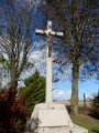
A green route around Ablain Saint-Nazaire, joining Gouy-Servins and stopping on the way back at the tomb of Arsène Lemaire "La Guérisseuse" (The Healer).
Du Bois l'Abbé au Bois de Piéton depuis Carency
 7.58 mi
+394 ft
-394 ft
3h 50
Moderate
Departure from Carency (Pas-de-Calais)
7.58 mi
+394 ft
-394 ft
3h 50
Moderate
Departure from Carency (Pas-de-Calais)
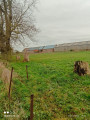
Cette randonnée en forme de huit vous verra passer sur de très bons chemins en passant sous le site de Notre-Dame-de-Lorette et en lisière du Bois l'Abbé.
Boucle par Ablain-Saint-Nazaire depuis Carency
 6.66 mi
+289 ft
-262 ft
3h 20
Moderate
Departure from Carency (Pas-de-Calais)
6.66 mi
+289 ft
-262 ft
3h 20
Moderate
Departure from Carency (Pas-de-Calais)
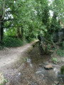
Belle randonnée avec vue sur Notre-Dame-de-Lorette et le Mont Saint-Éloi
Les dorés musis depuis Carency
 6.67 mi
+289 ft
-272 ft
3h 20
Moderate
Departure from Carency (Pas-de-Calais)
6.67 mi
+289 ft
-272 ft
3h 20
Moderate
Departure from Carency (Pas-de-Calais)
De Carency à Ablain-Saint-Nazaire en passant dans la plaine et les bords de la Souchez, avec quelques beaux raidillons
Au fil du Crinchon depuis Arras
 7.72 mi
+138 ft
-138 ft
3h 40
Moderate
Departure from Arras (Pas-de-Calais)
7.72 mi
+138 ft
-138 ft
3h 40
Moderate
Departure from Arras (Pas-de-Calais)
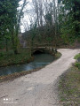
Cette belle randonnée vous entrainera à la citadelle avant de vous inviter à traverser la plaine d'Arras. Au retour vous longerez le Crinchon.
The Carency rollercoaster
4.99 mi
+177 ft
-167 ft
2h 25
Easy
Departure from Carency (Pas-de-Calais)
This walk, starting from Carency, is not particularly difficult and will take you through Villers-au-Bois, between the plain and the woods. Carency was a seigneury until around 1620, then became a barony until 1665, before becoming a marquisate.
Claudine’s walk from Carency
 4.47 mi
+276 ft
-262 ft
2h 20
Easy
Departure from Carency (Pas-de-Calais)
4.47 mi
+276 ft
-262 ft
2h 20
Easy
Departure from Carency (Pas-de-Calais)
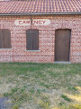
This walk, starting from the old Carency railway station, will take you through the surrounding countryside along good paths, with views of Notre-Dame de Lorette and Mont Saint-Éloi, not to mention the Anneau de la Mémoire.
After the Battle of the Somme
7.32 mi
+253 ft
-230 ft
3h 35
Moderate
Departure from Carency (Pas-de-Calais)
An easy route offering fine views of the memorial sites of the Battle of the Somme during the First World War: Lorette, Mont-Saint-Éloi, Vimy and the ruined church at Ablain.
Les deux gares depuis Carency
 6.83 mi
+184 ft
-184 ft
3h 20
Moderate
Departure from Carency (Pas-de-Calais)
6.83 mi
+184 ft
-184 ft
3h 20
Moderate
Departure from Carency (Pas-de-Calais)
This walk takes you through the countryside around Carency and Villers-au-Bois, and along the old narrow-gauge railway line (the railway line linking Lens to Frévent).
From Carency to Mont-Saint-Éloi via the Bois Poret
 13.80 mi
+843 ft
-837 ft
6h 00
Moderate
Departure from Carency (Pas-de-Calais)
13.80 mi
+843 ft
-837 ft
6h 00
Moderate
Departure from Carency (Pas-de-Calais)
A fairly standard route around Mont-Saint-Éloi (the area is very well signposted), but with three less-travelled sections leading to Villers-au-Bois
It’s a bit winding (’not very logical’, as one of my friends always says), but it allows you to take a few less-travelled paths.
From Lac Bleu to the Plouvain Marsh
3.42 mi
+59 ft
-59 ft
1h 35
Easy
Departure from Rœux (Pas-de-Calais)
A peaceful, shaded walk around Lac Bleu, along the River Scarpe and through the Plouvain Marshes. Easily accessible and suitable for all seasons.
Bois de Mont trail starting from Notre-Dame de Lorette
 5.17 mi
+312 ft
-312 ft
2h 40
Moderate
Departure from Ablain-Saint-Nazaire (Pas-de-Calais)
5.17 mi
+312 ft
-312 ft
2h 40
Moderate
Departure from Ablain-Saint-Nazaire (Pas-de-Calais)
This circular loop, steeped in history, will allow you to experience first-hand the horrors of war, pay tribute to those who saved us, and reflect on the vital need to maintain peace between nations.
Mont Hernu
4.62 mi
+302 ft
-325 ft
2h 25
Easy
Departure from Ablain-Saint-Nazaire (Pas-de-Calais)
This walk pays tribute to Doctor Ablin Hernu, born in 1849 in Divion and died in 1920. He was the seventh of 10 children. His work covered an area stretching from Arras in the south to Aire-sur-la-Lys in the north and from Béthune in the east to Saint-Pol-sur-Ternoise in the west. He was a medical officer during the 1870 war, when he studied medicine. He would walk the 40 km from Divion to Arras.
La randonnée de Daniel et Roger à Aix-Noulettte
 4.39 mi
+210 ft
-230 ft
2h 10
Easy
Departure from Aix-Noulette (Pas-de-Calais)
4.39 mi
+210 ft
-230 ft
2h 10
Easy
Departure from Aix-Noulette (Pas-de-Calais)
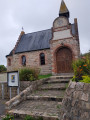
Petite randonnée sympa, à faire en famille, pour vous faire découvrir les alentours d'Aix-Noulette.
From Noulette to Aix via the greenway
 4.00 mi
+154 ft
-171 ft
2h 00
Easy
Departure from Aix-Noulette (Pas-de-Calais)
4.00 mi
+154 ft
-171 ft
2h 00
Easy
Departure from Aix-Noulette (Pas-de-Calais)
This walk is a great way to get some fresh air with the family or friends
The necropolis from Étang du Brochet
 7.11 mi
+220 ft
-207 ft
3h 30
Moderate
Departure from Noyelles-sous-Lens (Pas-de-Calais)
7.11 mi
+220 ft
-207 ft
3h 30
Moderate
Departure from Noyelles-sous-Lens (Pas-de-Calais)
Starting from Étang du Brochet, this hike will take you up Terril du Lavoir, before crossing the Méricourt mining village and then the necropolis of 10 March 1906, a memorial site following the mining disaster that claimed 1,099 lives.
Slag heap 74 and 74A, the highest in Europe
 4.38 mi
+748 ft
-761 ft
2h 40
Moderate
Departure from Loos-en-Gohelle (Pas-de-Calais)
4.38 mi
+748 ft
-761 ft
2h 40
Moderate
Departure from Loos-en-Gohelle (Pas-de-Calais)
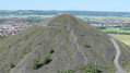
An itinerary that will take you to Europe's king of slag heaps! You'll first discover the former 11/19 base with its headframes and mining buildings currently being converted. You'll also enjoy a few pleasant passages through the undergrowth.
The Necropolis of 10 March 1906 via the canal
7.21 mi
+69 ft
-66 ft
3h 25
Moderate
Departure from Noyelles-sous-Lens (Pas-de-Calais)
This walk, starting from the Étang du Brochet, will take you through the Cité du Moulin and then past the former 6/14 trench at Courrières. You will then arrive at the necropolis and follow the Path of Remembrance.
Marsh trail around Biache - Saint-Vaast
 6.28 mi
+26 ft
-26 ft
2h 55
Easy
Departure from Biache-Saint-Vaast (Pas-de-Calais)
6.28 mi
+26 ft
-26 ft
2h 55
Easy
Departure from Biache-Saint-Vaast (Pas-de-Calais)
Hiking through the marshes of Biache - Saint-Vaast, Plouvain Roeux and Pelves.
La palis à Dainville
7.49 mi
+197 ft
-210 ft
3h 35
Moderate
Departure from Dainville (Pas-de-Calais)
Venez découvrir Dainville et ses voyettes (petits passages entre les maisons) et sentiers battus, ainsi que la Ferme Saint-Jean.
Les trois clochers depuis Achicourt
 7.12 mi
+131 ft
-131 ft
3h 25
Moderate
Departure from Achicourt (Pas-de-Calais)
7.12 mi
+131 ft
-131 ft
3h 25
Moderate
Departure from Achicourt (Pas-de-Calais)
Belle randonnée entre la plaine de l'arrageois et le long du Crinchon avec ses trois clochers achicourt wailly et agny
The Loos cycle route
 5.20 mi
+105 ft
-105 ft
2h 30
Easy
Departure from Loos-en-Gohelle (Pas-de-Calais)
5.20 mi
+105 ft
-105 ft
2h 30
Easy
Departure from Loos-en-Gohelle (Pas-de-Calais)
Starting from the Jardins du Louvre nursery, this round trip will take you along Eurovélo 5, through woods and town, to Saint-Auguste Church, where you will turn back.
 The city centre
 16.26 mi
+197 ft
-207 ft
2.5 hrs
Easy
Departure from Beaurains (Pas-de-Calais)
16.26 mi
+197 ft
-207 ft
2.5 hrs
Easy
Departure from Beaurains (Pas-de-Calais)
A route combining town and countryside, taking you round Arras. A mix of rural landscapes and historic monuments such as the Citadel, the English Memorial and the ramparts.
Caribou from Monchy-le-Preux
 6.37 mi
+108 ft
-105 ft
3h 00
Moderate
Departure from Monchy-le-Preux (Pas-de-Calais)
6.37 mi
+108 ft
-105 ft
3h 00
Moderate
Departure from Monchy-le-Preux (Pas-de-Calais)
This walk will take you through the plains and woods of the Arrageois region, which marked the limit of the German advance during the First World War. The marker can be seen on the RD 939. From Monchy, the Germans bombarded Arras, destroying the belfry.
Le Grand Mont in Loos-en-Gohelle
4.85 mi
+115 ft
-105 ft
2h 20
Easy
Departure from Loos-en-Gohelle (Pas-de-Calais)
A beautiful walk that will allow you to discover Loos-en-Gohelle, passing by the Canadian Memorial, the 11-19 base and other sites.
The Wood Trail in Loos-en-Gohellle
 4.73 mi
+200 ft
-171 ft
2h 20
Easy
Departure from Loos-en-Gohelle (Pas-de-Calais)
4.73 mi
+200 ft
-171 ft
2h 20
Easy
Departure from Loos-en-Gohelle (Pas-de-Calais)
This walk will take you to the foot of Europe’s tallest slag heaps, rising to 187 m and offering a 360° view. The more adventurous can climb the slag heap
La motte depuis Aix-Noulette
 7.06 mi
+400 ft
-400 ft
3h 35
Moderate
Departure from Aix-Noulette (Pas-de-Calais)
7.06 mi
+400 ft
-400 ft
3h 35
Moderate
Departure from Aix-Noulette (Pas-de-Calais)
Très jolie randonnée en passant par le site de Notre-Dame-de-Lorette et le Bois de Marqueffles.
Le château d'eau à Aix-Noulette
 7.60 mi
+299 ft
-299 ft
3h 45
Moderate
Departure from Aix-Noulette (Pas-de-Calais)
7.60 mi
+299 ft
-299 ft
3h 45
Moderate
Departure from Aix-Noulette (Pas-de-Calais)
Randonnée variée autour Aix-Noulette et au pied de Notre-Dame-de-Lorette.
Around Bouvigny-Boyeffles from Aix-Noulette
7.59 mi
+371 ft
-364 ft
3h 50
Moderate
Departure from Aix-Noulette (Pas-de-Calais)
This walk, starting from Aix-Noulette, will take you around Bouvigny-Boyeffles along good, easy paths. You’ll pass through the Bois du Carrenbssé. Before returning to Aix, you’ll be able to admire the oppidum.
The woods around Notre-Dame de Lorette from Aix-Noulette
7.68 mi
+545 ft
-515 ft
4h 00
Moderate
Departure from Aix-Noulette (Pas-de-Calais)
This walk, starting from the community hall next to the town hall, alternates between town and woodland with a lovely climb and a descent that is well worth the detour but should be avoided after heavy rain.
Artois hills and plains
 17.17 mi
+1,109 ft
-1,096 ft
8h 50
Difficult
Departure from Aix-Noulette (Pas-de-Calais)
17.17 mi
+1,109 ft
-1,096 ft
8h 50
Difficult
Departure from Aix-Noulette (Pas-de-Calais)
This route will delight you with its diversity of landscapes. Enjoy some panoramic views and the ancient abbey of Mont Saint-Eloi.
(19) See: practical information.
Notre-Dame de Lorette National Cemetery circular from Aix-Noulette
8.39 mi
+604 ft
-587 ft
4h 25
Moderate
Departure from Aix-Noulette (Pas-de-Calais)
This hike takes you on the trail of the Great War, passing through Aix-Noulette and Notre-Dame-de-Lorette. From 15 May 1915 onwards, numerous battles raged between French and German forces. There were many dead and wounded on both sides.
En passant par Lorette (avec mes croquenots)
 13.84 mi
+755 ft
-755 ft
7h 00
Difficult
Departure from Aix-Noulette (Pas-de-Calais)
13.84 mi
+755 ft
-755 ft
7h 00
Difficult
Departure from Aix-Noulette (Pas-de-Calais)
After a fairly gentle start on wide farm tracks, the walk becomes more challenging as you cross the Bois des Bruyères in Angres, where the paths are very wet.Next comes the climb up Lorette, ending with a double crossing of the equally damp Bois de Noulette.
ROUTE CHANGED IN SEPTEMBER 2025. However, as the trail between points 19 and 20 is very difficult in wet weather, I have noted the end of the old route, from point 15, in the practical information section.
Le tour d'Aix-Noulette par Marqueffles
 5.04 mi
+335 ft
-305 ft
2h 35
Easy
Departure from Aix-Noulette (Pas-de-Calais)
5.04 mi
+335 ft
-305 ft
2h 35
Easy
Departure from Aix-Noulette (Pas-de-Calais)
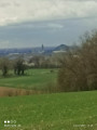
This walk will take you through open countryside and woodland
The footpaths of Aix-Noulette
 4.02 mi
+194 ft
-187 ft
2h 00
Easy
Departure from Aix-Noulette (Pas-de-Calais)
4.02 mi
+194 ft
-187 ft
2h 00
Easy
Departure from Aix-Noulette (Pas-de-Calais)
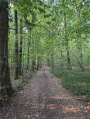
This walk will take you on a tour of Aix-Noulette via the narrow paths (voyettes), then through the woods. Aix-Noulette was a front line during the First World War, defended by the 11th Infantry Brigade and the 24th and 28th Infantry Regiments.
The Bois de Noulette
5.04 mi
+226 ft
-217 ft
2h 30
Easy
Departure from Aix-Noulette (Pas-de-Calais)
A short walk that takes you past some of Aix-Noulette’s little lanes and through the woods. This area is quite busy, especially on Sundays.
Le Bois de Florimond et les terrils
 6.21 mi
+246 ft
-249 ft
3h 05
Easy
Departure from Harnes (Pas-de-Calais)
6.21 mi
+246 ft
-249 ft
3h 05
Easy
Departure from Harnes (Pas-de-Calais)
Belle randonnée à faire en famille entre terrils, étangs et points de vue.
Slag Heaps 83 and 94 - Fouquières marshes
 5.57 mi
+308 ft
-308 ft
2h 50
Easy
Departure from Harnes (Pas-de-Calais)
5.57 mi
+308 ft
-308 ft
2h 50
Easy
Departure from Harnes (Pas-de-Calais)
A route that takes you through the Fouquières marshes. You'll climb the wooded slag heap 83, offering a view of a mysterious artificial valley. You'll then head for slag heap 94 (staircase slag heap), passing the schlamm bins (storage of mining waste) and the Harnes fishing pond. Return along the path that runs alongside the Lens canal.
Slag heaps 58 and 58A
 6.72 mi
+400 ft
-381 ft
3h 25
Moderate
Departure from Grenay (Pas-de-Calais) (Pas-de-Calais)
6.72 mi
+400 ft
-381 ft
3h 25
Moderate
Departure from Grenay (Pas-de-Calais) (Pas-de-Calais)
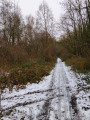
These two large modern slag heaps, part of a vast mining complex, open onto the agricultural plain of Loos-en-Gohelle. Slag heap 58, whose construction began in 1896, is tabular and triangular. Also tabular, T58A is very recent, dating from 1961.
In search of cherries from Grenay
4.58 mi
+190 ft
-200 ft
2h 15
Easy
Departure from Grenay (Pas-de-Calais) (Pas-de-Calais)
This short hike will allow you to discover the village of Grenay in a different light, with its green setting in this vast mining town and its miners' houses. It is one of the 353 sites in the mining basin listed as a UNESCO World Heritage Site.
Sentier des Fumerolles and Bois de Florimond
 3.55 mi
+118 ft
-118 ft
1h 45
Easy
Departure from Harnes (Pas-de-Calais)
3.55 mi
+118 ft
-118 ft
1h 45
Easy
Departure from Harnes (Pas-de-Calais)
Slag heaps are not just piles of dead rocks; reactions are still taking place at their core. As evidence of these reactions, gaseous fumaroles escape from them. To see this for yourself, head to Harnes, starting from the Bois de Florimond, and make your way towards the slag heap. Then follow the signposted path known as the “Sentier des Fumerolles” (Fumaroles Trail), marked by concrete posts, which will take you to Slurry Heap 230. It is a surprising journey offering a wide variety of landscapes and points of interest: views of fumaroles, a viewpoint over the south-east of the mining basin, a viewpoint over the canyon, and more.