Country:
 City:
City:


Parking in Souchez, at Place Kensington near the town hall.
(S/E) Cross the D937 to arrive in front of the Café de la Mairie. Opposite the café, turn left, then immediately right into the small Rue Pierre Curie. As you come out of the bend, you’ll find a small gate on the right (the gate opens at 7 am). Cross the Souchez and take Rue Émile Verdière opposite (the church is on the right). Reach Rue Voltaire and follow it to the right to reach Rue Paul Briquet.
(1) Turn left and ignore the street branching off to the right. Cross the housing estate and, further on at the end of the street, leave the road and take the dirt track opposite. Ignore the path branching off to the right and head uphill towards the motorway. There, the track turns right and descends to arrive near a pumping station. Continue straight on for another fifty metres or so (towards the military cemetery).
(2) At the left-hand bend, don’t miss the path branching off to the right just after the pumping station (a variant of the GR®127). Cross a stream and you’ll reach a junction. Turn left onto Rue Victor Hugo. You’ll then be in the Vallée des Zouaves for about 2 km.
Ignore the paths branching off to the right and you’ll arrive near a military cemetery on your right.
(3) Continue straight on for a further 400 m or so until you reach the motorway. Turn right to reach a T-junction.
(4) Turn right and then immediately left to join the D937. Follow it on the left for a few dozen metres (take extreme care) and turn right onto a footpath. Continue to asecond T-junction.
(5) Turn left onto a wider track. About 200 metres further on, leave this wide track and take the grassy path opposite. Join the D937 and cross it to take the path opposite. Ignore the path on the right and continue to a T-junction.
(6) Turn right towards Neuville-Saint-Vaast. At the T-junction, turn right to reach a crossroads. Then turn left to join Rue du Carlin opposite a farm.
(7) Then, opposite (slightly to the right), take the lovely little lane between the walls of two houses. Join Rue du 8 Mai and follow it to the right. Pass a junction and reach the start of a path (on the left).
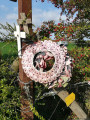
(8) At the wayside cross, turn left, then immediately right to follow the Sentier du Souvenir (follow the signposts for a short while). A long, straight path crosses the hamlet known as “Croupil” and joins the D49E1 near a monument on the left.
(9) Turn right onto the grassy path that runs alongside the departmental road. Turn sharply right, ignoring the path that branches off to the left, and reach a crossroads. Take a sharp left-hand bend and walk alongside the German cemetery (it’s easier to climb the embankment to cross the cemetery, heading for the house by the D937) to reach the D937. Follow it for a hundred metres to the right, passing in front of the Maison Blanche.
(10) Take the first track on the left. It very quickly loses its surface and reaches a T-junction. Turn right and join the D55.
(11) Leave the signposted path to the left, follow the road with care for about 200 m and turn right onto the first track. It turns left and becomes a path that is often difficult to follow. Ignore the path on the right and continue to a T-junction. Turn right and keep heading in the same direction (north-north-west) for about 3 km. Walk past the horse farm and reach the junction with the GR®127 and GR®145.
(12) Go straight on, then follow the edge of the Bois l’Abbé (often a difficult track) until you reach a track coming from the left.
(13) Carry on straight ahead. Ignore the path branching off to the right and continue north-west along the GR®127 and GR®145 towards Carency and its water tower. Ignore a turn-off to the left and reach the water tower. At the three-way junction, turn right and arrive at a T-junction. Head straight ahead across the grass to join the D58.
(14) Cross the road and follow it to the right. A little further on, a small flight of steps on the left leads to Rue Roger Salengro. Follow it to the left. Turn right into the first street, Rue Joliot-Curie. A little further on, turn left to reach a T-junction. Follow Rue du Moulin to the left. As you come out of a slight right-hand bend, look out for the entrance to a footpath on the right.
(15) Follow this path (signposted). A short climb takes you up onto the plateau (view towards Ablain and Notre-Dame-de-Lorette). Ignore the paths branching off to the left and right and head back down to the junction with the D57.
(16) Head straight ahead and continue until you reach the footbridge crossing the Saint-Nazaire. Turn right onto this lovely path alongside the stream. You’ll come to a gate.
(17) Turn left (off the GR®) onto the lovely path – which can be very tricky in wet weather – that climbs (a nice little climb!) up the Cense valley. Join the main path through the Bois de Mont.
(18) Turn right onto the GR® and you’ll find yourself opposite the Lorette necropolis. Keep to the right of the cemetery and you’ll reach the signposted arrows just before the Anneau de la Mémoire.
(19) Turn right onto this lovely, well-maintained downhill path. Just before reaching the small road – the ‘Voie Blanche’, popular with cyclists – take the path on the left (off the GR®). Further on, it turns right and reaches a T-junction near the ruined church of Ablain.
.(20) Join the GR®127 (alternative route) which leads back to Souchez. Follow it to the left. Walk to the end of Rue de Lens, where you’ll find an information sign. Continue along a well-maintained path, ignoring the one branching off to the right. Shortly after passing under the power line, turn right towards the housing estate. Keep going in the same direction, first along Rue du Chemin Vert, then into Rue Rice Oxley.
Finally, reach the D57 and follow it to the left to quickly reach the car park (S/E).

 Visorando Member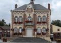
 Easy
Easy 

 Moderate
 Association / Club / Walk leader