Country:

 City:
City:


Start from the car park at the junction of Rue de la Bruyère and Rue Uriane Sorriaux
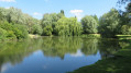
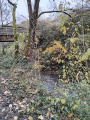
(S/E) Leave the car park by going down the embankment and cutting across the grass to reach the Souchez.
(1) Take the path on the right and follow the river on your left. Carry straight on until you reach Rue du Percot.
(2) First turn left then right to rejoin the path, this time with the Souchez on your right. Continue straight on until you reach a flight of steps near the sports centre.
(3) Turn right, go under the bandstand and join Rue Henri Darras. Walk about thirty metres to the right, then cross the street to take a path on the left. Keep to the right at the nearby three-way junction, then turn right again to follow the bank of the pond.
(4) Keep to the right. At the end, turn left to cross the small car park, then left again to cross over to the other bank of the Souchez. Carry on straight ahead, turn right at the junction to join the cycle path.
(5) Follow it to the left, cross Rue Henri Darras and carry on straight ahead until you reach the next street, Rue du Perçot.
(6) Carry on to the right, taking the path through the Parc de l’Oiselet. Walk straight through the park and, at the end, turn left opposite the Résidence du Sénégal to reach a roundabout.
(7) Turn right, ignore Rue du Premier Mai on your left and take the next street, Allée Henri Becquerel. Follow it to the end, continue along the path to join Rue Albert Einstein and emerge onto Rue Jean Perrin.
(8) Turn left, then right, to follow Rue du Premier Mai until you reach the first junction.
(9) Continue straight on until you reach Rue Thiers.
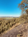
(10) Follow it to the left, then turn into the first street on the right. Take the path immediately on the right to enter the woodland. Turn right again at the first junction, pass the Notre-Dame de Riaumont Chapel on your right and continue straight on until you reach a gentle incline and arrive at the top of the Bois de Riaumont hill.
(11) Then turn right and follow the second path on the right to reach a flight of steps.
(12) Go down the steps, then at the bottom, take a quick first turn right then left to join Rue Henri Dernoncourt. Return to the junction you passed earlier.
(9) This time, keep straight on opposite Rue Nicolas Boileau, continuing along Rue Fabre d’Églantine to number 39. Then leave the street and take a path on the left, cross the Souchez and head for the car park (S/E).
 Association / Club / Walk leader
 Moderate
 Visorando Member