Bois de Berthonval depuis Thélus

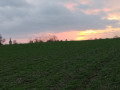
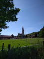
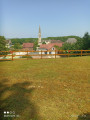
À la decouverte des villages de Thélus et Farbus, en passant par le Bois de Berthonval.

Details

62669571
Creation:
Last update:
Last review:
  • Walking
    Activity: Walking
  • ↔
    Distance: 7.26 mi
  • ◔
    Average duration: 3h 35 
  • ▲
    Difficulty: Moderate

  • ⚐
    Back to start: Yes
  • ↗
    Ascent: + 312 ft
  • ↘
    Descent: - 295 ft

  • ▲
    Highest point: 459 ft
  • ▼
    Lowest point: 236 ft
  • ⚐ Country: France
  • ⚐ City: Thélus (62580)
  • ⚑
    Start/End: N 50.354489° / E 2.801246°
  • ❏
    IGN map(s): Ref. 2406E
  • Hour-by-hour weather

Photos

Description of the walk

Start from Place du Maréchal Leclerc, in Thélus.

(S/E) With your back to the square, take Rue de Bailleul opposite, heading towards “La Gohelle”. Stay on this road at the roundabout, then carry on until the next street on the right.

(1) Turn right, then carry on straight along this path until you reach the Arides crossroads.

(2) Turn left, then left at the end, and take the first right, until you reach a Fork in the road.

(3) Turn left and stay on this path, ignoring the paths to the right and left, until you reach the next crossroads.

(4) Keep to the left and, at the end, you’ll reach the road.

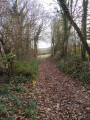
(5) Turn left, then take the path immediately on the right and follow it, staying on thePR®® route. At Les Crocs, continue to the left, pass through the Bois de Berthonval, and head towards Rue du 19 mars 1962.

(6) Keep to the right and head down towards the level crossing.

(7) Just before the level crossing, turn left onto Rue de la Gare and carry on straight ahead until you reach Chemin des Marlisseurs.

(8) Turn left onto the path, then carry on straight ahead until you reach the stop sign at the junction with Rue de la République.

(9) Cross the road – take care – and take Rue de la Libération, continuing straight on until the end of the street, then the end of the path, at a T-junction.

(10) Turn right, then right again at the end, until you reach the Bois du Goulot.

(11) Continue to the left and go straight on to reach Place du Maréchal Leclerc (S/E).

Waypoints

  1. S/E : mi 0 - alt. 404 ft - Place du Maréchal Leclerc
  2. 1 : mi 0.29 - alt. 404 ft - Street on the right
  3. 2 : mi 0.99 - alt. 348 ft - Les Arides
  4. 3 : mi 2.03 - alt. 371 ft - Fork
  5. 4 : mi 2.8 - alt. 285 ft - Crossroads
  6. 5 : mi 3.35 - alt. 276 ft - Route
  7. 6 : mi 4.44 - alt. 325 ft - Rue du 19 mars 1962
  8. 7 : mi 4.77 - alt. 253 ft - Level crossing
  9. 8 : mi 5.23 - alt. 236 ft - Chemin des Marlisseurs
  10. 9 : mi 5.65 - alt. 295 ft - Junction of Rue de la République and Rue de la Libération
  11. 10 : mi 6.02 - alt. 410 ft - T-junction
  12. 11 : mi 6.62 - alt. 423 ft - Bois du Goulot
  13. S/E : mi 7.26 - alt. 404 ft - Place du Maréchal Leclerc

Notes

Pas de point d'eau.

Worth a visit

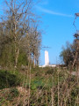
Église de Thélus et, à environ 5 km, mémorial canadien de Vimy.

Always be cautious and plan ahead when you're outdoors. Visorando and the author of this route cannot be held responsible for any accidents occurring on this route.

The GR® and PR® markings are the intellectual property of the Fédération Française de Randonnée Pédestre.

Other walks in the area

For more walks, use our search engine .

The GPS track and description are the property of this route's author. Please do not copy them without permission.