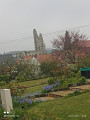
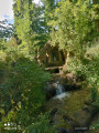
Open-air café and supposed to be from Souchez

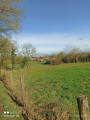
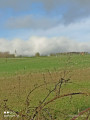
A hilly walk that circles the Notre-Dame-de-Lorette site, passing through Aix-Noulette and Ablain-Saint-Nazaire, with some very beautiful views.

Details

69196441
Creation:
Last update:
Last review:
  • Walking
    Activity: Walking
  • ↔
    Distance: 7.08 mi
  • ◔
    Average duration: 3h 40 
  • ▲
    Difficulty: Moderate

  • ⚐
    Back to start: Yes
  • ↗
    Ascent: + 466 ft
  • ↘
    Descent: - 472 ft

  • ▲
    Highest point: 604 ft
  • ▼
    Lowest point: 243 ft

Photos

Description of the walk

Start from the car park by the pyramid, Rue Carnot.

(S/E) Leave the car park on the left and walk down Rue Carnot, passing two junctions. At the bottom, cut diagonally across the town hall car park.

(1) Turn left onto Rue Peri-Brossolette and continue straight on until you reach the last houses.

(2) Cross the road and take the path leading uphill opposite. At the top, you’ll come to the GR® trail.

(3) First turn right then left. At the Y-junction, turn right and carry on straight ahead until you reach the footpath.

(4) Turn right, then cross the D58E3 with care to take the path on the left at the junction. Continue to the Chemin du Roi d’Angleterre.

(5) Turn left, then take the first right until you reach a Fork in the road.

(6) Turn left onto Chemin des Coussinettes, then, at the junction with another street, turn left onto Chemin des Vingt and continue straight on until you reach Carrefour de la Couture.

(7) Carry on straight ahead until you reach the top of a hill and come to a Fork in the road.

(8) First turn right then left, and carry on straight ahead. At the junction, turn left and carry on straight ahead until you reach the sports grounds.

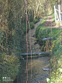
(9) Turn onto the path on the right and keep left at the Y-junction, then first turn right then left to follow the banks of the Souchez as far as Rue du 8 Mai.

(10) First turn right then left and stay on the banks of the Souchez. Cross a street and, at the end of the banks, turn left and cut diagonally across the Place de la Vieille Église.

(11) Turn left, then right onto Rue de Lens and carry on straight ahead until you reach the junction from the outward leg.

(3) Keep going straight on until you reach Rue du Chemin Vert.

(12) Turn right, then carry on straight ahead, cutting across a street. Join it again further on and follow it to the end. At the bottom, turn left, then cross the road and cut diagonally across the square and its car park.

(1) Walk up Rue Carnot to the car park (S/E).

Waypoints

  1. S/E : mi 0 - alt. 305 ft - Pyramid car park
  2. 1 : mi 0.39 - alt. 243 ft - Town hall car park near the - Sochez (rivière) - Canal de Lens
  3. 2 : mi 0.71 - alt. 253 ft - Last houses, uphill path
  4. 3 : mi 1.03 - alt. 344 ft - GR junction
  5. 4 : mi 1.81 - alt. 407 ft - D58E3
  6. 5 : mi 2.55 - alt. 328 ft - Chemin du Roi d’Angleterre
  7. 6 : mi 3.01 - alt. 354 ft - Y-junction
  8. 7 : mi 3.57 - alt. 384 ft - La Couture. Near the - Cimetière militaire britanique (Aix-Noulette)
  9. 8 : mi 4.24 - alt. 591 ft - Fork in the road at the top of the hill. Near the - Cimetière National de Notre-Dame de Lorette
  10. 9 : mi 4.96 - alt. 331 ft - Sports grounds
  11. 10 : mi 5.22 - alt. 272 ft - Rue du 8 Mai
  12. 11 : mi 5.47 - alt. 279 ft - Old Church Square
  13. 12 : mi 6.22 - alt. 318 ft - Rue du Chemin Vert
  14. S/E : mi 7.08 - alt. 305 ft - Pyramid car park

Notes

No water point

Worth a visit

Always be cautious and plan ahead when you're outdoors. Visorando and the author of this route cannot be held responsible for any accidents occurring on this route.

The GR® and PR® markings are the intellectual property of the Fédération Française de Randonnée Pédestre.

Reviews and comments

4.7 / 5
Based on 1 review

Reliability of the description
5 / 5
Ease of following the route
4 / 5
Route interest
5 / 5
PATRICK NOTTE
PATRICK NOTTE

Overall rating : 4.7 / 5

Date of your route : May 22, 2025
Reliability of the description : ★★★★★ Very good
Ease of following the route : ★★★★☆ Good
Route interest : ★★★★★ Very good
Very busy route : No

We really enjoyed this hike – it was varied and challenging.

Wattrelos Hikers’ Association

Machine-translated

Other walks in the area

For more walks, use our search engine .

The GPS track and description are the property of this route's author. Please do not copy them without permission.