Country:

 City:
City:


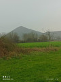
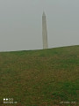
Start at the Canadian Memorial car park, Rue Faidherbe
(S/E) With your back to the street, take the path opposite uphill. At the top, turn right to reach Rue du Général de Gaulle at the end, then turn left to reach a Fork in the road.
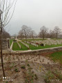
(1) Take the path on the left and continue straight ahead, then walk alongside the British cemetery on your right. Cross Rue Roger Salengro (at the pedestrian crossing) and head straight across to reach a Fork in the road.
(2) Follow the path to the right and cross the pasture diagonally to reach Rue François Couperin. Take this street, then turn right onto Rue Maurice Ravel, then take the footpath on the left just after number 50.
(3) Stay on this path, then turn left again and walk alongside the stadium to reach Rue Mirabeau; turn left onto this street and follow it until you reach Rue Thiers.
(4) Turn left onto Rue Thiers and, at the roundabout, cross Route de Béthune at the pedestrian crossing on the right. Take Rue Léon Blum, then turn right onto Chemin de la Voie du Bois and follow it to the end.
(5) Turn left and follow the path to the end.
(6) Follow the path uphill to the right, then at the crossroads take the grassy path opposite; before you reach the woods, head back up the red-marked path on the right and follow it to the left. Pass a tarmacoured uphill path on your right.
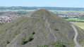
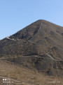
(7) Just after this, take the path on the right, then further on turn left to walk along the foot of the slag heap. At the end, turn right and continue straight on until you reach a junction.
(8) Turn left onto the red path, enter the woodland and reach the exit by crossing the footbridge over a road (Rue Léon Blum) and the A21 (Rocade Minière).
(9) First turn right then left, and continue along this path until you reach Veloroute 5 at the end, which you should follow to the left. Cross the Route de Béthune (D943) and then Rue Roger Salengro to reach a Fork in the road.
(10) Leave Cycle Route 5 by taking the path on the left. At the next fork, take the path on the left again, then turn left once more and continue straight on, running alongside the motorway.
(11) At the end, go down the steps and turn left under the ring road to reach the car park by following Rue Louis Faidherbe (S/E).
 Association / Club / Walk leader
 Moderate
  Visorando Member