Country:

 City:
City:


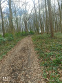
Start from the car park, Rue des Lombards.
(S/E) With your back to the church, head towards Rue des Lombards opposite and first turn left then right to reach Rue de Béthune.
(1) Turn right, cross the street and turn left onto Chemin de Sains. Continue straight on to the end of the street to reach a crossroads.
(2) Head up to the left; at the next junction, first turn right then left and carry on straight ahead until you reach the D165.
(3) Cross it carefully, and head straight ahead onto Rue des Blattiers. Take the first left, onto Rue Curie, to reach the care home.
(4) First turn right then left, and carry on straight ahead. At the end, stay on the path on the left; at the Y-junction, turn left and you’ll come to a Fork in the road at the edge of the forest.
(5) Head down to the left and carry on straight ahead to the car park.
(6) At this point, turn right onto the ‘Chemin derrière les Bois’ and follow it to the end.
(7) Turn left until you reach a bend, turn left there and carry on straight ahead until you reach the houses.
(8) Carry on along the path opposite; at the end, follow Rue Notre-Dame de Lorette and turn left. Cross Rue du Bois and take the path opposite until you reach Rue René Delsaut.
(9) Turn right onto this street, do the same again at the end and, opposite 21–23 Rue Froide, take the path on the left until you reach a crossroads.
(10) Take the path on the left again; at the end, turn right, then immediately left to reach a bend.
(11) Take the path on the right, then turn left to reach the Town Hall, cross Rue de Béthune and head for the car park (S/E).
 Association / Club / Walk leader

 Visorando Member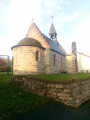
 Difficult
  Moderate