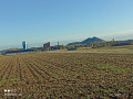
The Bois de Noulette

A short walk that takes you past some of Aix-Noulette’s little lanes and through the woods. This area is quite busy, especially on Sundays.

Details

45954304
Creation:
Last update:
Last review:
  • Walking
    Activity: Walking
  • ↔
    Distance: 5.04 mi
  • ◔
    Average duration: 2h 30 
  • ▲
    Difficulty: Easy

  • ⚐
    Back to start: Yes
  • ↗
    Ascent: + 226 ft
  • ↘
    Descent: - 217 ft

  • ▲
    Highest point: 420 ft
  • ▼
    Lowest point: 226 ft

Description of the walk

Park at the side of the D937, at the entrance to Aix-Noulette on the Sains-en-Gohelle side (you can also park in the large car park before the church).

(S/E) Head towards the centre along the D937.

(1) Just before the church, turn right onto Rue des Marronniers. After about a hundred metres, turn left.

(2) After about fifty metres, turn right into Impasse Piltepois. After a few bends, you’ll reach a grassy square. Carry on along the narrow lane that branches off to the right and eventually joins Rue Froide.
Follow it to the left until you reach a T-junction. Turn left, then immediately turn right onto Rue René Lantoine and follow it for about sixty metres.

(3) Turn right into Grande Ruelle and you’ll reach a junction by the school.

(4) Then turn left onto a well-maintained path (gate). Continue straight on, skirting the sports ground. At the end, turn right, then immediately left to cross the woodland. On leaving the woodland, turn left onto Allée des Jonquilles and continue to a T-junction.

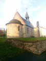
(5) Turn right onto Rue de la Chapelle. Follow this street, which passes a goat farm, a honey farm and the chapel (of course), until you reach the edge of a small wood.

(6) Carry on straight ahead through this small woodland until you reach a T-junction.

(7) Turn right and, about 200 metres further on, turn right again at the edge of the woods. You are now on the cycle route, where tarmac has replaced the dirt track: it’s hard to call this a ‘greenway’ then!
Ignore a path on the right and continue to the junction with Rue du Marois.

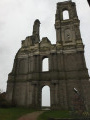
(8) Turn left. If you take the street opposite and turn left at the very end, you can visit the castle: a short detour of about 300 m. The cycle route runs alongside the woods.

(9) After about 500 m, turn right towards the military cemetery. You can, of course, make a round trip to the cemetery for another short detour. The path turns right at a 90° angle to come out opposite a lane leading into the woods.

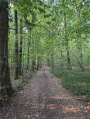
(10) Do not take this path, but head left instead. About 150 metres further on, take the path on the right to cross the Bois de Noulette. Leave the woods (gate) and continue straight on along Rue du Bois. Ignore the street on the left.

(11) About 200 metres further on, take the small lane branching off to the left. At the very end, turn right onto Rue René Delsaut. At the T-junction, turn left to reach a crossroads.

(12) Carry on straight ahead along Rue de Boyeffles, walk past the malt house, and leave the street to take the path on the right. Ignore the alleyway branching off to the left and continue along the path which, after a few bends, eventually leads to a small street (Chemin de Sains). Turn right to join the D343 and return to the starting point (S/E).

Waypoints

  1. S/E : mi 0 - alt. 226 ft - Entrance to Aix-Noulette on the Sains-en-Gohelle side
  2. 1 : mi 0.16 - alt. 230 ft - Rue des Marronniers on the right
  3. 2 : mi 0.25 - alt. 233 ft - Impasse Piltepois on the right
  4. 3 : mi 0.54 - alt. 253 ft - Grande Ruelle on the right
  5. 4 : mi 0.66 - alt. 279 ft - Path on the left (gate)
  6. 5 : mi 1.08 - alt. 318 ft - Rue de la Chapelle on the right
  7. 6 : mi 1.78 - alt. 325 ft - Edge of the woods
  8. 7 : mi 2.12 - alt. 328 ft - T-junction. Near the - Cimetière National de Notre-Dame de Lorette
  9. 8 : mi 2.81 - alt. 328 ft - Junction: turn left
  10. 9 : mi 3.15 - alt. 384 ft - Cycle route to the right - Cimetière militaire britanique (Aix-Noulette)
  11. 10 : mi 3.71 - alt. 417 ft - Turn left at the fork
  12. 11 : mi 4.47 - alt. 259 ft - Voyette on the left
  13. 12 : mi 4.71 - alt. 240 ft - Crossroads
  14. S/E : mi 5.04 - alt. 226 ft - Entrance to Aix-Noulette on the Sains-en-Gohelle side

Notes

Apart from in the woods, the paths are in good condition.
Do make sure you wear sturdy footwear, especially in wet weather.

Reviews and comments

4.3 / 5
Based on 3 reviews

Reliability of the description
4.3 / 5
Ease of following the route
4.3 / 5
Route interest
4.3 / 5
PIRLOU.
PIRLOU.

Overall rating : 5 / 5

Date of your route : Aug 10, 2025
Reliability of the description : ★★★★★ Very good
Ease of following the route : ★★★★★ Very good
Route interest : ★★★★★ Very good
Very busy route : Yes

Beautiful hike with no difficulty

Machine-translated

Chici
Chici

Overall rating : 3 / 5

Date of your route : Jul 15, 2025
Reliability of the description : ★★★☆☆ Average
Ease of following the route : ★★★☆☆ Average
Route interest : ★★★☆☆ Average
Very busy route : Yes

Nothing to report

Machine-translated

joorange
joorange

Glad you enjoyed the walk.
To upload photos, go back to the walk’s page and click on ‘actions’.
Then choose “post photos” and follow the instructions (whilst grumbling a bit because it’s a bit of a faff!)

Have a nice day

Machine-translated

Fanny2204
Fanny2204

I would have liked to post some photos, but I couldn’t work out how

Machine-translated

Fanny2204
Fanny2204

Overall rating : 5 / 5

Date of your route : Oct 28, 2024
Reliability of the description : ★★★★★ Very good
Ease of following the route : ★★★★★ Very good
Route interest : ★★★★★ Very good
Very busy route : Yes

I absolutely loved this route
The first part takes you through streets lined with lovely houses, where you come across a charming little church, a place where goat’s milk products are made and sold, and, a little further on, some honey

Charming little hidden alleyways, lush with greenery

And then there’s the whole section through fields and woods, which is lovely

A very well-detailed route

Machine-translated

Other walks in the area

For more walks, use our search engine .

The GPS track and description are the property of this route's author. Please do not copy them without permission.