Country:

 City:
City:





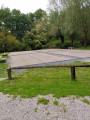
Start from the car park, situated a little further on, at 41 Rue du Pré, at the entrance to the woods
(S/E) From the car park, head straight across and enter the woods. At the end, turn right onto Chemin du Roi d’Angleterre, and continue to the next junction.
(1) Turn right and carry on straight ahead until you reach Chemin des Coussinettes.
(2) Turn left onto the path and carry on straight ahead. Ignore the path on the left to reach Chemin des Vingt.
(3) Keep left and carry on straight ahead, then turn right onto the path behind the woods until you reach the access path to the British cemetery.
(4) You can make a round trip to the cemetery. Otherwise, carry on straight ahead until you reach the second junction.
(5) Turn left to continue along the path behind the woods. Follow it, then turn onto the dirt track on the right. Follow this to return to Aix-Noulette, and carry on straight ahead until you reach a road.
(6) Turn right, then take the first right; at the end, carry straight on until you reach the T-junction. Keep slightly to the left and carry straight on.
(7) Carry on straight ahead, then take the first right, and continue straight on along Rue de la Chapelle.
(8) Turn right onto Rue du Château, then left to rejoin Rue du Vingt.
(3) Turn left onto this road to reach Rue du Pré, follow it to the right, and head for the car park (S/E).
 Association / Club / Walk leader


 Moderate
  Visorando Member