Les bords de la Scarpe depuis Saint-Laurent-Blangy

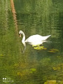
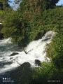
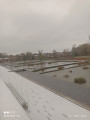
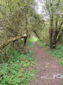
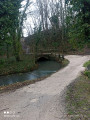
Superbe randonnée entre rivière et marais et leur biodiversité

Details

68981319
Creation:
Last update:
Last review:
  • Walking
    Activity: Walking
  • ↔
    Distance: 7.62 mi
  • ◔
    Average duration: 3h 30 
  • ▲
    Difficulty: Moderate

  • ⚐
    Back to start: Yes
  • ↗
    Ascent: + 43 ft
  • ↘
    Descent: - 39 ft

  • ▲
    Highest point: 217 ft
  • ▼
    Lowest point: 161 ft

Photos

Description of the walk

Start from the square by the church, Rue Marcel Hannard.

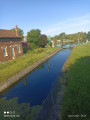
(S/E) With the church behind you, turn left towards Rue Laurent Gers. Cross the street, take the towpath and follow it until you reach a second copse on the left and a GR® junction.

(1) Continue along the towpath until you reach a railway bridge.

(2) Go under the bridge and follow the riverbanks to Athies and its lock.

(3) First turn right then left, and rejoin the towpath to Fampoux and its lock.

(4) Turn left, cross the bridge, and carry on straight ahead, past the second branch, until you reach Rue des Tilleuls.

(5) Follow it to the left, then left again onto Rue d’Ohain, and continue to the end of the street.

(6) Carry on straight ahead until you reach a road.

(7) Cross to the opposite side and do the same at the next Fork in the road to reach the end of Rue des Prés.

(8) Turn right, cross the road, and turn left. Walk past the church forecourt and continue along Rue de la Chapelle until you reach Rue Pierre Letienne.

(9) Turn left into the cul-de-sac and carry on (Rue du Marais) until the tarmac ends.

(10) Cross the bridge and take the path on the right just before the canal, to enter the marsh, then continue to the left until you reach the end of the path.

(11) Turn right, then continue along the path on the left. At the Y-junction, turn left to reach another Fork in the road.

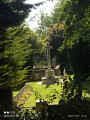
(12) Keep left, pass to the left of the British cemetery, then continue to the right until you reach the junction.

(13) Carry on to the left, stay on the lower side to pass under the railway bridge, then turn left immediately and keep left until you reach the small bridge on the right which spans a stream.

(14) Cross the bridge and, at the end, turn right and carry on straight ahead until you reach a path coming from the left.

(15) Turn left, then take a first turn left then right to pass between the two ponds. You’ll come to a junction.

(16) Keep to the left, go straight ahead at the four-way crossroads, then turn left twice. At the end, join the towpath.

(1) Turn right and continue straight on in the opposite direction to your outward journey, go under the road bridge, then take the first right to reach the square (S/E).


Waypoints

  1. S/E : mi 0 - alt. 174 ft - Church square
  2. 1 : mi 0.52 - alt. 171 ft - GR junction - Scarpe (rivière)
  3. 2 : mi 1.01 - alt. 171 ft - Railway bridge - Scarpe (rivière)
  4. 3 : mi 1.72 - alt. 174 ft - Lock - Scarpe (rivière)
  5. 4 : mi 3.17 - alt. 164 ft - Lock - Scarpe (rivière)
  6. 5 : mi 3.38 - alt. 174 ft - Rue des Tilleuls
  7. 6 : mi 3.71 - alt. 164 ft - End of Rue des Tilleuls
  8. 7 : mi 4.53 - alt. 164 ft - Rue des Pies
  9. 8 : mi 4.97 - alt. 167 ft - Arthur Delobelle Street
  10. 9 : mi 5.16 - alt. 174 ft - Rue Pierre Letienne
  11. 10 : mi 5.36 - alt. 167 ft - Crossroads after the stream
  12. 11 : mi 5.57 - alt. 171 ft - End of the path
  13. 12 : mi 5.86 - alt. 184 ft - Fork in the road
  14. 13 : mi 5.97 - alt. 213 ft - Rue d’Athies
  15. 14 : mi 6.3 - alt. 171 ft - Small bridge
  16. 15 : mi 6.61 - alt. 171 ft - Path on the left
  17. 16 : mi 6.8 - alt. 167 ft - Fork in the road
  18. S/E : mi 7.62 - alt. 177 ft - Return to car park

Notes

Pas de point d'eau.

Worth a visit

Églises.
Cimetière britannique.
Marais.

Always be cautious and plan ahead when you're outdoors. Visorando and the author of this route cannot be held responsible for any accidents occurring on this route.

The GR® and PR® markings are the intellectual property of the Fédération Française de Randonnée Pédestre.

Reviews and comments

5 / 5
Based on 1 review

Reliability of the description
5 / 5
Ease of following the route
5 / 5
Route interest
5 / 5
souchez rando
souchez rando

thank you for your feedback. We wish you all the best on your future hiking trips

Machine-translated

Michel D2.
Michel D2.
• Edited:

Overall rating : 5 / 5

Date of your route : Aug 25, 2025
Reliability of the description : ★★★★★ Very good
Ease of following the route : ★★★★★ Very good
Route interest : ★★★★★ Very good
Very busy route : No

Departure from Athies for a shortened hike. A pleasant walk through the Athies marshes, then a hidden military cemetery, arriving at the Saint Laurent Blangy water sports centre via a busy park

Machine-translated

Other walks in the area

For more walks, use our search engine .

The GPS track and description are the property of this route's author. Please do not copy them without permission.