Madame’s walk from Souchez

A pleasant little walk between the plain and the river

Details

n°65195507
Creation:
Last update:
Last review:
  • Walking
    Activity: Walking
  • ↔
    Distance: 4.76 mi
  • ◔
    Average duration: 2h 25 
  • ▲
    Difficulty: Easy

  • ⚐
    Back to start: Yes
  • ↗
    Ascent: + 262 ft
  • ↘
    Descent: - 236 ft

  • ▲
    Highest point: 449 ft
  • ▼
    Lowest point: 253 ft
  • ⚐ Country: France
  • ⚐ City: Souchez (62153)
  • ⚑
    Start/End: N 50.390476° / E 2.734255°
  • ❏
    IGN map(s): Ref. 2406E
  • Hour-by-hour weather

Description of the walk

Start from the car park at the old station, Rue Pierre Brosselette (on the left when coming from Souchez, just at the start of the bend).

(S) Follow the path up towards the old station, then, after the farm, you’ll reach a junction.

(1) Take the path on the right towards Ablain-Saint-Nazaire. At the end, you’ll come out onto Rue Marcel Lancino.

(2) Follow the main street, veering slightly to the left, until you reach the second left, Rue Gares.

(3) Follow this street, then go straight on along Chemin du Bois Piéton until you reach the end.

(4) Turn right onto Rue des Vauchaux and continue to the end, where you’ll reach Rue Marcel Lancino, with Rue de Namur almost directly opposite.

(5) Cross the road and first turn left then right onto Rue de Namur; after the bridge, turn right and carry on straight ahead, passing by the stadium.

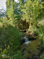
(6) Just after the motorhome car park, turn left to reach the Souchez stream, which you should follow, veering left or right as required, whilst passing Rue du 8 Mai and Rue du Flot, until you reach Rue du Maréchal Lancino.

(7) Turn left towards the ruins of the old church, then walk up Rue de la Blanche Voie and turn right onto Rue de Lens, following it to the end.

(8) Continue straight on and, after the uphill stretch, take the path leading downhill. Cross with care and turn left to reach the car park on the right (S/E).


Waypoints

  1. S/E : mi 0 - alt. 253 ft - Car park at the old station - Saint-Nazaire (ruisseau) - Affluent du Souchez
  2. 1 : mi 0.5 - alt. 276 ft - Junction - Carency (ruisseau) - Affluent du Souchez
  3. 2 : mi 0.92 - alt. 276 ft - Rue Marcel Lancino
  4. 3 : mi 1.24 - alt. 305 ft - Rue Gares
  5. 4 : mi 2.13 - alt. 449 ft - End of the Chemin du Bois Piéton
  6. 5 : mi 2.74 - alt. 331 ft - Rue de Namur
  7. 6 : mi 3.41 - alt. 279 ft - Stadium, motorhome car park
  8. 7 : mi 3.7 - alt. 272 ft - Rue du Maréchal Lancino, old church
  9. 8 : mi 4.22 - alt. 292 ft - End of Rue de Lens
  10. S/E : mi 4.76 - alt. 253 ft - Car park at the old station

Notes

No water source

Worth a visit

Ruins of the old church.
Site of Notre-Dame-de-Lorette.

Reviews and comments

5 / 5
Based on 1 review

Reliability of the description
5 / 5
Ease of following the route
5 / 5
Route interest
5 / 5
souchez rando
souchez rando

Thank you for your feedback. It’s true, the paths are muddy given the weather. All the best.

Machine-translated

MF MARCQ Auchy-les-mines

Overall rating : 5 / 5

Date of your route : Jan 27, 2025
Reliability of the description : ★★★★★ Very good
Ease of following the route : ★★★★★ Very good
Route interest : ★★★★★ Very good
Very busy route : No

A brilliant, easy walk. But be careful in wet weather – you sometimes have to walk through water and it’s slippery!
All in all, it’s well worth doing. There are some lovely views.

Machine-translated

Other walks in the area

For more walks, use our search engine .

The GPS track and description are the property of this route's author. Please do not copy them without permission.