Mont Saint-Vaast from Sainte-Catherine

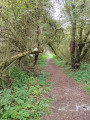
This walk will take you around Sainte-Catherine and its surroundings via Mont Saint-Vaast.

Details

69134934
Creation:
Last update:
Last review:
  • Walking
    Activity: Walking
  • ↔
    Distance: 7.53 mi
  • ◔
    Average duration: 3h 35 
  • ▲
    Difficulty: Moderate

  • ⚐
    Back to start: Yes
  • ↗
    Ascent: + 164 ft
  • ↘
    Descent: - 164 ft

  • ▲
    Highest point: 292 ft
  • ▼
    Lowest point: 184 ft

Description of the walk

Start from the Grandes Prairies car park, opposite the Pré Fleuri.

(S/E) Cross the car park to pass over the Fontaine Baudimont, then turn right and, immediately, left, until you reach a Fork in the road.

(1) Turn right, and continue straight ahead twice. Take the Chemin des Maçons and follow it to the Rue du 8 mai 1945.

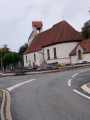
(2) Turn right onto this street and carry on straight ahead until you reach the priory.

(3) Cross the road to take the path opposite, and keep left until you reach the Fork in the road at the end, where it joins the Sentier des Filatiers.

(4) Continue left along the path, follow it to the right and carry on straight ahead until it joins the cycle path.

(5) Head straight ahead along the cycle path to get closer to the N25.

(6) Just before the N25, turn right twice, and carry on until you reach a third Fork in the road.

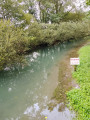
(7) Turn left, cross two watercourses – including the Scarpe – to reach Rue Briquet-Taillandier.

(8) Turn left onto this street, go round two bends, pass a lane on the right, and arrive at a track (the second one before the ring road).

(9) Turn right and follow the ring road, continuing straight on. You’ll come to a sharp bend at the end of the track.

(10) Keep to the right to join Chemin du Bois Vincent. Turn right onto it and continue until you reach Rue Briquet-Taillandier.

(11) Turn left, cross the road, and carry on straight ahead on the right-hand side until you reach the roundabout.

(12) At the roundabout, take the left-hand exit and continue straight ahead until you reach Rue Desiré Delansorne.

(13) Turn left into the street and continue straight on along Rue Charles Goudemand. Pass the cemetery and carry on to the end at the place known as “la Flaque à Harengs”.

(14) Keep to the right and cross Rue des Filatiers.

(15) Carry on straight ahead until you reach the electricity substation.

(16) After this, turn right onto Rue Charles Demory; at the bend, keep left and you’ll reach the roundabout. Turn right until you reach the first path on the left.

(17) Take this path and keep straight on past two junctions until you reach a sharp left-hand fork.

(18) Turn left again and head towards the Scarpe, keeping straight on. Follow it on your right-hand side and carry on straight ahead until you reach the Chaussée Brunehaut.

(19) Turn right; at the end, keep right onto the Route de Lens, and head for the car park (S/E).

Waypoints

  1. S/E : mi 0 - alt. 187 ft - Grandes Prairies car park
  2. 1 : mi 0.26 - alt. 194 ft - Turn right
  3. 2 : mi 0.67 - alt. 187 ft - Rue du 8 Mai 1945
  4. 3 : mi 1.17 - alt. 197 ft - The Priory
  5. 4 : mi 1.27 - alt. 213 ft - Filatiers Trail
  6. 5 : mi 1.87 - alt. 282 ft - Fork in the road between the footpath and the cycle path
  7. 6 : mi 2.26 - alt. 217 ft - N25
  8. 7 : mi 2.54 - alt. 194 ft - Fork
  9. 8 : mi 2.86 - alt. 197 ft - Rue Briquet-Taillandier
  10. 9 : mi 3.16 - alt. 213 ft - Path before the bypass
  11. 10 : mi 3.6 - alt. 276 ft - Bend
  12. 11 : mi 4.14 - alt. 197 ft - Rue Briquet-Taillandier
  13. 12 : mi 4.41 - alt. 223 ft - Roundabout
  14. 13 : mi 4.57 - alt. 203 ft - Rue Désiré Delansorne
  15. 14 : mi 5.2 - alt. 279 ft - Place known as “la Flaque à Harengs”
  16. 15 : mi 5.59 - alt. 292 ft - Rue des Filatiers
  17. 16 : mi 6.12 - alt. 266 ft - Electricity supply
  18. 17 : mi 6.41 - alt. 256 ft - Path on the left
  19. 18 : mi 6.58 - alt. 187 ft - Sharp left-hand bend
  20. 19 : mi 7.19 - alt. 190 ft - Chaussée Brunehaut
  21. S/E : mi 7.53 - alt. 187 ft - Grandes Prairies car park

Notes

No water point

Worth a visit

Priory

Reviews and comments

4.7 / 5
Based on 2 reviews

Reliability of the description
5 / 5
Ease of following the route
4.5 / 5
Route interest
4.5 / 5
souchez rando
souchez rando

thank you for your feedback

Machine-translated

didier1234
didier1234

Overall rating : 5 / 5

Date of your route : Mar 03, 2026
Reliability of the description : ★★★★★ Very good
Ease of following the route : ★★★★★ Very good
Route interest : ★★★★★ Very good
Very busy route : Yes

Lovely discoveries. I didn't know Arras. Just a slight change of route following the closure of the abbey.

Machine-translated

souchez rando
souchez rando

Hello, thank you for your feedback. I hope you have a lovely day out on the walking trails.

Machine-translated

Semifox23
Semifox23

Overall rating : 4.3 / 5

Date of your route : Apr 18, 2025
Reliability of the description : ★★★★★ Very good
Ease of following the route : ★★★★☆ Good
Route interest : ★★★★☆ Good
Very busy route : No

A lovely route through the countryside. A slight climb, but easily manageable for all fitness levels. The route passes by the golf course and through the village of Anzin.
Very peaceful and relaxing.

Machine-translated

Other walks in the area

For more walks, use our search engine .

The GPS track and description are the property of this route's author. Please do not copy them without permission.