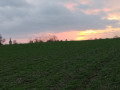
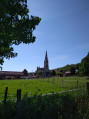
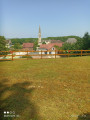
Short route around Farbus

A circular route around Farbus, allowing you to explore the village and the surrounding countryside.

Details

39689607
Creation:
Last update:
Last review:
  • Walking
    Activity: Walking
  • ↔
    Distance: 3.29 mi
  • ◔
    Average duration: 1h 40 
  • ▲
    Difficulty: Easy

  • ⚐
    Back to start: Yes
  • ↗
    Ascent: + 141 ft
  • ↘
    Descent: - 144 ft

  • ▲
    Highest point: 413 ft
  • ▼
    Lowest point: 223 ft
  • ⚐ Country: France
  • ⚐ City: Farbus (62580)
  • ⚑
    Start/End: N 50.35702° / E 2.82225°
  • ❏
    IGN map(s): Ref. 2406E
  • Hour-by-hour weather

Description of the walk

The route starts at the Stade Dudat, behind the town hall.

(S/E) Head back towards the town hall and emerge onto Rue de la République. Turn left and walk 100 metres to the crossroads.

(1) Turn left onto Rue de la Libération, which becomes a track leading to a road. Turn left onto this road and rejoin the D50 cross-country route, which forms part of the GRP®.

(2) Turn left onto this road, then take the path to the left, joining Rue du 8 mai 1945. Follow it to the left towards the village. You’ll reach a fork in the road at a bend.

(3) Leave theGRP® trail. Turn right onto Rue du Onze Novembre for 50 metres, then leave the street and head straight ahead onto Rue du Maréchal Foch, towards the station, until you reach a side street.

(4) Turn left, pass the station and follow the railway line to Chemin du Moulin. The path then turns left and leads to the D51.

(5) Turn right onto this road and follow it for 150 metres, then turn left towards the Ferme du Moulin de Bois to reach Chemin de la Fontaine Saint-Ranulphe. Follow this path to the left until you reach the start of a road.

(6) Turn left again and rejoin the D51 at a junction. Turn right and return to the original junction.

(1) Continue straight on until you reach Klaus Dudat Park (S/E).

Waypoints

  1. S/E : mi 0 - alt. 312 ft - Klaus Dudat Park
  2. 1 : mi 0.09 - alt. 295 ft - Junction marking the end of the circular loop
  3. 2 : mi 0.56 - alt. 397 ft - Junction – D50
  4. 3 : mi 0.91 - alt. 289 ft - Junction
  5. 4 : mi 1.19 - alt. 249 ft - T-junction - Gare de Farbus
  6. 5 : mi 2.21 - alt. 249 ft - T-junction – D51
  7. 6 : mi 2.94 - alt. 285 ft - Junction
  8. S/E : mi 3.29 - alt. 312 ft - Klaus Dudat Park

Reviews and comments

4.3 / 5
Based on 3 reviews

Reliability of the description
4.3 / 5
Ease of following the route
4.3 / 5
Route interest
4.3 / 5
pruvot
pruvot

Overall rating : 4 / 5

Date of your route : Jul 21, 2025
Reliability of the description : ★★★★☆ Good
Ease of following the route : ★★★★☆ Good
Route interest : ★★★★☆ Good
Very busy route : No

The first part of the hike through the woods is not very interesting.
The second part, through the fields, is much more pleasant.
We completed the hike in 1 hour and 20 minutes without breaking a sweat

Machine-translated

Gohellans
Gohellans

Thank you for your comment!
I’ve tried to find the ambiguous bit in the description: Visorando’s moderators often tweak a few details to ensure consistency (in vocabulary and landmarks). It’s true that the phrasing “Come to a fork in the road at a bend. Leave the GRP®. Turn right” could be simplified! I’ll give it a go!!
Thank you, and enjoy your walks.

Machine-translated

frimousse59
frimousse59

Overall rating : 4.3 / 5

Date of your route : May 09, 2024
Reliability of the description : ★★★★☆ Good
Ease of following the route : ★★★★☆ Good
Route interest : ★★★★★ Very good
Very busy route : No

A lovely little route combining countryside, woodland and open fields. Very peaceful. However, the description could be a bit more specific regarding changes of direction (I’m thinking of a point where it says to turn left onto a street whilst on a bend on a regional road. It would be simpler to say: ‘turn left onto such-and-such street’. Otherwise, the directions are clear.

Machine-translated

Salamand59115
Salamand59115

Overall rating : 4.7 / 5

Date of your route : Oct 02, 2023
Reliability of the description : ★★★★★ Very good
Ease of following the route : ★★★★★ Very good
Route interest : ★★★★☆ Good
Very busy route : No

A lovely route that combines countryside (which was perfect for my dog and for us) and village life. It was nice to discover Farbus, a place we hadn’t been to before and which turned out to be lovely. We really enjoyed it – thank you.

Machine-translated

Other walks in the area

For more walks, use our search engine .

The GPS track and description are the property of this route's author. Please do not copy them without permission.