The city centre

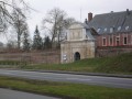
A route combining town and countryside, taking you round Arras. A mix of rural landscapes and historic monuments such as the Citadel, the English Memorial and the ramparts.

Details

204074
Creation:
Last update:
Last review:
  • Mountain biking
    Activity: Mountain biking
  • ↔
    Distance: 16.26 mi
  • ◔
    Duration according to the author: 2.5 hrs 
  • ▲
    Difficulty: Easy

  • ⚐
    Back to start: Yes
  • ↗
    Ascent: + 197 ft
  • ↘
    Descent: - 207 ft

  • ▲
    Highest point: 328 ft
  • ▼
    Lowest point: 164 ft
  • ⚐ Country: France
  • ⚐ City: Beaurains (62217)
  • ⚑
    Start/End: N 50.26259° / E 2.791623°
  • ❏
    IGN map(s): Ref. 2406E

  • ◶
    Type of surface:
  •  
     
     
     33% Road  34% Byway  33% Path
  • ⇧
    Bike carrying: Not specified
  • ▲
    Difficulty: Not specified
  • Hour-by-hour weather

Photos

Description of the route

Start in front of the Maison Coluche in Beaurains.

(S/E) Take Rue Aristide Briand heading south-west.

(1) Turn right into Rue Victor Hugo. After 100 metres, turn left into the small lane signposted ‘Les Blancs Miroirs’ walking trail. Continue straight on until you reach the D917 main road and follow it to the left for a few metres.

(2) Take the small road on the right to enter the park and walk through it. At the park exit, turn left onto Rue Angèle Richard and continue to the last building on the right.

(3) Turn right and follow the path for about 2 km, crossing the Route de Bucquoy (D919). Go under the small SNCF bridge and follow Rue des Maraîchers straight ahead. After the junction with Rue Marcel Délis, continue for about a hundred metres and take the small road on the left until the next junction.

(4) Follow the Crinchon stream to the left, cross the D60 (Rue Emile Zola) and, at the end of the path, turn left.

(5) Turn right onto Rue du Crinchon, continue to the end of the road and cross the bridge over the stream to reach the first four-way junction.

(6) Turn right and follow this path for 1 km, crossing the D60.

(7) Cross Rue des Maraîchers, go over a small bridge and turn left to follow the stream.

(8) Go round the roundabout, then turn right to continue following the stream until you reach Rue du Belloy, which runs alongside a railway line.

(9) Turn left, then right to cross the level crossing. Then turn left twice to take the path that runs alongside the railway line.

(10) Turn right onto the first path that goes uphill and follows the edge of a wood; carry on straight ahead until you reach the park in front of the vocational college.

(11) Turn right onto the park path which runs to the right of the pond and carry on until you reach Avenue du Mémorial des Fusillés, then continue to the traffic lights.

(12) Turn left onto the cycle path along Boulevard du Général De Gaulle, then, at the next set of traffic lights, turn right onto Rue d’Amiens. Take the first left, Rue des Carabiniers d’Artois.

(13) At the junction with Rue de la Paix, turn left onto the path leading up into a new park and continue onto Boulevard Georges Besnier, opposite the hospital. Turn right and head towards a large crossroads. Turn left towards the high-pressure car wash.

(14) Behind the station, take Chemin de la Fontaine Baudimont. This path ends in a flight of steps. At the bottom of the steps, turn left, follow the stream and cross it via the next small bridge (not shown on the IGN map).

(15) Turn right after the bridge, follow the stream and head towards the park exit. Cross the car park and turn left onto Route de Lens.

(16) Before the large traffic lights, take the path on the right,the GR®121, marked in white and red, and follow it for 6 km, keeping as close as possible to the River Scarpe. TheGR® joins the towpath of the Canal de la Scarpe and passes three locks.

(17) Turn right onto Rue Arthur Delobelle towards Feuchy. At the roundabout, take the first exit onto Rue d’Arras, continue for 50 metres and turn left onto Chemin des Fonds.

(18) Go under the railway bridge, turn right and, at the first junction, take the path that goes up to the left.

(19) At the end of the path, turn right and, at the first junction, turn left to join the Route de Cambrai.

(20) At the Stop sign, turn right, cross the road at the pedestrian crossing and take the small path that continues from there. Carry on straight ahead, cross the first street in the housing estate and then the second, Rue du Noble, to reach the end of Rue d’Arras.

(21) Turn left onto Rue d’Arras, go straight on at the next junction and then, at the fork, turn right towards Neuville.

(22) On leaving the village, turn into the first small street on the right, near the allotments, to reach the D60.

(23) Cross the D60 and take the cycle path to the left towards Beaurains. Go round the roundabout and continue along the cycle path until you reach the wayside cross.

(24) Take the path on the right after the wayside cross, turn left after the barrier, then right to reach the Maison Coluche.

Waypoints

  1. S/E : mi 0 - alt. 312 ft - Maison Coluche
  2. 1 : mi 0.12 - alt. 315 ft - On the right, Rue Victor Hugo
  3. 2 : mi 0.37 - alt. 308 ft - D917, turn right
  4. 3 : mi 0.84 - alt. 305 ft - At the last building, turn right
  5. 4 : mi 2.16 - alt. 220 ft - At the junction, follow the path to the left - Crinchon (rivière) - Affluent de la Scarpe
  6. 5 : mi 2.71 - alt. 223 ft - On Rue du Crinchon, turn right
  7. 6 : mi 3.1 - alt. 226 ft - At the first junction after the farm, turn right
  8. 7 : mi 3.79 - alt. 213 ft - Cut across Rue des Maraîchers
  9. 8 : mi 4.27 - alt. 213 ft - Roundabout on Rue Raoul Briquet, take the first exit on the right
  10. 9 : mi 4.7 - alt. 210 ft - Rue du Belloy, turn left towards the level crossing
  11. 10 : mi 5.1 - alt. 226 ft - Junction, turn right
  12. 11 : mi 5.53 - alt. 210 ft - Park opposite the secondary school, on the right
  13. 12 : mi 6.18 - alt. 203 ft - Boulevard du Général de Gaulle, on the right - Mémorial anglais (Arras)
  14. 13 : mi 6.6 - alt. 230 ft - At the junction with Rue de la Paix, take the path up the steps
  15. 14 : mi 7.09 - alt. 253 ft - Take the Chemin de la Fontaine Baudimont
  16. 15 : mi 7.5 - alt. 184 ft - Bridge over a stream, on the right
  17. 16 : mi 8.05 - alt. 187 ft - Chemin des 3 fontaines GR121 on the right after the - Scarpe (rivière)
  18. 17 : mi 11.83 - alt. 171 ft - Athies lock: turn right
  19. 18 : mi 12.2 - alt. 177 ft - Underpass beneath the railway line; turn left after the underpass
  20. 19 : mi 13.1 - alt. 269 ft - End of the path, on the right
  21. 20 : mi 13.75 - alt. 279 ft - STOP sign, on the right
  22. 21 : mi 14.09 - alt. 276 ft - Rue d’Arras, on the left
  23. 22 : mi 14.59 - alt. 305 ft - Allotment gardens, on the right
  24. 23 : mi 15.06 - alt. 272 ft - D60, on the left
  25. 24 : mi 16.07 - alt. 312 ft - Calvary, on the right
  26. S/E : mi 16.26 - alt. 312 ft - Maison Coluche

Always be cautious and plan ahead when you're outdoors. Visorando and the author of this route cannot be held responsible for any accidents occurring on this route.

The GR® and PR® markings are the intellectual property of the Fédération Française de Randonnée Pédestre.

Reviews and comments

4.5 / 5
Based on 2 reviews

Reliability of the description
4.5 / 5
Ease of following the route
4 / 5
Route interest
5 / 5
Delphine62
Delphine62

Overall rating : 4 / 5

Date of your route : Apr 22, 2022
Reliability of the description : ★★★★☆ Good
Ease of following the route : ★★★☆☆ Average
Route interest : ★★★★★ Very good
Very busy route : Yes

For those new to orienteering, the instructions are fairly clear, though the route isn’t entirely accurate in places. (This led to us having to turn back a few times.) Street names aren’t always indicated, so we had to look for them on the building facades.

S/E: km 0 – alt. 96m – Maison Coluche (if there are no parking spaces, a little further down there is the town hall car park)

The narrow lane signposted ‘Les Blancs Miroirs’ walking trail. The passage is between two houses. If you’re on a bike, you’ll need to lift it over, as there are the infamous barriers to prevent two-wheeled vehicles from passing.
Otherwise, no particular problems; make sure you have a spare battery for your mobile phones.

This route is best done in dry weather as there are quite a few dirt tracks and paths through fields.
You’ll discover some lovely spots.
Done with a 12-year-old child.

Machine-translated

DEBETHUNE alain
DEBETHUNE alain

Overall rating : 5 / 5

Date of your route : Mar 04, 2016
Reliability of the description : ★★★★★ Very good
Ease of following the route : ★★★★★ Very good
Route interest : ★★★★★ Very good

A really lovely route that I walked. I’m not put off by long distances.
It’s a route that, in a way, takes you round the outskirts of the Arras conurbation, along lovely paths. A harmonious blend of countryside scenery and historic monuments.
The sun was shining; all in all, 4 hours and 45 minutes of pure joy, and a breath of fresh air.
For a regular walker, this route can be done on foot; you have more time to appreciate the scenery.

Machine-translated

For more walks, use our search engine .

The GPS track and description are the property of this route's author. Please do not copy them without permission.